TopoQuest Logo
Do you find TopoQuest useful?
Help keep TopoQuest running and adding new maps/features by donating!
Bitcoin:  19c7KJd3qBynnjoSw5npx9KScwjBe4ifkT
Litecoin:  LXs6TkuXGGXo1vDsWCkWVdjQX94eUKd6ui
Home View Maps Find Maps Find Places Resources & Links


Sangerville, Maine Topographic Map

USGS Map Title: Sangerville, ME
USGS Map MRC: 45069B3
DRG (GeoTIFF) Download: o45069b3.tif


Neighboring USGS Topographic Map Quads:


  Monson East, ME  
45069C4
 

  Sebec Lake West, ME  
45069C3
 

  Sebec Lake East, ME  
45069C2
 

  Guilford, ME  
45069B4
 

  Sangerville, ME  
45069B3
 

  Dover-Foxcroft, ME  
45069B2
 

  Cambridge, ME  
45069A4
 

  Dexter, ME  
45069A3
 

  Garland, ME  
45069A2


Map MRC Location:

N46°
W70°
N46°
W69°
H8 H7 H6 H5 H4 H3 H2 H1
G8 G7 G6 G5 G4 G3 G2 G1
F8 F7 F6 F5 F4 F3 F2 F1
E8 E7 E6 E5 E4 E3 E2 E1
D8 D7 D6 D5 D4 D3 D2 D1
C8 C7 C6 C5 C4 C3 C2 C1
B8 B7 B6 B5 B4 B3 B2 B1
A8 A7 A6 A5 A4 A3 A2 A1
N45°
W70°
N45°
W69°

Sangerville, ME USGS 1:24K Topographic Map Preview:
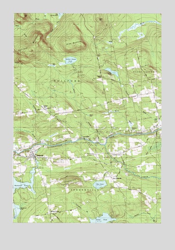
Sangerville, ME USGS Topographic Map
Click on map above to begin viewing in our Map Viewer.

This topographic map contains these locations and features:
Feature Name Type Latitude Longitude GNIS ID View Map
Abbie Fowler SchoolSchoolN45.1659°W69.3587°1909999View Map
Birch MountainSummitN45.2466°W69.3034°562324View Map
Black StreamStreamN45.1720°W69.2967°562516View Map
Brawn CemeteryCemeteryN45.2249°W69.3040°2736946View Map
Brown BrookStreamN45.2498°W69.3478°563030View Map
Brown SchoolSchoolN45.1987°W69.2962°563065View Map
Buker MountainSummitN45.2308°W69.3232°563146View Map
Campbell Corner SchoolSchoolN45.1670°W69.2839°563431View Map
Carlton StreamStreamN45.1714°W69.3478°563572View Map
Carlton Stream DamDamN45.1677°W69.3545°1773817View Map
Carlton Stream ReservoirReservoirN45.1672°W69.3550°1773818View Map
Dover-Foxcroft Plaza Shopping CenterLocaleN45.1812°W69.2573°1910050View Map
Dunham CornerPopulated PlaceN45.2117°W69.3009°579259View Map
Dunham PondLakeN45.2153°W69.2915°565408View Map
East SangervillePopulated PlaceN45.1526°W69.2914°579281View Map
First Unitarian Universalist Church of SangervilleChurchN45.1648°W69.3550°1910059View Map
Flanders BrookStreamN45.1637°W69.2909°566277View Map
Flanders HillSummitN45.1500°W69.3253°566278View Map
Gray CemeteryCemeteryN45.1813°W69.2557°1910067View Map
Guilford CenterPopulated PlaceN45.1928°W69.3484°579373View Map
Guilford Center Baptist ChurchChurchN45.1926°W69.3514°1910077View Map
Guilford Center CemeteryCemeteryN45.1941°W69.3427°1910076View Map
Guilford MountainSummitN45.2278°W69.3595°567368View Map
Howard CornerPopulated PlaceN45.1662°W69.3053°579415View Map
Jackson Corner SchoolSchoolN45.1309°W69.3400°568738View Map
Knowlton Mills CemeteryCemeteryN45.1576°W69.2843°2736952View Map
Lows BridgeBridgeN45.1752°W69.3150°1910106View Map
Lows BridgeLocaleN45.1759°W69.3139°570559View Map
Manhanock Pond DamDamN45.1628°W69.3555°1773819View Map
Manhanock Pond DamDamN45.1577°W69.3556°1774255View Map
Marr PondLakeN45.1481°W69.3017°570794View Map
Maxfield BrookStreamN45.1726°W69.3509°570920View Map
Merrill BrookStreamN45.1781°W69.2745°571151View Map
Minnow PondLakeN45.1893°W69.3112°571443View Map
Oak BrookStreamN45.1603°W69.2925°572560View Map
Old Blacksmith Shop MuseumBuildingN45.1970°W69.2512°1910143View Map
Piscataquis Country ClubLocaleN45.1764°W69.3606°1910156View Map
Rural Grove CemeteryCemeteryN45.1796°W69.2684°1910162View Map
Salmon StreamStreamN45.1753°W69.2953°574777View Map
Salmon Stream PondLakeN45.2220°W69.3267°574785View Map
SangervillePopulated PlaceN45.1648°W69.3564°574907View Map
Sangerville Post OfficePost OfficeN45.1611°W69.3561°2768959View Map
Sangerville Public LibraryBuildingN45.1654°W69.3580°2738487View Map
Sangerville Volunteer Fire DepartmentBuildingN45.1653°W69.3584°2552862View Map
Schoolhouse BrookStreamN45.1681°W69.3714°575023View Map
South InletStreamN45.2481°W69.3353°575855View Map
Sucker BrookStreamN45.1278°W69.3706°576488View Map
Thompson PondLakeN45.1816°W69.2751°577022View Map
Town House CemeteryCemeteryN45.1335°W69.3210°2727386View Map
Town of GuilfordCivilN45.2113°W69.3506°582504View Map
Town of SangervilleCivilN45.1276°W69.3069°582713View Map
Townhouse BrookStreamN45.1267°W69.3081°577241View Map
Village CemeteryCemeteryN45.1691°W69.3590°1910204View Map
Watson HillSummitN45.1625°W69.3375°577899View Map

Note: Coordinates in the location and feature list above are referenced to NAD83 datum.


Copyright (C) 2008-2024 Ryan Niemi / Sunset Dynamics ... All Rights Reserved