TopoQuest Logo
Do you find TopoQuest useful?
Help keep TopoQuest running and adding new maps/features by donating!
Bitcoin:  19c7KJd3qBynnjoSw5npx9KScwjBe4ifkT
Litecoin:  LXs6TkuXGGXo1vDsWCkWVdjQX94eUKd6ui
Home View Maps Find Maps Find Places Resources & Links


Sanger, California Topographic Map

USGS Map Title: Sanger, CA
USGS Map MRC: 36119F5
DRG (GeoTIFF) Download: o36119f5.tif


Neighboring USGS Topographic Map Quads:


  Clovis, CA  
36119G6
 

  Round Mountain, CA  
36119G5
 

  Piedra, CA  
36119G4
 

  Malaga, CA  
36119F6
 

  Sanger, CA  
36119F5
 

  Wahtoke, CA  
36119F4
 

  Conejo, CA  
36119E6
 

  Selma, CA  
36119E5
 

  Reedley, CA  
36119E4


Map MRC Location:

N37°
W120°
N37°
W119°
H8 H7 H6 H5 H4 H3 H2 H1
G8 G7 G6 G5 G4 G3 G2 G1
F8 F7 F6 F5 F4 F3 F2 F1
E8 E7 E6 E5 E4 E3 E2 E1
D8 D7 D6 D5 D4 D3 D2 D1
C8 C7 C6 C5 C4 C3 C2 C1
B8 B7 B6 B5 B4 B3 B2 B1
A8 A7 A6 A5 A4 A3 A2 A1
N36°
W120°
N36°
W119°

Sanger, CA USGS 1:24K Topographic Map Preview:
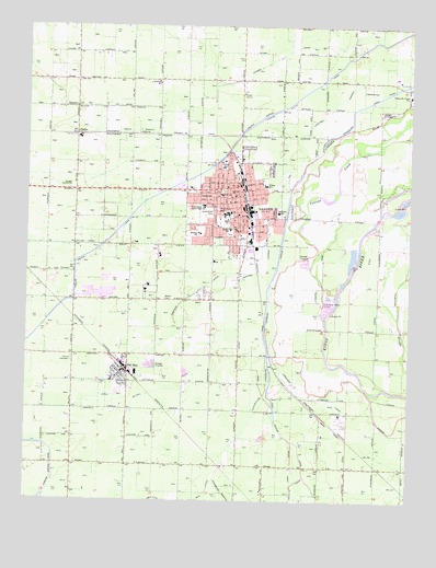
Sanger, CA USGS Topographic Map
Click on map above to begin viewing in our Map Viewer.

This topographic map contains these locations and features:
Feature Name Type Latitude Longitude GNIS ID View Map
Bethel CemeteryCemeteryN36.6781°W119.5811°219099View Map
Bethel School (historical)SchoolN36.6800°W119.5737°1665595View Map
California Department of Forestry and Fire Protection Fresno Kings Fire StationBuildingN36.7326°W119.5558°2624590View Map
Centerville Elementary SchoolSchoolN36.7317°W119.5010°220829View Map
Centerville Kingsburg CanalCanalN36.7147°W119.5326°220826View Map
Church of ChristChurchN36.7113°W119.5610°1811872View Map
City of SangerCivilN36.6989°W119.5575°2411811View Map
ClothoPopulated PlaceN36.7213°W119.6099°221234View Map
Collins CanalCanalN36.6925°W119.6065°221389View Map
Collins CreekStreamN36.6713°W119.5282°221390View Map
Del ReyPopulated PlaceN36.6591°W119.5937°1658399View Map
Del Rey Census Designated PlaceCensusN36.6562°W119.5993°2408651View Map
Del Rey Elementary SchoolSchoolN36.6566°W119.5979°1811811View Map
Del Rey Post OfficePost OfficeN36.6585°W119.5950°2780949View Map
Faller ParkParkN36.7030°W119.5487°1811812View Map
Fargo (historical)Populated PlaceN36.6369°W119.5149°1665616View Map
Fig Garden Fire Protection DistrictBuildingN36.7325°W119.5550°2624635View Map
First Methodist ChurchChurchN36.7036°W119.5599°1811876View Map
First Pentecostal ChurchChurchN36.7011°W119.5585°1811877View Map
First Presbyterian ChurchChurchN36.7077°W119.5607°1811878View Map
First Southern Baptist ChurchChurchN36.7005°W119.5571°1811879View Map
Four Square Gospel ChurchChurchN36.7038°W119.5585°1811880View Map
Fowler Switch CanalCanalN36.6927°W119.6001°223772View Map
Freewater CanalCanalN36.7327°W119.5107°253215View Map
Fresno County Fire Protection District - Sanger Station 84BuildingN36.7323°W119.5558°2623737View Map
Fresno County Fire Protection District Station 82 Del ReyBuildingN36.6635°W119.6153°2624543View Map
Fresno County Sheriff's Office Del ReyBuildingN36.6564°W119.5967°2755698View Map
Garfield DitchCanalN36.6505°W119.6015°224060View Map
Granville SchoolSchoolN36.7355°W119.5829°224440View Map
Greenwood ParkParkN36.7019°W119.5660°224598View Map
Hanke DitchCanalN36.6911°W119.5132°224876View Map
Hansen CanalCanalN36.7286°W119.5882°224883View Map
Harp DitchCanalN36.6341°W119.5385°224951View Map
Jackson Elementary SchoolSchoolN36.7128°W119.5622°226093View Map
Jefferson Elementary SchoolSchoolN36.7008°W119.5438°226170View Map
Kings River PitMineN36.7036°W119.5044°2678166View Map
Kudo FarmsLocaleN36.6678°W119.5847°2558341View Map
Lincoln Elementary SchoolSchoolN36.6964°W119.5599°227131View Map
Lincoln ParkParkN36.6952°W119.5599°1811815View Map
Lonetree ChannelCanalN36.7291°W119.5257°234189View Map
Madison Elementary SchoolSchoolN36.6952°W119.5697°227918View Map
Mill DitchCanalN36.6272°W119.5660°228711View Map
Nazarene ChurchChurchN36.7086°W119.5496°1811882View Map
Pentecostal Deliverance ChurchChurchN36.7002°W119.5557°1811883View Map
Prairie CemeteryCemeteryN36.6615°W119.6110°231022View Map
Prairie School (historical)SchoolN36.6619°W119.6112°1665652View Map
Reka (historical)Populated PlaceN36.6888°W119.5518°1665655View Map
Rotary Ball ParkParkN36.6950°W119.5732°1811816View Map
Salem ChurchChurchN36.6991°W119.6099°1665663View Map
SangerPopulated PlaceN36.7080°W119.5560°277596View Map
Sanger Branch Fresno County Free LibraryBuildingN36.7063°W119.5590°1811818View Map
Sanger CemeteryCemeteryN36.7266°W119.5101°232529View Map
Sanger Fire DepartmentBuildingN36.7069°W119.5615°2623855View Map
Sanger HeliportAirportN36.7319°W119.5554°1653948View Map
Sanger High SchoolSchoolN36.7008°W119.5607°1811884View Map
Sanger HospitalHospitalN36.7075°W119.5729°1811819View Map
Sanger ParkParkN36.7100°W119.5574°1811820View Map
Sanger Police DepartmentBuildingN36.7062°W119.5613°2755846View Map
Sanger Post OfficePost OfficeN36.7054°W119.5581°1811821View Map
Sanger SubstationLocaleN36.7075°W119.6107°1654422View Map
Sanger WineryLocaleN36.6936°W119.5529°1665664View Map
Sanger Women ClubBuildingN36.7063°W119.5601°1811885View Map
Seventh Day Adventist ChurchChurchN36.7050°W119.5607°1811886View Map
Smith CanalCanalN36.6408°W119.5207°233310View Map
South Branch Hansen CanalCanalN36.7213°W119.5804°234933View Map
Southgate Shopping CenterLocaleN36.6911°W119.5557°1811823View Map
Taft High SchoolSchoolN36.7054°W119.5626°235969View Map
Taft Kindergarten (historical)SchoolN36.7061°W119.5624°1811887View Map
Washington Middle SchoolSchoolN36.7027°W119.5679°237280View Map
Wilson Elementary SchoolSchoolN36.7079°W119.5482°237988View Map

Note: Coordinates in the location and feature list above are referenced to NAD83 datum.


Copyright (C) 2008-2024 Ryan Niemi / Sunset Dynamics ... All Rights Reserved