TopoQuest Logo
Do you find TopoQuest useful?
Help keep TopoQuest running and adding new maps/features by donating!
Bitcoin:  19c7KJd3qBynnjoSw5npx9KScwjBe4ifkT
Litecoin:  LXs6TkuXGGXo1vDsWCkWVdjQX94eUKd6ui
Home View Maps Find Maps Find Places Resources & Links


Sanford Hills, Colorado Topographic Map

USGS Map Title: Sanford Hills, CO
USGS Map MRC: 37104G2
DRG (GeoTIFF) Download: o37104g2.tif


Neighboring USGS Topographic Map Quads:


  Red Top Ranch, CO  
37104H3
 

  Yellowbank Creek, CO  
37104H2
 

  Apishapa Bridge, CO  
37104H1
 

  Myers Canyon, CO  
37104G3
 

  Sanford Hills, CO  
37104G2
 

  Snowden Lake, CO  
37104G1
 

  Jones Lake Spring, CO  
37104F3
 

  Sun Valley Ranch, CO  
37104F2
 

  Delhi, CO  
37104F1


Map MRC Location:

N38°
W105°
N38°
W104°
H8 H7 H6 H5 H4 H3 H2 H1
G8 G7 G6 G5 G4 G3 G2 G1
F8 F7 F6 F5 F4 F3 F2 F1
E8 E7 E6 E5 E4 E3 E2 E1
D8 D7 D6 D5 D4 D3 D2 D1
C8 C7 C6 C5 C4 C3 C2 C1
B8 B7 B6 B5 B4 B3 B2 B1
A8 A7 A6 A5 A4 A3 A2 A1
N37°
W105°
N37°
W104°

Sanford Hills, CO USGS 1:24K Topographic Map Preview:
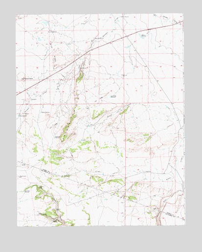
Sanford Hills, CO USGS Topographic Map
Click on map above to begin viewing in our Map Viewer.

This topographic map contains these locations and features:
Feature Name Type Latitude Longitude GNIS ID View Map
Berry ReservoirReservoirN37.8153°W104.2481°194207View Map
Black RanchLocaleN37.8250°W104.2386°194206View Map
Black WindmillLocaleN37.7795°W104.2483°194191View Map
Blue RidgeRidgeN37.8533°W104.2225°194199View Map
Buffalo Arroyo DamDamN37.7767°W104.1539°199112View Map
Buffalo Arroyo ReservoirReservoirN37.7775°W104.1538°199113View Map
Carr WindmillLocaleN37.8606°W104.1891°194202View Map
Cottonwood CanyonValleyN37.7547°W104.2192°194188View Map
Cottonwood SpringSpringN37.7531°W104.2230°194209View Map
Davis ReservoirReservoirN37.8617°W104.1569°194205View Map
English CampLocaleN37.8433°W104.2016°194203View Map
Fox WindmillLocaleN37.8733°W104.1702°194201View Map
Haystack ButteSummitN37.8372°W104.2444°194200View Map
Iron RidgeRidgeN37.8186°W104.2019°194194View Map
Iron Ridge ReservoirReservoirN37.8262°W104.1797°194195View Map
Jacobs RanchLocaleN37.7817°W104.1550°194193View Map
Lily Pond SpringSpringN37.7728°W104.2341°194190View Map
Linnard WellWellN37.8386°W104.1689°194204View Map
Lou Nelson RanchLocaleN37.7595°W104.2211°194208View Map
Mobley ReservoirReservoirN37.8172°W104.2316°194196View Map
New WindmillLocaleN37.8647°W104.2244°194198View Map
Rock Dam ReservoirReservoirN37.7706°W104.2449°194189View Map
Sanford HillsRangeN37.8139°W104.2089°194197View Map
Southwest ReservoirReservoirN37.8024°W104.2215°194192View Map

Note: Coordinates in the location and feature list above are referenced to NAD83 datum.


Copyright (C) 2008-2024 Ryan Niemi / Sunset Dynamics ... All Rights Reserved