TopoQuest Logo
Do you find TopoQuest useful?
Help keep TopoQuest running and adding new maps/features by donating!
Bitcoin:  19c7KJd3qBynnjoSw5npx9KScwjBe4ifkT
Litecoin:  LXs6TkuXGGXo1vDsWCkWVdjQX94eUKd6ui
Home View Maps Find Maps Find Places Resources & Links


Sanders, Kentucky Topographic Map

USGS Map Title: Sanders, KY
USGS Map MRC: 38084F8
DRG (GeoTIFF) Download: o38084f8.tif


Neighboring USGS Topographic Map Quads:


  Vevay North, IN  
38085G1
 

  Florence, IN  
38084G8
 

  Patriot, IN  
38084G7
 

  Vevay South, IN  
38085F1
 

  Sanders, KY  
38084F8
 

  Glencoe, KY  
38084F7
 

  Worthville, KY  
38085E1
 

  New Liberty, KY  
38084E8
 

  Owenton, KY  
38084E7


Map MRC Location:

N39°
W85°
N39°
W84°
H8 H7 H6 H5 H4 H3 H2 H1
G8 G7 G6 G5 G4 G3 G2 G1
F8 F7 F6 F5 F4 F3 F2 F1
E8 E7 E6 E5 E4 E3 E2 E1
D8 D7 D6 D5 D4 D3 D2 D1
C8 C7 C6 C5 C4 C3 C2 C1
B8 B7 B6 B5 B4 B3 B2 B1
A8 A7 A6 A5 A4 A3 A2 A1
N38°
W85°
N38°
W84°

Sanders, KY USGS 1:24K Topographic Map Preview:
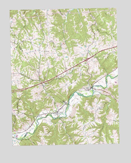
Sanders, KY USGS Topographic Map
Click on map above to begin viewing in our Map Viewer.

This topographic map contains these locations and features:
Feature Name Type Latitude Longitude GNIS ID View Map
Bramlette ChurchChurchN38.6873°W84.9402°487815View Map
Briar ForkStreamN38.6676°W84.9888°487871View Map
CarsonPopulated PlaceN38.6801°W84.9627°507660View Map
City of SandersCivilN38.6548°W84.9468°2405414View Map
City of SpartaCivilN38.6969°W84.9074°2405502View Map
Drury ChapelChurchN38.7112°W84.9594°491132View Map
Goose CreekStreamN38.6498°W84.9519°493017View Map
Indian CreekStreamN38.6448°W84.9713°494936View Map
Kentucky Speedway Fire Safety DepartmentBuildingN38.7117°W84.9099°2637380View Map
Lick CreekStreamN38.6528°W84.9541°496473View Map
Lost BranchStreamN38.6878°W84.8872°497175View Map
Old SpartaPopulated PlaceN38.6755°W84.9020°2742119View Map
Park Ridge Church (historical)ChurchN38.6881°W84.9191°500182View Map
SandersPopulated PlaceN38.6553°W84.9472°502945View Map
Sanders Volunteer Fire DepartmentBuildingN38.6546°W84.9473°2636395View Map
SpartaPopulated PlaceN38.6770°W84.9069°504031View Map
Stephens BranchStreamN38.7484°W84.9711°504333View Map
Stony CreekStreamN38.6790°W84.9627°504501View Map
Tanbark BranchStreamN38.6620°W84.9347°504935View Map
Twomile CreekStreamN38.6728°W84.9030°505734View Map

Note: Coordinates in the location and feature list above are referenced to NAD83 datum.


Copyright (C) 2008-2024 Ryan Niemi / Sunset Dynamics ... All Rights Reserved