TopoQuest Logo
Do you find TopoQuest useful?
Help keep TopoQuest running and adding new maps/features by donating!
Bitcoin:  19c7KJd3qBynnjoSw5npx9KScwjBe4ifkT
Litecoin:  LXs6TkuXGGXo1vDsWCkWVdjQX94eUKd6ui
Home View Maps Find Maps Find Places Resources & Links


Sand Lake, Wyoming Topographic Map

USGS Map Title: Sand Lake, WY
USGS Map MRC: 41106D3
DRG (GeoTIFF) Download: o41106d3.tif


Neighboring USGS Topographic Map Quads:


  Elk Mountain SW, WY  
41106E4
 

  White Rock Canyon, WY  
41106E3
 

  Arlington, WY  
41106E2
 

  Turpin Reservoir, WY  
41106D4
 

  Sand Lake, WY  
41106D3
 

  Morgan, WY  
41106D2
 

  Phantom Lake, WY  
41106C4
 

  Medicine Bow Peak, WY  
41106C3
 

  Centennial, WY  
41106C2


Map MRC Location:

N42°
W107°
N42°
W106°
H8 H7 H6 H5 H4 H3 H2 H1
G8 G7 G6 G5 G4 G3 G2 G1
F8 F7 F6 F5 F4 F3 F2 F1
E8 E7 E6 E5 E4 E3 E2 E1
D8 D7 D6 D5 D4 D3 D2 D1
C8 C7 C6 C5 C4 C3 C2 C1
B8 B7 B6 B5 B4 B3 B2 B1
A8 A7 A6 A5 A4 A3 A2 A1
N41°
W107°
N41°
W106°

Sand Lake, WY USGS 1:24K Topographic Map Preview:
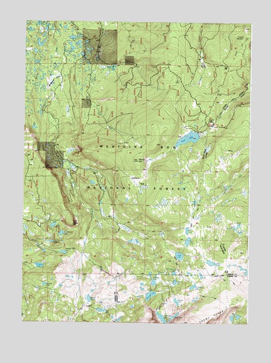
Sand Lake, WY USGS Topographic Map
Click on map above to begin viewing in our Map Viewer.

This topographic map contains these locations and features:
Feature Name Type Latitude Longitude GNIS ID View Map
Arrowhead LakeLakeN41.3901°W106.2807°1597809View Map
Black Spotted LakeLakeN41.3957°W106.2912°1604612View Map
Bow River Observation SiteLocaleN41.4358°W106.3600°1605038View Map
Bow River OverlookLocaleN41.4816°W106.3008°1598335View Map
Campbell LakeLakeN41.3985°W106.3658°1598603View Map
Carlson ParkLocaleN41.4819°W106.2761°1598635View Map
Carlson Park Guard StationLocaleN41.4864°W106.2764°1598636View Map
Cascade LakeLakeN41.4041°W106.3526°1598655View Map
Corpening DamDamN41.3950°W106.3672°1606162View Map
Corpening ReservoirReservoirN41.3950°W106.3672°1606163View Map
Corral LakeLakeN41.4250°W106.2799°1598919View Map
Crescent LakeLakeN41.3839°W106.2898°1599017View Map
Cutthoat LakeLakeN41.3920°W106.2908°1599095View Map
Deep Creek CampgroundLocaleN41.4577°W106.2725°1599180View Map
Deep LakeLakeN41.4029°W106.2884°1599185View Map
Drillers LakeLakeN41.4090°W106.3120°1704432View Map
East Banner LakeLakeN41.4120°W106.3539°1599446View Map
Edwards LakeLakeN41.3908°W106.3630°1604610View Map
Glacier LakesLakeN41.3778°W106.2555°1599948View Map
Golden Crown Mining Syndicate MineMineN41.4486°W106.3422°1726112View Map
Grassy LakeLakeN41.4156°W106.2584°1704437View Map
Jeff LakeLakeN41.4135°W106.2842°1600595View Map
Johnson ParkFlatN41.4339°W106.3103°1600647View Map
Little Long LakeLakeN41.3764°W106.3213°1704444View Map
Lookout MountainSummitN41.4939°W106.2533°1601124View Map
Meadows LakesLakeN41.3917°W106.3024°1601334View Map
Mutt LakeLakeN41.4091°W106.2837°1601649View Map
North Banner LakeLakeN41.4153°W106.3584°1601712View Map
North Gap LakeLakeN41.3766°W106.2972°1601831View Map
Pine ButteSummitN41.4158°W106.3478°1602147View Map
Quealy LakeLakeN41.3849°W106.3380°1602342View Map
Reservoir LakeLakeN41.3866°W106.3041°1602504View Map
Sand LakeLakeN41.4517°W106.2841°1602719View Map
Sand Lake LodgeBuildingN41.4383°W106.2681°1763996View Map
Sand Lake ReservoirReservoirN41.4533°W106.2689°1606139View Map
Sheep LakeLakeN41.4001°W106.2707°1602847View Map
Shelf LakesLakeN41.3775°W106.2917°1602865View Map
South Banner LakeLakeN41.4086°W106.3592°1603089View Map
Stillwater ParkFlatN41.4741°W106.3592°1603366View Map
Upper Long LakeLakeN41.3881°W106.3361°1763999View Map
Vagner LakeLakeN41.3801°W106.3315°1603898View Map
Vosseller LakeLakeN41.3773°W106.3249°1764000View Map
Waterloo ProspectMineN41.4864°W106.3575°1726103View Map
Wheatland Reservoir DamDamN41.4533°W106.2689°1606138View Map
Windy HillSummitN41.4422°W106.3111°1604243View Map

Note: Coordinates in the location and feature list above are referenced to NAD83 datum.


Copyright (C) 2008-2024 Ryan Niemi / Sunset Dynamics ... All Rights Reserved