TopoQuest Logo
Do you find TopoQuest useful?
Help keep TopoQuest running and adding new maps/features by donating!
Bitcoin:  19c7KJd3qBynnjoSw5npx9KScwjBe4ifkT
Litecoin:  LXs6TkuXGGXo1vDsWCkWVdjQX94eUKd6ui
Home View Maps Find Maps Find Places Resources & Links


Sam George Hill, Montana Topographic Map

USGS Map Title: Sam George Hill, MT
USGS Map MRC: 48112B1
DRG (GeoTIFF) Download: o48112b1.tif


Neighboring USGS Topographic Map Quads:


  Valier East, MT  
48112C2
 

  Belgian Hill, MT  
48112C1
 

  Pioneer School, MT  
48111C8
 

  Lone Man Coulee East, MT  
48112B2
 

  Sam George Hill, MT  
48112B1
 

  Conrad, MT  
48111B8
 

  Agawam North, MT  
48112A2
 

  Gallup City, MT  
48112A1
 

  Conrad SW, MT  
48111A8


Map MRC Location:

N49°
W113°
N49°
W112°
H8 H7 H6 H5 H4 H3 H2 H1
G8 G7 G6 G5 G4 G3 G2 G1
F8 F7 F6 F5 F4 F3 F2 F1
E8 E7 E6 E5 E4 E3 E2 E1
D8 D7 D6 D5 D4 D3 D2 D1
C8 C7 C6 C5 C4 C3 C2 C1
B8 B7 B6 B5 B4 B3 B2 B1
A8 A7 A6 A5 A4 A3 A2 A1
N48°
W113°
N48°
W112°

Sam George Hill, MT USGS 1:24K Topographic Map Preview:
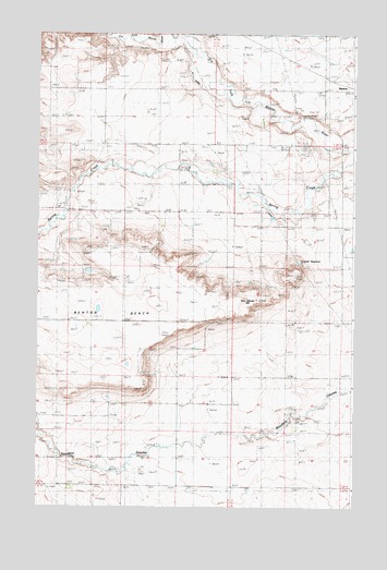
Sam George Hill, MT USGS Topographic Map
Click on map above to begin viewing in our Map Viewer.

This topographic map contains these locations and features:
Feature Name Type Latitude Longitude GNIS ID View Map
28N03W17AABB01 WellWellN48.1858°W112.0106°1633943View Map
28N03W17ABBC01 WellWellN48.1869°W112.0147°1633958View Map
28N03W17ABDB01 WellWellN48.1864°W112.0122°1633951View Map
Benton BenchBenchN48.1754°W112.0954°768711View Map
Boucher CouleeValleyN48.1547°W112.0011°1748703View Map
Conrad ReservoirReservoirN48.1900°W112.0216°770060View Map
DeBoer CouleeValleyN48.2022°W112.0284°1748704View Map
Earhart School (historical)SchoolN48.1527°W112.0909°770982View Map
Graham RanchLocaleN48.2080°W112.1125°771900View Map
Haatvedt CouleeValleyN48.2119°W112.0481°1748700View Map
King School (historical)SchoolN48.2036°W112.0692°773049View Map
MacLain RanchLocaleN48.2128°W112.0542°773784View Map
MansonPopulated PlaceN48.2375°W112.0064°773866View Map
Manson (historical)LocaleN48.2375°W112.0064°1748789View Map
Manson Post Office (historical)Post OfficeN48.2375°W112.0064°1748790View Map
Manson School (historical)SchoolN48.2375°W112.0064°1748827View Map
Old Camp (historical)LocaleN48.2486°W112.0425°1748787View Map
Sam George HillSummitN48.1797°W112.0389°776149View Map

Note: Coordinates in the location and feature list above are referenced to NAD83 datum.


Copyright (C) 2008-2024 Ryan Niemi / Sunset Dynamics ... All Rights Reserved