TopoQuest Logo
Do you find TopoQuest useful?
Help keep TopoQuest running and adding new maps/features by donating!
Bitcoin:  19c7KJd3qBynnjoSw5npx9KScwjBe4ifkT
Litecoin:  LXs6TkuXGGXo1vDsWCkWVdjQX94eUKd6ui
Home View Maps Find Maps Find Places Resources & Links


Saltillo, Pennsylvania Topographic Map

USGS Map Title: Saltillo, PA
USGS Map MRC: 40078B1
DRG (GeoTIFF) Download: o40078b1.tif


Neighboring USGS Topographic Map Quads:


  Entriken, PA  
40078C2
 

  Cassville, PA  
40078C1
 

  Butler Knob, PA  
40077C8
 

  Saxton, PA  
40078B2
 

  Saltillo, PA  
40078B1
 

  Orbisonia, PA  
40077B8
 

  Wells Tannery, PA  
40078A2
 

  Hustontown, PA  
40078A1
 

  Burnt Cabins, PA  
40077A8


Map MRC Location:

N41°
W79°
N41°
W78°
H8 H7 H6 H5 H4 H3 H2 H1
G8 G7 G6 G5 G4 G3 G2 G1
F8 F7 F6 F5 F4 F3 F2 F1
E8 E7 E6 E5 E4 E3 E2 E1
D8 D7 D6 D5 D4 D3 D2 D1
C8 C7 C6 C5 C4 C3 C2 C1
B8 B7 B6 B5 B4 B3 B2 B1
A8 A7 A6 A5 A4 A3 A2 A1
N40°
W79°
N40°
W78°

Saltillo, PA USGS 1:24K Topographic Map Preview:
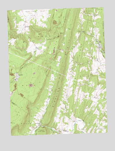
Saltillo, PA USGS Topographic Map
Click on map above to begin viewing in our Map Viewer.

This topographic map contains these locations and features:
Feature Name Type Latitude Longitude GNIS ID View Map
Borough of SaltilloCivilN40.2118°W78.0062°1215278View Map
Brier RidgeRidgeN40.2001°W78.0008°1192186View Map
Calvary ChurchChurchN40.2179°W78.0089°1170930View Map
Cave HillSummitN40.1815°W78.0019°1171351View Map
Cedar Grove School (historical)SchoolN40.1565°W78.0158°1197702View Map
Center Grove ChurchChurchN40.1734°W78.0319°1171437View Map
Center Grove School (historical)SchoolN40.1734°W78.0319°1197701View Map
Cherry Grove CemeteryCemeteryN40.1560°W78.0151°1844208View Map
Cherry Grove ChurchChurchN40.1604°W78.0139°1171632View Map
Coles SummitSummitN40.2256°W78.0572°1172198View Map
Coles ValleyValleyN40.1351°W78.0867°1172199View Map
Coles Valley CemeteryCemeteryN40.2164°W78.0539°1844211View Map
Coles Valley Church (historical)ChurchN40.2173°W78.0539°1197697View Map
CooksPopulated PlaceN40.2115°W78.0872°1203330View Map
Eagle FoundryLocaleN40.2323°W78.1028°1173692View Map
Eagle Foundry ChurchChurchN40.2306°W78.1025°1197694View Map
Edwards Family CemeteryCemeteryN40.2157°W78.0861°2026379View Map
FairviewPopulated PlaceN40.2117°W78.0375°1203549View Map
Fairview CemeteryCemeteryN40.2124°W78.0374°1844210View Map
Gracey TrailTrailN40.1292°W78.0914°1175913View Map
Grave MountainSummitN40.2195°W78.1070°1192540View Map
Green SchoolSchoolN40.2381°W78.1014°1197695View Map
HubelsvilleLocaleN40.1376°W78.0422°1207142View Map
Hubelsville (historical)LocaleN40.1573°W78.0514°1202273View Map
JollerPopulated PlaceN40.2040°W78.0667°1178137View Map
KimmelPopulated PlaceN40.2095°W78.0558°1178467View Map
KnightsvillePopulated PlaceN40.2420°W78.0117°1178608View Map
Meadow Green ChurchChurchN40.1895°W78.0417°1180821View Map
Meadow Green SchoolSchoolN40.1851°W78.0439°1197700View Map
Mount Pleasant CemeteryCemeteryN40.2187°W78.0941°1181802View Map
New GrenadaPopulated PlaceN40.1345°W78.0875°1182327View Map
Oak Grove CemeteryCemeteryN40.1376°W78.0426°1844207View Map
Oak Grove ChurchChurchN40.1373°W78.0419°1182742View Map
Oak Grove SchoolSchoolN40.1392°W78.0447°1197704View Map
Pine Grove School (historical)SchoolN40.2237°W78.0178°1197698View Map
Pine Grove School (historical)SchoolN40.1537°W78.0778°1197703View Map
Poplar HollowValleyN40.2221°W78.0131°1184255View Map
Roaring RunStreamN40.1345°W78.0858°1185171View Map
Roaring RunStreamN40.2487°W78.0117°1185181View Map
RobertsdalePopulated PlaceN40.1842°W78.1153°1185213View Map
Robertsdale Elementary SchoolSchoolN40.1812°W78.1172°1211464View Map
Robertsdale Italian CemeteryCemeteryN40.1786°W78.1168°2026377View Map
Robertsdale Post OfficePost OfficeN40.1830°W78.1148°2779577View Map
Robertsdale Wood Broadtop Volunteer Fire Company Station 17BuildingN40.1794°W78.1161°2645301View Map
Rock Hill Lookout TowerTowerN40.1379°W78.1245°1213345View Map
Rocky RidgeRidgeN40.2226°W78.0572°1185360View Map
Round KnobSummitN40.2259°W78.0864°1185530View Map
SaltilloPopulated PlaceN40.2106°W78.0067°1186881View Map
Saltillo CemeteryCemeteryN40.2063°W78.0070°1988411View Map
Saltillo Post OfficePost OfficeN40.2102°W78.0069°2772960View Map
Shore ValleyValleyN40.1375°W78.0432°1187590View Map
Shore Valley CemeteryCemeteryN40.1597°W78.0526°1844209View Map
Spring Farms Elementary SchoolSchoolN40.1976°W78.0094°1217374View Map
State Game Lands Number 121ParkN40.1704°W78.0631°1193433View Map
Taylor SchoolSchoolN40.2487°W78.0683°1197696View Map
Three Springs Farm SchoolSchoolN40.1956°W78.0064°1197699View Map
Township of ClayCivilN40.1804°W78.0200°1216505View Map
Township of WoodCivilN40.1774°W78.0995°1216530View Map
Trough Creek ValleyValleyN40.2473°W78.0783°1193551View Map
WaterfallPopulated PlaceN40.1276°W78.0628°1190671View Map
Waterfall Post OfficePost OfficeN40.1267°W78.0616°2773020View Map
West Branch Roaring RunStreamN40.1817°W78.0656°1190930View Map
Yellow BranchStreamN40.2104°W78.0856°1191871View Map
Zion ChurchChurchN40.1320°W78.0714°1191974View Map
Zion Methodist Church CemeteryCemeteryN40.1322°W78.0713°1844206View Map

Note: Coordinates in the location and feature list above are referenced to NAD83 datum.


Copyright (C) 2008-2024 Ryan Niemi / Sunset Dynamics ... All Rights Reserved