TopoQuest Logo
Do you find TopoQuest useful?
Help keep TopoQuest running and adding new maps/features by donating!
Bitcoin:  19c7KJd3qBynnjoSw5npx9KScwjBe4ifkT
Litecoin:  LXs6TkuXGGXo1vDsWCkWVdjQX94eUKd6ui
Home View Maps Find Maps Find Places Resources & Links


Salt Canyon, Wyoming Topographic Map

USGS Map Title: Salt Canyon, WY
USGS Map MRC: 43106D5
DRG (GeoTIFF) Download: o43106d5.tif


Neighboring USGS Topographic Map Quads:


  TTT Ranch, WY  
43106E6
 

  Wall Creek, WY  
43106E5
 

  Dugout Ranch, WY  
43106E4
 

  Broken Horn Creek, WY  
43106D6
 

  Salt Canyon, WY  
43106D5
 

  Government Creek, WY  
43106D4
 

  Fiftymile Flat, WY  
43106C6
 

  Camel Hump Reservoir, WY  
43106C5
 

  Big Gulch, WY  
43106C4


Map MRC Location:

N44°
W107°
N44°
W106°
H8 H7 H6 H5 H4 H3 H2 H1
G8 G7 G6 G5 G4 G3 G2 G1
F8 F7 F6 F5 F4 F3 F2 F1
E8 E7 E6 E5 E4 E3 E2 E1
D8 D7 D6 D5 D4 D3 D2 D1
C8 C7 C6 C5 C4 C3 C2 C1
B8 B7 B6 B5 B4 B3 B2 B1
A8 A7 A6 A5 A4 A3 A2 A1
N43°
W107°
N43°
W106°

Salt Canyon, WY USGS 1:24K Topographic Map Preview:
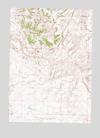
Salt Canyon, WY USGS Topographic Map
Click on map above to begin viewing in our Map Viewer.

This topographic map contains these locations and features:
Feature Name Type Latitude Longitude GNIS ID View Map
Antelope SpringsSpringN43.4314°W106.5805°1584895View Map
Antelope Springs RanchLocaleN43.4269°W106.5870°1584898View Map
Big V ReservoirReservoirN43.3877°W106.5907°1585523View Map
Bobcat BasinBasinN43.4655°W106.5381°1585720View Map
Chocolate ReservoirReservoirN43.4544°W106.5666°1586683View Map
Devils MonumentPillarN43.4527°W106.5828°1587565View Map
Fitzpatrick DrawValleyN43.3825°W106.6223°1588523View Map
Jacques SpringSpringN43.4101°W106.5497°1590041View Map
Rock Spring ReservoirReservoirN43.4068°W106.5314°1593587View Map
Salt CanyonValleyN43.4766°W106.6187°1593806View Map
South Wall DamDamN43.4250°W106.5889°1607190View Map
South Wall Number 3 DamDamN43.4200°W106.5789°1606486View Map
South Wall Number 3 ReservoirReservoirN43.4200°W106.5789°1606487View Map
South Wall ReservoirReservoirN43.4250°W106.5889°1607191View Map
Three Forks ReservoirReservoirN43.4241°W106.6026°1595535View Map
Tisdale Number Ten MineMineN43.4919°W106.5123°1746170View Map
Willow ReservoirReservoirN43.4193°W106.6048°1596471View Map

Note: Coordinates in the location and feature list above are referenced to NAD83 datum.


Copyright (C) 2008-2024 Ryan Niemi / Sunset Dynamics ... All Rights Reserved