TopoQuest Logo
Do you find TopoQuest useful?
Help keep TopoQuest running and adding new maps/features by donating!
Bitcoin:  19c7KJd3qBynnjoSw5npx9KScwjBe4ifkT
Litecoin:  LXs6TkuXGGXo1vDsWCkWVdjQX94eUKd6ui
Home View Maps Find Maps Find Places Resources & Links


Saint Regis, Montana Topographic Map

USGS Map Title: Saint Regis, MT
USGS Map MRC: 47115C1
DRG (GeoTIFF) Download: o47115c1.tif


Neighboring USGS Topographic Map Quads:


  Penrose Peak, MT  
47115D2
 

  Sunset Peak, MT  
47115D1
 

  Plains, MT  
47114D8
 

  Boyd Mountain, MT  
47115C2
 

  Saint Regis, MT  
47115C1
 

  Keystone Peak, MT  
47114C8
 

  Torino Peak, MT  
47115B2
 

  Wilson Gulch, MT  
47115B1
 

  Superior, MT  
47114B8


Map MRC Location:

N48°
W116°
N48°
W115°
H8 H7 H6 H5 H4 H3 H2 H1
G8 G7 G6 G5 G4 G3 G2 G1
F8 F7 F6 F5 F4 F3 F2 F1
E8 E7 E6 E5 E4 E3 E2 E1
D8 D7 D6 D5 D4 D3 D2 D1
C8 C7 C6 C5 C4 C3 C2 C1
B8 B7 B6 B5 B4 B3 B2 B1
A8 A7 A6 A5 A4 A3 A2 A1
N47°
W116°
N47°
W115°

Saint Regis, MT USGS 1:24K Topographic Map Preview:
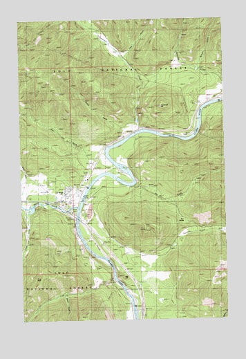
Saint Regis, MT USGS Topographic Map
Click on map above to begin viewing in our Map Viewer.

This topographic map contains these locations and features:
Feature Name Type Latitude Longitude GNIS ID View Map
Bitterroot Ferry (historical)LocaleN47.2977°W115.0871°1781694View Map
Brown GulchValleyN47.2597°W115.1001°780443View Map
Burr SaddleGapN47.2930°W115.0274°798935View Map
Butler GulchValleyN47.3277°W115.0629°769440View Map
Campground Saint RegisLocaleN47.3119°W115.1232°1781743View Map
Cold CreekStreamN47.2672°W115.0690°781489View Map
Cold PeakSummitN47.2674°W115.1146°770018View Map
Fourmile CreekStreamN47.2755°W115.0421°783647View Map
Graham GulchValleyN47.3552°W115.0154°784150View Map
Halpin Post Office (historical)Post OfficeN47.2999°W115.1232°1781648View Map
Interchange 33CrossingN47.2966°W115.1010°1781725View Map
Interchange 37CrossingN47.2541°W115.0532°1781724View Map
John Mullan StatueParkN47.2994°W115.1026°1781705View Map
Kinneys Spur (historical)LocaleN47.2999°W115.1232°1781636View Map
Kitchen (historical)LocaleN47.2972°W115.0912°1781635View Map
Little Joe CreekStreamN47.2966°W115.1213°786311View Map
Long GulchValleyN47.3602°W115.0599°786524View Map
Mayo GulchValleyN47.3219°W115.0879°773948View Map
Mill CreekStreamN47.3066°W115.0560°787366View Map
Miller DrawValleyN47.2860°W115.0043°807039View Map
Mullan GulchValleyN47.3116°W115.1232°787848View Map
Red HillSummitN47.2674°W115.0618°775643View Map
Riberdy Post Office (historical)Post OfficeN47.3152°W115.0801°1781612View Map
Saint RegisPopulated PlaceN47.2994°W115.1026°776134View Map
Saint RegisLocaleN47.2994°W115.1026°1781607View Map
Saint Regis BeaconLocaleN47.2866°W115.0504°776135View Map
Saint Regis Branch LibraryBuildingN47.2994°W115.1026°1781737View Map
Saint Regis CemeteryCemeteryN47.3055°W115.0876°1781762View Map
Saint Regis Census Designated PlaceCensusN47.3016°W115.1015°2409233View Map
Saint Regis Fishing Access SiteLocaleN47.3022°W115.0893°1744334View Map
Saint Regis KOA KampgroundsLocaleN47.2838°W115.0724°1781741View Map
Saint Regis Methodist Church (historical)ChurchN47.2994°W115.1026°1781707View Map
Saint Regis Post OfficePost OfficeN47.2987°W115.1001°1781608View Map
Saint Regis Public SchoolsSchoolN47.2999°W115.1010°1781712View Map
Saint Regis Riding Stables CampgroundLocaleN47.2994°W115.1026°1781739View Map
Saint Regis RiverStreamN47.2966°W115.0904°789958View Map
Saint Regis Rural Fire DepartmentBuildingN47.3015°W115.0935°1781701View Map
Saint Regis Visitor Information CenterBuildingN47.2994°W115.1026°1781751View Map
Spitfire MineMineN47.3566°W115.0065°804746View Map
Tamarack CreekStreamN47.3288°W115.0490°791876View Map
Tamarack HillSummitN47.3383°W115.0396°777413View Map
ToolePopulated PlaceN47.3260°W115.0229°777708View Map
Toole School (historical)SchoolN47.3260°W115.0229°1781591View Map
Trestle Creek Golf ClubLocaleN47.2863°W115.0879°1781742View Map

Note: Coordinates in the location and feature list above are referenced to NAD83 datum.


Copyright (C) 2008-2024 Ryan Niemi / Sunset Dynamics ... All Rights Reserved