TopoQuest Logo
Do you find TopoQuest useful?
Help keep TopoQuest running and adding new maps/features by donating!
Bitcoin:  19c7KJd3qBynnjoSw5npx9KScwjBe4ifkT
Litecoin:  LXs6TkuXGGXo1vDsWCkWVdjQX94eUKd6ui
Home View Maps Find Maps Find Places Resources & Links


Saint Onge, South Dakota Topographic Map

USGS Map Title: Saint Onge, SD
USGS Map MRC: 44103E6
DRG (GeoTIFF) Download: o44103e6.tif


Neighboring USGS Topographic Map Quads:


  Belle Fourche, SD  
44103F7
 

  Fruitdale, SD  
44103F6
 

  Nisland, SD  
44103F5
 

  Jolly, SD  
44103E7
 

  Saint Onge, SD  
44103E6
 

  Saint Onge SE, SD  
44103E5
 

  Spearfish, SD  
44103D7
 

  Deadwood North, SD  
44103D6
 

  Sturgis, SD  
44103D5


Map MRC Location:

N45°
W104°
N45°
W103°
H8 H7 H6 H5 H4 H3 H2 H1
G8 G7 G6 G5 G4 G3 G2 G1
F8 F7 F6 F5 F4 F3 F2 F1
E8 E7 E6 E5 E4 E3 E2 E1
D8 D7 D6 D5 D4 D3 D2 D1
C8 C7 C6 C5 C4 C3 C2 C1
B8 B7 B6 B5 B4 B3 B2 B1
A8 A7 A6 A5 A4 A3 A2 A1
N44°
W104°
N44°
W103°

Saint Onge, SD USGS 1:24K Topographic Map Preview:
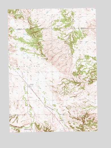
Saint Onge, SD USGS Topographic Map
Click on map above to begin viewing in our Map Viewer.

This topographic map contains these locations and features:
Feature Name Type Latitude Longitude GNIS ID View Map
Asbury SchoolSchoolN44.5108°W103.6741°1253698View Map
Baldy PeakSummitN44.5571°W103.6507°1253755View Map
Dane ChurchChurchN44.5255°W103.6708°1254598View Map
Dry CreekStreamN44.5619°W103.7335°1261585View Map
Little Dane CemeteryCemeteryN44.5253°W103.6708°2779180View Map
Middle False Bottom SchoolSchoolN44.5030°W103.7196°1256447View Map
Polo CreekStreamN44.5089°W103.7191°1262225View Map
Rodeo Grounds CemeteryCemeteryN44.5577°W103.7488°2779183View Map
Saint OngePopulated PlaceN44.5467°W103.7210°1257699View Map
Saint Onge CemeteryCemeteryN44.5353°W103.7235°1257700View Map
Saint Onge Census Designated PlaceCensusN44.5457°W103.7199°2628850View Map
Saint Onge PeakSummitN44.5736°W103.6958°1257701View Map
Saint Onge Post OfficePost OfficeN44.5479°W103.7210°2711880View Map
Saint Onge Volunteer Fire DepartmentBuildingN44.5475°W103.7219°2580756View Map
Township of Saint OngeCivilN44.5612°W103.7489°1729737View Map

Note: Coordinates in the location and feature list above are referenced to NAD83 datum.


Copyright (C) 2008-2024 Ryan Niemi / Sunset Dynamics ... All Rights Reserved