TopoQuest Logo
Do you find TopoQuest useful?
Help keep TopoQuest running and adding new maps/features by donating!
Bitcoin:  19c7KJd3qBynnjoSw5npx9KScwjBe4ifkT
Litecoin:  LXs6TkuXGGXo1vDsWCkWVdjQX94eUKd6ui
Home View Maps Find Maps Find Places Resources & Links


Billy Goat Mountain, Washington Topographic Map

USGS Map Title: Billy Goat Mountain, WA
USGS Map MRC: 48120G3
DRG (GeoTIFF) Download: o48120g3.tif


Neighboring USGS Topographic Map Quads:


  Ashnola Mountain, WA  
48120H4
 

  Ashnola Pass, WA  
48120H3
 

  Remmel Mountain, WA  
48120H2
 

  Lost Peak, WA  
48120G4
 

  Billy Goat Mountain, WA  
48120G3
 

  Mount Barney, WA  
48120G2
 

  McLeod Mountain, WA  
48120F4
 

  Sweetgrass Butte, WA  
48120F3
 

  Doe Mountain, WA  
48120F2


Map MRC Location:

N49°
W121°
N49°
W120°
H8 H7 H6 H5 H4 H3 H2 H1
G8 G7 G6 G5 G4 G3 G2 G1
F8 F7 F6 F5 F4 F3 F2 F1
E8 E7 E6 E5 E4 E3 E2 E1
D8 D7 D6 D5 D4 D3 D2 D1
C8 C7 C6 C5 C4 C3 C2 C1
B8 B7 B6 B5 B4 B3 B2 B1
A8 A7 A6 A5 A4 A3 A2 A1
N48°
W121°
N48°
W120°

Billy Goat Mountain, WA USGS 1:24K Topographic Map Preview:
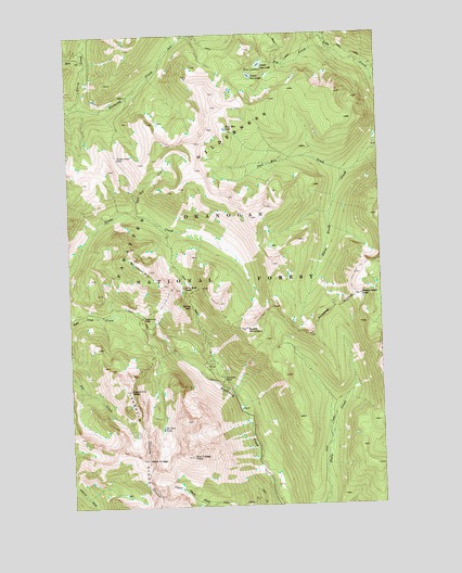
Billy Goat Mountain, WA USGS Topographic Map
Click on map above to begin viewing in our Map Viewer.

This topographic map contains these locations and features:
Feature Name Type Latitude Longitude GNIS ID View Map
Big Craggy PeakSummitN48.7629°W120.3276°1516478View Map
Billy Goat CorralLocaleN48.7838°W120.3148°1516558View Map
Billy Goat MountainSummitN48.8126°W120.3434°1516560View Map
Billy Goat PassGapN48.8079°W120.3293°1516562View Map
Billy Goat TrailheadLocaleN48.7843°W120.3159°1529716View Map
Burch MountainSummitN48.7968°W120.3045°1517105View Map
Carol CreekStreamN48.8640°W120.2529°1517411View Map
Early Winters DivisionCivilN48.7944°W120.3592°1939495View Map
Eightmile PassGapN48.7996°W120.3462°1519214View Map
Eightmile PeakSummitN48.7807°W120.3518°1519215View Map
Fool Hen CreekStreamN48.8379°W120.2637°1519678View Map
Fool Hen LakeLakeN48.8498°W120.3123°1519679View Map
Fox CreekStreamN48.8699°W120.2684°1519753View Map
Fox LakesLakeN48.8654°W120.2993°1519757View Map
Larch CreekStreamN48.8563°W120.3737°1521903View Map
Lower Fox LakeLakeN48.8667°W120.2980°1522541View Map
Newland CreekStreamN48.8726°W120.2712°1523643View Map
No Dice LakeLakeN48.7708°W120.3397°1523690View Map
Obstruction PeakSummitN48.8057°W120.2593°1523968View Map
Three Fools PassGapN48.8426°W120.3559°1527146View Map
Tony CreekStreamN48.8679°W120.3673°1527308View Map
Two Bit CreekStreamN48.8282°W120.3512°1531570View Map
Upper Fox LakeLakeN48.8639°W120.3022°1527629View Map
West CraggyCliffN48.7624°W120.3457°1527921View Map

Note: Coordinates in the location and feature list above are referenced to NAD83 datum.


Copyright (C) 2008-2024 Ryan Niemi / Sunset Dynamics ... All Rights Reserved