TopoQuest Logo
Do you find TopoQuest useful?
Help keep TopoQuest running and adding new maps/features by donating!
Bitcoin:  19c7KJd3qBynnjoSw5npx9KScwjBe4ifkT
Litecoin:  LXs6TkuXGGXo1vDsWCkWVdjQX94eUKd6ui
Home View Maps Find Maps Find Places Resources & Links


Saint Joseph, Iowa Topographic Map

USGS Map Title: Saint Joseph, IA
USGS Map MRC: 42094H2
DRG (GeoTIFF) Download: o42094h2.tif


Neighboring USGS Topographic Map Quads:


  Hobarton, IA  
43094A3
 

  Algona, IA  
43094A2
 

  Sexton, IA  
43094A1
 

  West Bend NE, IA  
42094H3
 

  Saint Joseph, IA  
42094H2
 

  Lu Verne, IA  
42094H1
 

  Bode, IA  
42094G3
 

  Livermore, IA  
42094G2
 

  Hardy, IA  
42094G1


Map MRC Location:

N43°
W95°
N43°
W94°
H8 H7 H6 H5 H4 H3 H2 H1
G8 G7 G6 G5 G4 G3 G2 G1
F8 F7 F6 F5 F4 F3 F2 F1
E8 E7 E6 E5 E4 E3 E2 E1
D8 D7 D6 D5 D4 D3 D2 D1
C8 C7 C6 C5 C4 C3 C2 C1
B8 B7 B6 B5 B4 B3 B2 B1
A8 A7 A6 A5 A4 A3 A2 A1
N42°
W95°
N42°
W94°

Saint Joseph, IA USGS 1:24K Topographic Map Preview:
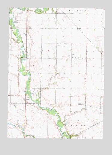
Saint Joseph, IA USGS Topographic Map
Click on map above to begin viewing in our Map Viewer.

This topographic map contains these locations and features:
Feature Name Type Latitude Longitude GNIS ID View Map
Byron Post Office (historical)Post OfficeN42.9069°W94.1725°1926076View Map
Damman CemeteryCemeteryN42.9333°W94.1391°1925122View Map
Devine Wildlife AreaParkN42.9500°W94.2308°1925090View Map
Drainage Ditch Number 1CanalN42.9011°W94.1561°465752View Map
Drainage Ditch Number 116CanalN42.9886°W94.1286°465764View Map
Drainage Ditch Number 182CanalN42.9475°W94.1886°465778View Map
Drainage Ditch Number 8CanalN42.9141°W94.2469°465811View Map
Eber (historical)LocaleN42.8783°W94.1641°1926075View Map
Eber Post Office (historical)Post OfficeN42.8783°W94.1641°1926074View Map
Fourmile CreekStreamN42.9983°W94.2469°456709View Map
GalbraithLocaleN42.9805°W94.1591°1925117View Map
GalbraithPopulated PlaceN42.9805°W94.1591°464552View Map
Galbraith Post Office (historical)Post OfficeN42.9805°W94.1591°1925118View Map
Kohlhaas AirportAirportN42.9539°W94.1677°466857View Map
Lotts CreekStreamN42.8777°W94.1725°465598View Map
Saint JosephPopulated PlaceN42.9133°W94.2272°461082View Map
Saint Joseph Catholic ChurchChurchN42.9127°W94.2277°1925086View Map
Saint Joseph Census Designated PlaceCensusN42.9123°W94.2309°2585486View Map
Saint Joseph Posot Office (historical)Post OfficeN42.9133°W94.2272°1925113View Map
Saint Joseph's Catholic CemeteryCemeteryN42.9120°W94.2301°1925170View Map
Spring Valley Golf CourseLocaleN42.9306°W94.1926°1926174View Map
SumnerLocaleN42.8819°W94.2239°463991View Map
Township of ShermanCivilN42.9515°W94.1486°468699View Map
Union CemeteryCemeteryN42.8779°W94.2178°462436View Map

Note: Coordinates in the location and feature list above are referenced to NAD83 datum.


Copyright (C) 2008-2024 Ryan Niemi / Sunset Dynamics ... All Rights Reserved