TopoQuest Logo
Do you find TopoQuest useful?
Help keep TopoQuest running and adding new maps/features by donating!
Bitcoin:  19c7KJd3qBynnjoSw5npx9KScwjBe4ifkT
Litecoin:  LXs6TkuXGGXo1vDsWCkWVdjQX94eUKd6ui
Home View Maps Find Maps Find Places Resources & Links


Sabinal Canyon, Texas Topographic Map

USGS Map Title: Sabinal Canyon, TX
USGS Map MRC: 29099G5
DRG (GeoTIFF) Download: o29099g5.tif


Neighboring USGS Topographic Map Quads:


  Hillcrest Ranch, TX  
29099H6
 

  Well Hollow, TX  
29099H5
 

  Diamond S Ranch, TX  
29099H4
 

  Circle Bluff, TX  
29099G6
 

  Sabinal Canyon, TX  
29099G5
 

  Love Creek, TX  
29099G4
 

  Rio Frio, TX  
29099F6
 

  Vanderpool, TX  
29099F5
 

  Seco Pass, TX  
29099F4


Map MRC Location:

N30°
W100°
N30°
W99°
H8 H7 H6 H5 H4 H3 H2 H1
G8 G7 G6 G5 G4 G3 G2 G1
F8 F7 F6 F5 F4 F3 F2 F1
E8 E7 E6 E5 E4 E3 E2 E1
D8 D7 D6 D5 D4 D3 D2 D1
C8 C7 C6 C5 C4 C3 C2 C1
B8 B7 B6 B5 B4 B3 B2 B1
A8 A7 A6 A5 A4 A3 A2 A1
N29°
W100°
N29°
W99°

Sabinal Canyon, TX USGS 1:24K Topographic Map Preview:
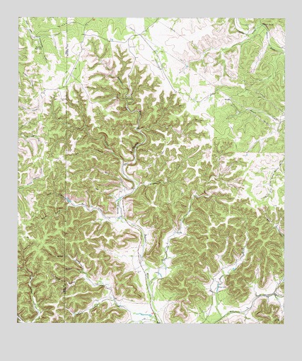
Sabinal Canyon, TX USGS Topographic Map
Click on map above to begin viewing in our Map Viewer.

This topographic map contains these locations and features:
Feature Name Type Latitude Longitude GNIS ID View Map
Brushy CreekStreamN29.7641°W99.5634°1353032View Map
Can CreekStreamN29.8155°W99.5753°1353712View Map
Dry Can CreekStreamN29.8027°W99.5742°1356290View Map
Evans CreekStreamN29.7527°W99.5295°1357102View Map
Fiddler HollowValleyN29.7684°W99.5930°1357303View Map
Flatrock SpringSpringN29.8724°W99.5112°1357464View Map
Jim Jernigan HollowValleyN29.7509°W99.5717°1338734View Map
Lost Maples State Natural AreaParkN29.8197°W99.5831°2029832View Map
Lost Maples State Natural Area TrailsTrailN29.8152°W99.5751°2033413View Map
Marler CreekStreamN29.7933°W99.5762°1362186View Map
Massey HollowValleyN29.7594°W99.5797°1362265View Map
Middle Prong Jerigan CreekStreamN29.7705°W99.5934°1362744View Map
North Prong Jernigan CreekStreamN29.7705°W99.5934°1364116View Map
North Prong Marler CreekStreamN29.7986°W99.5987°1364119View Map
Pelaez LakeLakeN29.7652°W99.5314°1365015View Map
Pelaez Lake DamDamN29.7636°W99.5320°1863636View Map
Post Oak WaterholeLakeN29.8627°W99.6142°1365669View Map
Sabinal CanyonValleyN29.7680°W99.5642°1367079View Map
Snow CreekStreamN29.8027°W99.5742°1368568View Map
South Prong Marler CreekStreamN29.7986°W99.5989°1368749View Map
Wedgeworth CreekStreamN29.8069°W99.5684°1370980View Map
Willow Springs BranchStreamN29.7627°W99.5050°1376825View Map

Note: Coordinates in the location and feature list above are referenced to NAD83 datum.


Copyright (C) 2008-2024 Ryan Niemi / Sunset Dynamics ... All Rights Reserved