TopoQuest Logo
Do you find TopoQuest useful?
Help keep TopoQuest running and adding new maps/features by donating!
Bitcoin:  19c7KJd3qBynnjoSw5npx9KScwjBe4ifkT
Litecoin:  LXs6TkuXGGXo1vDsWCkWVdjQX94eUKd6ui
Home View Maps Find Maps Find Places Resources & Links


Rugby, North Dakota Topographic Map

USGS Map Title: Rugby, ND
USGS Map MRC: 48099C8
DRG (GeoTIFF) Download: o48099c8.tif


Neighboring USGS Topographic Map Quads:


  Leverich, ND  
48100D1
 

  Rugby NW, ND  
48099D8
 

  Rugby NE, ND  
48099D7
 

  Tunbridge, ND  
48100C1
 

  Rugby, ND  
48099C8
 

  Pleasant Lake, ND  
48099C7
 

  Balta, ND  
48100B1
 

  Silva, ND  
48099B8
 

  Fillmore, ND  
48099B7


Map MRC Location:

N49°
W100°
N49°
W99°
H8 H7 H6 H5 H4 H3 H2 H1
G8 G7 G6 G5 G4 G3 G2 G1
F8 F7 F6 F5 F4 F3 F2 F1
E8 E7 E6 E5 E4 E3 E2 E1
D8 D7 D6 D5 D4 D3 D2 D1
C8 C7 C6 C5 C4 C3 C2 C1
B8 B7 B6 B5 B4 B3 B2 B1
A8 A7 A6 A5 A4 A3 A2 A1
N48°
W100°
N48°
W99°

Rugby, ND USGS 1:24K Topographic Map Preview:
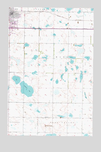
Rugby, ND USGS Topographic Map
Click on map above to begin viewing in our Map Viewer.

This topographic map contains these locations and features:
Feature Name Type Latitude Longitude GNIS ID View Map
City of RugbyCivilN48.3665°W99.9921°1036246View Map
Geographical Center of North America MonumentParkN48.3544°W99.9981°1029099View Map
Geographical Center SpeedwayLocaleN48.3739°W99.9921°2749258View Map
Gunderson LakeLakeN48.2951°W99.9728°1029259View Map
Heart of America Correctional and Treatment CenterBuildingN48.3737°W99.9775°2734494View Map
Heart of America LibraryBuildingN48.3675°W99.9980°2745713View Map
Heart of America Medical CenterHospitalN48.3635°W99.9973°2733289View Map
Highland Lutheran CemeteryCemeteryN48.2673°W99.8772°2782318View Map
KGCA-AM (Rugby)TowerN48.3539°W99.9924°1033429View Map
Lincoln School Number 1SchoolN48.3114°W99.9985°1029904View Map
Lincoln School Number 2SchoolN48.3403°W99.9549°1029908View Map
Lincoln School Number 3SchoolN48.2964°W99.9337°1029910View Map
Little Flower CemeteryCemeteryN48.3694°W99.9754°1029932View Map
Little Flower Elementary SchoolSchoolN48.3670°W99.9927°2748151View Map
Northern Lights Tower and Interpretive CenterParkN48.3543°W99.9948°2749259View Map
Pierce County CourthouseBuildingN48.3683°W99.9912°2743510View Map
Pierce County Sheriff DepartmentBuildingN48.3738°W99.9772°2734460View Map
Prairie Village MuseumBuildingN48.3529°W99.9951°2749260View Map
RugbyPopulated PlaceN48.3689°W99.9962°1031031View Map
Rugby City HallBuildingN48.3678°W99.9957°2745275View Map
Rugby Ely Elementary SchoolSchoolN48.3679°W99.9982°2748149View Map
Rugby Emergency Ambulance ServiceBuildingN48.3632°W99.9970°2658763View Map
Rugby Fire Department and Protection DistrictBuildingN48.3682°W99.9957°2637565View Map
Rugby High SchoolSchoolN48.3591°W99.9943°2748150View Map
Rugby Police DepartmentBuildingN48.3735°W99.9776°2734342View Map
Rugby Post OfficePost OfficeN48.3689°W99.9942°2742980View Map
School Number 1SchoolN48.3550°W99.8901°1031519View Map
School Number 2SchoolN48.2686°W99.9454°1031694View Map
School Number 3SchoolN48.2569°W99.8904°1031838View Map
Township of MeyerCivilN48.3267°W99.9121°1759557View Map
Victorian Dress MusuemBuildingN48.3670°W99.9979°2749261View Map

Note: Coordinates in the location and feature list above are referenced to NAD83 datum.


Copyright (C) 2008-2024 Ryan Niemi / Sunset Dynamics ... All Rights Reserved