TopoQuest Logo
Do you find TopoQuest useful?
Help keep TopoQuest running and adding new maps/features by donating!
Bitcoin:  19c7KJd3qBynnjoSw5npx9KScwjBe4ifkT
Litecoin:  LXs6TkuXGGXo1vDsWCkWVdjQX94eUKd6ui
Home View Maps Find Maps Find Places Resources & Links


Royal City, Washington Topographic Map

USGS Map Title: Royal City, WA
USGS Map MRC: 46119H6
DRG (GeoTIFF) Download: o46119h6.tif


Neighboring USGS Topographic Map Quads:


  George, WA  
47119A7
 

  Winchester SW, WA  
47119A6
 

  Winchester SE, WA  
47119A5
 

  Beverly NE, WA  
46119H7
 

  Royal City, WA  
46119H6
 

  Frenchman Hills Lake, WA  
46119H5
 

  Beverly SE, WA  
46119G7
 

  Smyrna, WA  
46119G6
 

  Wahatis Peak, WA  
46119G5


Map MRC Location:

N47°
W120°
N47°
W119°
H8 H7 H6 H5 H4 H3 H2 H1
G8 G7 G6 G5 G4 G3 G2 G1
F8 F7 F6 F5 F4 F3 F2 F1
E8 E7 E6 E5 E4 E3 E2 E1
D8 D7 D6 D5 D4 D3 D2 D1
C8 C7 C6 C5 C4 C3 C2 C1
B8 B7 B6 B5 B4 B3 B2 B1
A8 A7 A6 A5 A4 A3 A2 A1
N46°
W120°
N46°
W119°

Royal City, WA USGS 1:24K Topographic Map Preview:
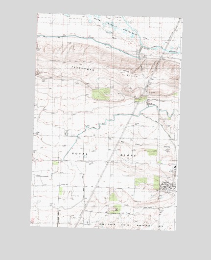
Royal City, WA USGS Topographic Map
Click on map above to begin viewing in our Map Viewer.

This topographic map contains these locations and features:
Feature Name Type Latitude Longitude GNIS ID View Map
B & G Farms AirportAirportN46.9277°W119.7415°2443274View Map
Cash ButteSummitN46.8860°W119.6784°1512070View Map
City of Royal CityCivilN46.9024°W119.6364°2411011View Map
Grant County Fire District 10 Station 2BuildingN46.9159°W119.7490°2619701View Map
Low Gap Pumping StationLocaleN46.9471°W119.6534°1533163View Map
Red Rock Elementary SchoolSchoolN46.9018°W119.6353°1531082View Map
Royal Branch CanalCanalN46.9318°W119.7064°1507943View Map
Royal CityPopulated PlaceN46.9010°W119.6306°1512626View Map
Royal City Post OfficePost OfficeN46.8999°W119.6309°2781718View Map
Royal High SchoolSchoolN46.9124°W119.6274°1507946View Map
Royal High SchoolSchoolN46.9126°W119.6270°1515596View Map
Royal Middle SchoolSchoolN46.9110°W119.6271°1515594View Map
Royal SlopeSlopeN46.9171°W119.6734°1507949View Map
Stillwater Creek AirportAirportN46.9581°W119.6359°2443233View Map
Watermaster HeadquartersBuildingN46.9051°W119.7462°1509330View Map

Note: Coordinates in the location and feature list above are referenced to NAD83 datum.


Copyright (C) 2008-2024 Ryan Niemi / Sunset Dynamics ... All Rights Reserved