TopoQuest Logo
Do you find TopoQuest useful?
Help keep TopoQuest running and adding new maps/features by donating!
Bitcoin:  19c7KJd3qBynnjoSw5npx9KScwjBe4ifkT
Litecoin:  LXs6TkuXGGXo1vDsWCkWVdjQX94eUKd6ui
Home View Maps Find Maps Find Places Resources & Links


Round Prairie, Texas Topographic Map

USGS Map Title: Round Prairie, TX
USGS Map MRC: 31096C3
DRG (GeoTIFF) Download: o31096c3.tif


Neighboring USGS Topographic Map Quads:


  Box Church, TX  
31096D4
 

  Farrar, TX  
31096D3
 

  Donie, TX  
31096D2
 

  Oletha, TX  
31096C4
 

  Round Prairie, TX  
31096C3
 

  Jewett, TX  
31096C2
 

  Bald Prairie, TX  
31096B4
 

  Marquez, TX  
31096B3
 

  Margie, TX  
31096B2


Map MRC Location:

N32°
W97°
N32°
W96°
H8 H7 H6 H5 H4 H3 H2 H1
G8 G7 G6 G5 G4 G3 G2 G1
F8 F7 F6 F5 F4 F3 F2 F1
E8 E7 E6 E5 E4 E3 E2 E1
D8 D7 D6 D5 D4 D3 D2 D1
C8 C7 C6 C5 C4 C3 C2 C1
B8 B7 B6 B5 B4 B3 B2 B1
A8 A7 A6 A5 A4 A3 A2 A1
N31°
W97°
N31°
W96°

Round Prairie, TX USGS 1:24K Topographic Map Preview:
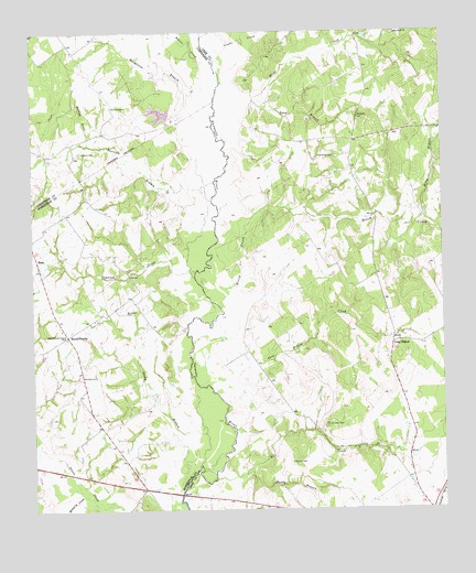
Round Prairie, TX USGS Topographic Map
Click on map above to begin viewing in our Map Viewer.

This topographic map contains these locations and features:
Feature Name Type Latitude Longitude GNIS ID View Map
Birch CreekStreamN31.3027°W96.3169°1352215View Map
Blains CreekStreamN31.3527°W96.3189°1372616View Map
Bumpus CemeteryCemeteryN31.3021°W96.3461°1353299View Map
Dogwood CreekStreamN31.3121°W96.3255°1967709View Map
Dogwood CreekStreamN31.3110°W96.3250°1356138View Map
Downs CemeteryCemeteryN31.2624°W96.2961°1356232View Map
Friendship CemeteryCemeteryN31.3424°W96.2816°1357742View Map
Grayson CemeteryCemeteryN31.2724°W96.2855°1358358View Map
Holly BranchStreamN31.3252°W96.2564°1359434View Map
Kellogg CreekStreamN31.3457°W96.3572°1360534View Map
Lake LimestoneReservoirN31.3461°W96.3582°1782062View Map
Lambs CreekStreamN31.3610°W96.3164°1374456View Map
Lies BranchStreamN31.3743°W96.3089°1374528View Map
Little Rock ChurchChurchN31.3746°W96.2639°1361450View Map
Long BranchStreamN31.3471°W96.3152°1361697View Map
Long HollowPopulated PlaceN31.2935°W96.2655°1380110View Map
Long Hollow CreekStreamN31.2774°W96.3155°1361745View Map
McKenzie CemeteryCemeteryN31.3555°W96.3500°1362486View Map
Mill CreekStreamN31.2580°W96.3202°1362863View Map
Mine CreekStreamN31.3574°W96.3058°1374965View Map
Mulberry CreekStreamN31.2535°W96.3577°1363445View Map
Paddy BranchStreamN31.2599°W96.3100°1364681View Map
Round PrairiePopulated PlaceN31.2960°W96.3644°1380463View Map
Running BranchStreamN31.3313°W96.3191°1367007View Map
Sandy BranchStreamN31.2616°W96.3244°1367692View Map
Sansom CemeteryCemeteryN31.3435°W96.3600°1367742View Map
SealePopulated PlaceN31.3132°W96.3730°2034756View Map
SealePopulated PlaceN31.3132°W96.3727°1380916View Map
Seale-Round Prairie CemeteryCemeteryN31.2952°W96.3650°1367909View Map
Steepleton BranchStreamN31.3491°W96.3177°1369162View Map
Sterling C Robertson DamDamN31.3251°W96.3172°1862990View Map
Whatley CemeteryCemeteryN31.2853°W96.3608°1371315View Map

Note: Coordinates in the location and feature list above are referenced to NAD83 datum.


Copyright (C) 2008-2024 Ryan Niemi / Sunset Dynamics ... All Rights Reserved