TopoQuest Logo
Do you find TopoQuest useful?
Help keep TopoQuest running and adding new maps/features by donating!
Bitcoin:  19c7KJd3qBynnjoSw5npx9KScwjBe4ifkT
Litecoin:  LXs6TkuXGGXo1vDsWCkWVdjQX94eUKd6ui
Home View Maps Find Maps Find Places Resources & Links


Rough Spur, California Topographic Map

USGS Map Title: Rough Spur, CA
USGS Map MRC: 36118H8
DRG (GeoTIFF) Download: o36118h8.tif


Neighboring USGS Topographic Map Quads:


  Nelson Mountain, CA  
37119A1
 

  Courtright Reservoir, CA  
37118A8
 

  Blackcap Mountain, CA  
37118A7
 

  Patterson Mountain, CA  
36119H1
 

  Rough Spur, CA  
36118H8
 

  Tehipite Dome, CA  
36118H7
 

  Verplank Ridge, CA  
36119G1
 

  Hume, CA  
36118G8
 

  Wren Peak, CA  
36118G7


Map MRC Location:

N37°
W119°
N37°
W118°
H8 H7 H6 H5 H4 H3 H2 H1
G8 G7 G6 G5 G4 G3 G2 G1
F8 F7 F6 F5 F4 F3 F2 F1
E8 E7 E6 E5 E4 E3 E2 E1
D8 D7 D6 D5 D4 D3 D2 D1
C8 C7 C6 C5 C4 C3 C2 C1
B8 B7 B6 B5 B4 B3 B2 B1
A8 A7 A6 A5 A4 A3 A2 A1
N36°
W119°
N36°
W118°

Rough Spur, CA USGS 1:24K Topographic Map Preview:
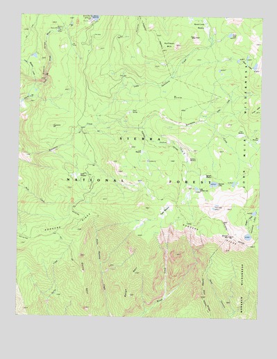
Rough Spur, CA USGS Topographic Map
Click on map above to begin viewing in our Map Viewer.

This topographic map contains these locations and features:
Feature Name Type Latitude Longitude GNIS ID View Map
Cabin CreekStreamN36.9566°W118.9071°220339View Map
Chain LakesLakeN36.9830°W118.8862°220879View Map
Cliff BridgeLocaleN36.9938°W118.9815°221217View Map
Cliff CampLocaleN36.9888°W118.9759°221218View Map
Cow MeadowFlatN36.9511°W118.8896°221706View Map
Deer RidgeRidgeN36.8838°W118.9050°266632View Map
Duck LakeLakeN36.9927°W118.8954°222682View Map
Finger RockPillarN36.9913°W118.9126°223504View Map
Garlic MeadowFlatN36.9211°W118.9251°224073View Map
Garlic SpurRidgeN36.9094°W118.9696°224074View Map
Geraldine LakesLakeN36.9090°W118.8816°224124View Map
Granite GorgeValleyN36.9691°W118.9921°224407View Map
Hoffman MountainSummitN36.9880°W118.9221°225384View Map
Kings Cavern Geological AreaLocaleN36.9213°W118.9898°276390View Map
Little Rancheria CreekStreamN36.9561°W118.9607°227339View Map
Little Spanish LakeLakeN36.9286°W118.9101°227374View Map
Long Meadow CreekStreamN36.9699°W118.9948°234192View Map
Lost MeadowFlatN36.9430°W118.9384°227715View Map
Rodgers RidgeRidgeN36.9094°W118.8916°231811View Map
Rough SpurRidgeN36.9069°W118.9340°231953View Map
Round Corral MeadowFlatN36.9988°W118.9129°231955View Map
Smith MeadowFlatN36.9349°W118.9712°233339View Map
Spanish LakeLakeN36.9306°W118.8998°235157View Map
Spanish MeadowFlatN36.9302°W118.9084°235158View Map
Spanish MountainSummitN36.9091°W118.8932°235159View Map
Statham CreekStreamN36.9536°W118.9373°235409View Map
Statham MeadowFlatN36.9430°W118.9148°235410View Map
Statham RiverStreamN36.9536°W118.9376°276389View Map
Sugarpine HillSummitN36.9538°W118.9846°235681View Map
Three SpringsSpringN36.9605°W118.9441°236320View Map
Twin LakesLakeN36.9216°W118.8998°236696View Map
Wet MeadowFlatN36.9502°W118.8779°237578View Map

Note: Coordinates in the location and feature list above are referenced to NAD83 datum.


Copyright (C) 2008-2024 Ryan Niemi / Sunset Dynamics ... All Rights Reserved