TopoQuest Logo
Do you find TopoQuest useful?
Help keep TopoQuest running and adding new maps/features by donating!
Bitcoin:  19c7KJd3qBynnjoSw5npx9KScwjBe4ifkT
Litecoin:  LXs6TkuXGGXo1vDsWCkWVdjQX94eUKd6ui
Home View Maps Find Maps Find Places Resources & Links


Rosies Ridge, Wyoming Topographic Map

USGS Map Title: Rosies Ridge, WY
USGS Map MRC: 43110G3
DRG (GeoTIFF) Download: o43110g3.tif


Neighboring USGS Topographic Map Quads:


  Whetstone Mountain, WY  
43110H4
 

  Gravel Mountain, WY  
43110H3
 

  Joy Peak, WY  
43110H2
 

  Davis Hill, WY  
43110G4
 

  Rosies Ridge, WY  
43110G3
 

  Angle Mountain, WY  
43110G2
 

  Mount Leidy, WY  
43110F4
 

  Green Mountain, WY  
43110F3
 

  Tripod Peak, WY  
43110F2


Map MRC Location:

N44°
W111°
N44°
W110°
H8 H7 H6 H5 H4 H3 H2 H1
G8 G7 G6 G5 G4 G3 G2 G1
F8 F7 F6 F5 F4 F3 F2 F1
E8 E7 E6 E5 E4 E3 E2 E1
D8 D7 D6 D5 D4 D3 D2 D1
C8 C7 C6 C5 C4 C3 C2 C1
B8 B7 B6 B5 B4 B3 B2 B1
A8 A7 A6 A5 A4 A3 A2 A1
N43°
W111°
N43°
W110°

Rosies Ridge, WY USGS 1:24K Topographic Map Preview:
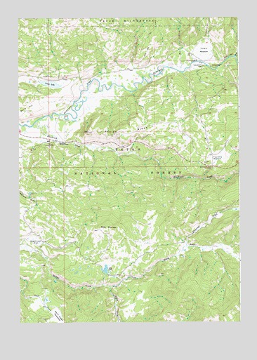
Rosies Ridge, WY USGS Topographic Map
Click on map above to begin viewing in our Map Viewer.

This topographic map contains these locations and features:
Feature Name Type Latitude Longitude GNIS ID View Map
Baldy MountainSummitN43.7880°W110.3213°1597901View Map
Blackrock CreekStreamN43.8322°W110.3633°1598225View Map
Blackrock Ranger District OfficeBuildingN43.8242°W110.3522°2764718View Map
Blackrock Ranger StationLocaleN43.8241°W110.3499°1598227View Map
Box CreekStreamN43.8530°W110.2796°1598341View Map
Boy Creek TrailheadLocaleN43.8619°W110.2933°1604890View Map
Bridger - Teton National Forest Blackrock - Buffalo Ranger District Fire Engine CrewBuildingN43.8240°W110.3522°2673606View Map
Burro HillSummitN43.8383°W110.3674°1598529View Map
Clear Creek TrailTrailN43.8727°W110.2635°1603797View Map
Flagstaff CreekStreamN43.7819°W110.2794°1599747View Map
Fourmile MeadowFlatN43.8172°W110.2607°1599824View Map
Fourmile Meadow Picnic AreaLocaleN43.8138°W110.2644°1599825View Map
Hatchet CampgroundLocaleN43.8241°W110.3535°1600229View Map
Lily LakeLakeN43.7719°W110.3264°1600911View Map
Marys LakeLakeN43.8037°W110.3688°1604624View Map
North Fork Spread CreekStreamN43.7644°W110.3230°1601817View Map
Preacher ParkFlatN43.7791°W110.3008°1604623View Map
Rosies RidgeRidgeN43.8277°W110.3110°1602631View Map
Sagebrush FlatFlatN43.7847°W110.3646°1602683View Map
Skull Creek MeadowsFlatN43.7527°W110.3533°1602950View Map
South Fork Spread CreekStreamN43.7641°W110.3235°1603175View Map
Tracy LakeReservoirN43.8483°W110.3674°1607955View Map
Tracy LakeLakeN43.8481°W110.3546°1603720View Map
Tracy Lake DamDamN43.8483°W110.3674°1607954View Map
Turpin MeadowFlatN43.8613°W110.2663°1603804View Map
Turpin Meadow CampgroundLocaleN43.8549°W110.2630°1603805View Map
Turpin Meadow LodgeLocaleN43.8552°W110.2680°1603806View Map
Turpin Meadow TrailheadLocaleN43.8580°W110.2655°1608762View Map

Note: Coordinates in the location and feature list above are referenced to NAD83 datum.


Copyright (C) 2008-2024 Ryan Niemi / Sunset Dynamics ... All Rights Reserved