TopoQuest Logo
Do you find TopoQuest useful?
Help keep TopoQuest running and adding new maps/features by donating!
Bitcoin:  19c7KJd3qBynnjoSw5npx9KScwjBe4ifkT
Litecoin:  LXs6TkuXGGXo1vDsWCkWVdjQX94eUKd6ui
Home View Maps Find Maps Find Places Resources & Links


Big Springs, Nebraska Topographic Map

USGS Map Title: Big Springs, NE
USGS Map MRC: 41102A1
DRG (GeoTIFF) Download: o41102a1.tif


Neighboring USGS Topographic Map Quads:


  Big Springs NW, NE  
41102B2
 

  Big Springs NE, NE  
41102B1
 

  Brule NW, NE  
41101B8
 

  Barton, NE  
41102A2
 

  Big Springs, NE  
41102A1
 

  Brule, NE  
41101A8
 

  Venango NW, CO  
40102H2
 

  Venango NE, CO  
40102H1
 

  Brandon NW, NE  
40101H8


Map MRC Location:

N42°
W103°
N42°
W102°
H8 H7 H6 H5 H4 H3 H2 H1
G8 G7 G6 G5 G4 G3 G2 G1
F8 F7 F6 F5 F4 F3 F2 F1
E8 E7 E6 E5 E4 E3 E2 E1
D8 D7 D6 D5 D4 D3 D2 D1
C8 C7 C6 C5 C4 C3 C2 C1
B8 B7 B6 B5 B4 B3 B2 B1
A8 A7 A6 A5 A4 A3 A2 A1
N41°
W103°
N41°
W102°

Big Springs, NE USGS 1:24K Topographic Map Preview:
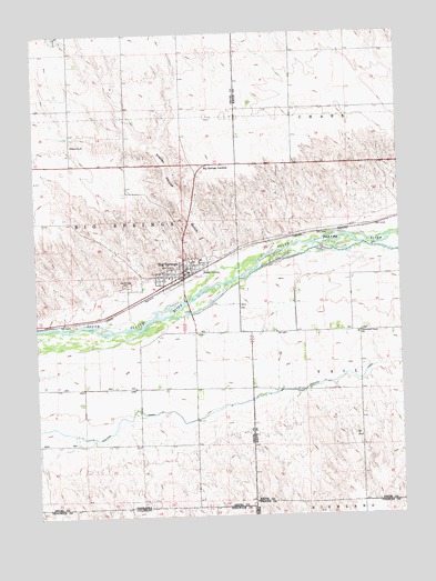
Big Springs, NE USGS Topographic Map
Click on map above to begin viewing in our Map Viewer.

This topographic map contains these locations and features:
Feature Name Type Latitude Longitude GNIS ID View Map
Assembly of God ChurchChurchN41.0614°W102.0743°1832381View Map
Big Spring CemeteryCemeteryN41.0595°W102.0932°827433View Map
Big SpringsPopulated PlaceN41.0614°W102.0743°827434View Map
Big SpringsLocaleN41.0614°W102.0743°1832374View Map
Big Springs JunctionLocaleN41.0908°W102.0671°1832403View Map
Big Springs Post OfficePost OfficeN41.0628°W102.0744°1832375View Map
Big Springs Public LibraryBuildingN41.0614°W102.0743°1832382View Map
Big Springs Volunteer Fire and RescueBuildingN41.0643°W102.0742°2553297View Map
Cottonwood Corner SchoolSchoolN41.0464°W102.0152°828373View Map
Eiker ParkParkN41.0619°W102.0755°1832401View Map
Farmers Cooperative Elevator Association ElevatorLocaleN41.0614°W102.0743°1832385View Map
Interchange 107CrossingN41.0514°W102.0718°1832404View Map
McGreer Camper ParkParkN41.0517°W102.0738°1832389View Map
Newman Airport (historical)AirportN41.0176°W102.0159°837497View Map
Phelps Hotel Historical MarkerParkN41.0619°W102.0755°1832393View Map
Sam Bass and the Big Springs Robbery Historical MarkerParkN41.0619°W102.0755°1832394View Map
School Number 30SchoolN41.0964°W102.1122°836551View Map
South Platte Elementary SchoolSchoolN41.0614°W102.0743°1832384View Map
South Platte High SchoolSchoolN41.0614°W102.0743°1832383View Map
Trailer House GulchValleyN41.0639°W102.0638°834147View Map
United Methodist ChurchChurchN41.0614°W102.0743°1832378View Map
Valley Medical ClinicHospitalN41.0614°W102.0743°1832379View Map
Village of Big SpringsCivilN41.0609°W102.0745°2398119View Map
Waterman Sod House Historical MarkerParkN41.0619°W102.0755°1832402View Map
Western CanalCanalN41.0342°W102.0268°834641View Map
Zion Lutheran ChurchChurchN41.0614°W102.0743°1832380View Map

Note: Coordinates in the location and feature list above are referenced to NAD83 datum.


Copyright (C) 2008-2024 Ryan Niemi / Sunset Dynamics ... All Rights Reserved