TopoQuest Logo
Do you find TopoQuest useful?
Help keep TopoQuest running and adding new maps/features by donating!
Bitcoin:  19c7KJd3qBynnjoSw5npx9KScwjBe4ifkT
Litecoin:  LXs6TkuXGGXo1vDsWCkWVdjQX94eUKd6ui
Home View Maps Find Maps Find Places Resources & Links


Rock River, Michigan Topographic Map

USGS Map Title: Rock River, MI
USGS Map MRC: 46086D8
DRG (GeoTIFF) Download: o46086d8.tif


Neighboring USGS Topographic Map Quads:


  Sand River, MI  
46087D1
 

  Rock River, MI  
46086D8
 

  Au Train, MI  
46086D7
 

  Ladoga, MI  
46087C1
 

  Chatham, MI  
46086C8
 

  Forest Lake, MI  
46086C7


Map MRC Location:

N47°
W87°
N47°
W86°
H8 H7 H6 H5 H4 H3 H2 H1
G8 G7 G6 G5 G4 G3 G2 G1
F8 F7 F6 F5 F4 F3 F2 F1
E8 E7 E6 E5 E4 E3 E2 E1
D8 D7 D6 D5 D4 D3 D2 D1
C8 C7 C6 C5 C4 C3 C2 C1
B8 B7 B6 B5 B4 B3 B2 B1
A8 A7 A6 A5 A4 A3 A2 A1
N46°
W87°
N46°
W86°

Rock River, MI USGS 1:24K Topographic Map Preview:
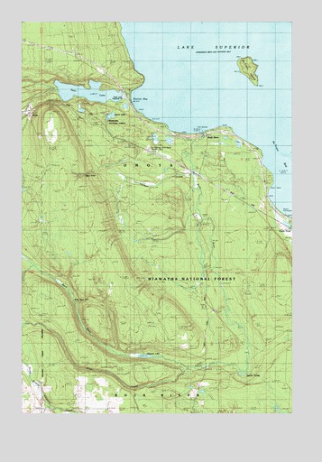
Rock River, MI USGS Topographic Map
Click on map above to begin viewing in our Map Viewer.

This topographic map contains these locations and features:
Feature Name Type Latitude Longitude GNIS ID View Map
Au Train BayBayN46.4455°W86.8790°1619055View Map
Au Train IslandIslandN46.4852°W86.8932°1619057View Map
B A CreekStreamN46.4541°W86.9163°1622433View Map
CCC CampLocaleN46.4013°W86.9140°1622388View Map
Deer LakeLakeN46.4774°W86.9696°1619693View Map
Deer Lake Roadside ParkParkN46.4724°W86.9524°1622614View Map
Ginpole LakeLakeN46.3933°W86.9425°1620018View Map
Hanson CreekStreamN46.4511°W86.9193°1620122View Map
Johnson Lake Lookout TowerTowerN46.4269°W86.9646°1623452View Map
Old Charcoal Kilns Ruins (historical)LocaleN46.4597°W86.9418°1622615View Map
OnotaPopulated PlaceN46.4710°W86.9960°1621112View Map
Onota Post Office (historical)Post OfficeN46.4711°W86.9961°2352374View Map
Onota Station (historical)LocaleN46.4711°W86.9961°2352375View Map
Rock RiverPopulated PlaceN46.4638°W86.9132°1621416View Map
Rock RiverStreamN46.4652°W86.9143°1621417View Map
Rock River Canyon WildernessReserveN46.3988°W86.9597°2035271View Map
Rock River FallsFallsN46.4113°W86.9762°1621418View Map
Rock River Post Office (historical)Post OfficeN46.4639°W86.9133°2352367View Map
Rock River Station (historical)LocaleN46.4639°W86.9136°2352365View Map
Shelter BayBayN46.4760°W86.9407°1621582View Map
Silver CreekStreamN46.3899°W86.9235°1621612View Map
Silver FallsFallsN46.4511°W86.9708°1621614View Map
Spider PondsLakeN46.3873°W86.8972°1621722View Map
Spirit LakeLakeN46.4700°W86.9591°1621726View Map
Township of OnotaCivilN46.4559°W86.9993°1626850View Map
Trudell's GravesCemeteryN46.4605°W86.9372°2352388View Map

Note: Coordinates in the location and feature list above are referenced to NAD83 datum.


Copyright (C) 2008-2024 Ryan Niemi / Sunset Dynamics ... All Rights Reserved