TopoQuest Logo
Do you find TopoQuest useful?
Help keep TopoQuest running and adding new maps/features by donating!
Bitcoin:  19c7KJd3qBynnjoSw5npx9KScwjBe4ifkT
Litecoin:  LXs6TkuXGGXo1vDsWCkWVdjQX94eUKd6ui
Home View Maps Find Maps Find Places Resources & Links


Robinson, Kansas Topographic Map

USGS Map Title: Robinson, KS
USGS Map MRC: 39095G4
DRG (GeoTIFF) Download: o39095g4.tif


Neighboring USGS Topographic Map Quads:


  Reserve, KS  
39095H5
 

  Highland NW, KS  
39095H4
 

  White Cloud, KS  
39095H3
 

  Hiawatha, KS  
39095G5
 

  Robinson, KS  
39095G4
 

  Highland, KS  
39095G3
 

  Horton, KS  
39095F5
 

  Everest, KS  
39095F4
 

  Denton, KS  
39095F3


Map MRC Location:

N40°
W96°
N40°
W95°
H8 H7 H6 H5 H4 H3 H2 H1
G8 G7 G6 G5 G4 G3 G2 G1
F8 F7 F6 F5 F4 F3 F2 F1
E8 E7 E6 E5 E4 E3 E2 E1
D8 D7 D6 D5 D4 D3 D2 D1
C8 C7 C6 C5 C4 C3 C2 C1
B8 B7 B6 B5 B4 B3 B2 B1
A8 A7 A6 A5 A4 A3 A2 A1
N39°
W96°
N39°
W95°

Robinson, KS USGS 1:24K Topographic Map Preview:
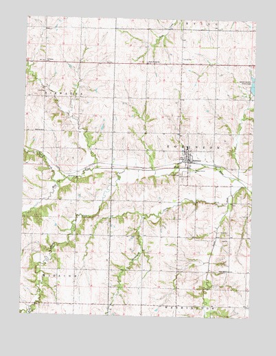
Robinson, KS USGS Topographic Map
Click on map above to begin viewing in our Map Viewer.

This topographic map contains these locations and features:
Feature Name Type Latitude Longitude GNIS ID View Map
Agricultural Partners Co - Operative Grain Elevator Number 7LocaleN39.8153°W95.4099°2695137View Map
Belleview SchoolSchoolN39.8272°W95.4897°472998View Map
Brown County State Lake DamDamN39.8450°W95.3769°479872View Map
Brown County State ParkParkN39.8453°W95.3769°473002View Map
Brown State Fishing Lake and Wildlife AreaParkN39.8453°W95.3769°479772View Map
Buttermilk CreekStreamN39.7986°W95.3883°472993View Map
City of RobinsonCivilN39.8152°W95.4115°2396391View Map
Davis AirfieldAirportN39.8544°W95.4801°481381View Map
Hazel CreekStreamN39.7533°W95.4944°473261View Map
Klinefelter CreekStreamN39.8336°W95.4761°2772323View Map
La Grange SchoolSchoolN39.8564°W95.4889°472999View Map
Middle Fork Wolf RiverStreamN39.8117°W95.4447°472994View Map
North Fork Wolf RiverStreamN39.8053°W95.4814°472982View Map
Prairie Springs School (historical)SchoolN39.8564°W95.4339°473000View Map
RobinsonPopulated PlaceN39.8167°W95.4105°472996View Map
Robinson City HallBuildingN39.8163°W95.4101°2693221View Map
Robinson Fire DepartmentBuildingN39.8165°W95.4112°2111795View Map
Robinson Middle School (historical)SchoolN39.8208°W95.4111°480227View Map
Robinson Post OfficePost OfficeN39.8162°W95.4106°2693947View Map
Robinson Senior Citizens CenterBuildingN39.8163°W95.4101°2692909View Map
Robinson United Methodist ChurchChurchN39.8200°W95.4103°2690233View Map
Robinson Wastewater Treatment PlantLocaleN39.8132°W95.4049°2691986View Map
Rose Hill CemeteryCemeteryN39.8097°W95.4148°472997View Map
Seward (historical)LocaleN39.8139°W95.3886°481997View Map
South Fork Wolf RiverStreamN39.8050°W95.3786°472992View Map
Township of HiawathaCivilN39.8452°W95.4939°472777View Map
Township of RobinsonCivilN39.8164°W95.3957°472990View Map
Ununda CemeteryCemeteryN39.8586°W95.4148°473001View Map
Upper Wolf Lutheran CemeteryCemeteryN39.7690°W95.3888°2673216View Map
Upper Wolf Lutheran ChurchChurchN39.7695°W95.3871°472995View Map

Note: Coordinates in the location and feature list above are referenced to NAD83 datum.


Copyright (C) 2008-2024 Ryan Niemi / Sunset Dynamics ... All Rights Reserved