TopoQuest Logo
Do you find TopoQuest useful?
Help keep TopoQuest running and adding new maps/features by donating!
Bitcoin:  19c7KJd3qBynnjoSw5npx9KScwjBe4ifkT
Litecoin:  LXs6TkuXGGXo1vDsWCkWVdjQX94eUKd6ui
Home View Maps Find Maps Find Places Resources & Links


Rising Sun, Montana Topographic Map

USGS Map Title: Rising Sun, MT
USGS Map MRC: 48113F5
DRG (GeoTIFF) Download: o48113f5.tif


Neighboring USGS Topographic Map Quads:


  Many Glacier, MT  
48113G6
 

  Lake Sherburne, MT  
48113G5
 

  Babb, MT  
48113G4
 

  Logan Pass, MT  
48113F6
 

  Rising Sun, MT  
48113F5
 

  Saint Mary, MT  
48113F4
 

  Mount Jackson, MT  
48113E6
 

  Mount Stimson, MT  
48113E5
 

  Cut Bank Pass, MT  
48113E4


Map MRC Location:

N49°
W114°
N49°
W113°
H8 H7 H6 H5 H4 H3 H2 H1
G8 G7 G6 G5 G4 G3 G2 G1
F8 F7 F6 F5 F4 F3 F2 F1
E8 E7 E6 E5 E4 E3 E2 E1
D8 D7 D6 D5 D4 D3 D2 D1
C8 C7 C6 C5 C4 C3 C2 C1
B8 B7 B6 B5 B4 B3 B2 B1
A8 A7 A6 A5 A4 A3 A2 A1
N48°
W114°
N48°
W113°

Rising Sun, MT USGS 1:24K Topographic Map Preview:
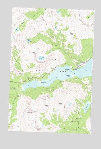
Rising Sun, MT USGS Topographic Map
Click on map above to begin viewing in our Map Viewer.

This topographic map contains these locations and features:
Feature Name Type Latitude Longitude GNIS ID View Map
Baring CreekStreamN48.6755°W113.5929°768507View Map
Baring Creek BridgeBridgeN48.6786°W113.5954°1750563View Map
Baring FallsFallsN48.6770°W113.5936°768508View Map
Dead Horse PointLocaleN48.6883°W113.5582°770510View Map
East Flattop MountainSummitN48.7386°W113.5211°771007View Map
Glacier National Park DivisionCivilN48.7114°W113.5974°1940630View Map
Goat LakeLakeN48.6998°W113.5787°771814View Map
Goat MountainSummitN48.7044°W113.5918°771817View Map
Going-to-the-Sun PointCapeN48.6778°W113.5801°771826View Map
Golden StairsLocaleN48.6900°W113.5265°771839View Map
Hudson Bay CreekStreamN48.6389°W113.5212°772599View Map
Little Chief MountainSummitN48.6443°W113.5957°773426View Map
Lost LakeLakeN48.6816°W113.5758°773700View Map
Mahtotopa MountainSummitN48.6515°W113.5701°773821View Map
Many Falls TrailTrailN48.6714°W113.6096°773871View Map
Medicine Owl CreekStreamN48.6319°W113.5198°774080View Map
Otokomi LakeLakeN48.7171°W113.5984°774995View Map
Otokomi MountainSummitN48.7249°W113.5363°774996View Map
Red Eagle LakeLakeN48.6524°W113.5071°775635View Map
Red Eagle MountainSummitN48.6544°W113.5492°775636View Map
Rising SunPopulated PlaceN48.6964°W113.5179°775783View Map
Rising Sun CampgroundLocaleN48.6944°W113.5218°1750526View Map
Rose BasinBasinN48.7153°W113.5973°775936View Map
Rose CreekStreamN48.6914°W113.5184°775939View Map
Saint Mary FallsFallsN48.6680°W113.6154°776121View Map
Saint Mary Lake TrailTrailN48.6803°W113.5179°776123View Map
Silver Dollar BeachLocaleN48.6825°W113.5332°776553View Map
Siyeh Pass TrailTrailN48.7119°W113.6240°776601View Map
Sunrift GorgeValleyN48.6785°W113.5955°777328View Map
The NarrowsGutN48.6866°W113.5304°777521View Map
Virginia CreekStreamN48.6680°W113.6112°778038View Map
Virginia FallsFallsN48.6602°W113.6131°778039View Map
Water Ouzel TrailTrailN48.6772°W113.5851°778136View Map
Wild Goose IslandIslandN48.6889°W113.5398°778465View Map

Note: Coordinates in the location and feature list above are referenced to NAD83 datum.


Copyright (C) 2008-2024 Ryan Niemi / Sunset Dynamics ... All Rights Reserved