TopoQuest Logo
Do you find TopoQuest useful?
Help keep TopoQuest running and adding new maps/features by donating!
Bitcoin:  19c7KJd3qBynnjoSw5npx9KScwjBe4ifkT
Litecoin:  LXs6TkuXGGXo1vDsWCkWVdjQX94eUKd6ui
Home View Maps Find Maps Find Places Resources & Links


Rio Bravo Ranch, California Topographic Map

USGS Map Title: Rio Bravo Ranch, CA
USGS Map MRC: 35118D7
DRG (GeoTIFF) Download: o35118d7.tif


Neighboring USGS Topographic Map Quads:


  Knob Hill, CA  
35118E8
 

  Pine Mountain, CA  
35118E7
 

  Democrat Hot Springs, CA  
35118E6
 

  Oil Center, CA  
35118D8
 

  Rio Bravo Ranch, CA  
35118D7
 

  Mount Adelaide, CA  
35118D6
 

  Lamont, CA  
35118C8
 

  Edison, CA  
35118C7
 

  Bena, CA  
35118C6


Map MRC Location:

N36°
W119°
N36°
W118°
H8 H7 H6 H5 H4 H3 H2 H1
G8 G7 G6 G5 G4 G3 G2 G1
F8 F7 F6 F5 F4 F3 F2 F1
E8 E7 E6 E5 E4 E3 E2 E1
D8 D7 D6 D5 D4 D3 D2 D1
C8 C7 C6 C5 C4 C3 C2 C1
B8 B7 B6 B5 B4 B3 B2 B1
A8 A7 A6 A5 A4 A3 A2 A1
N35°
W119°
N35°
W118°

Rio Bravo Ranch, CA USGS 1:24K Topographic Map Preview:
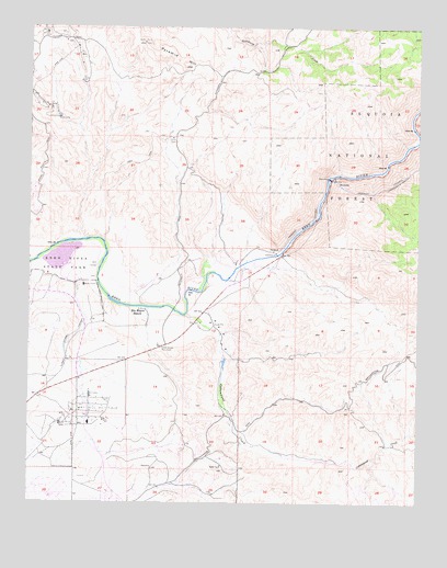
Rio Bravo Ranch, CA USGS Topographic Map
Click on map above to begin viewing in our Map Viewer.

This topographic map contains these locations and features:
Feature Name Type Latitude Longitude GNIS ID View Map
Ant Hill Oil FieldOilfieldN35.3988°W118.8548°277354View Map
Bakersfield Fire Department Station 10BuildingN35.4306°W118.8699°2664578View Map
Cottonwood CreekStreamN35.4244°W118.8256°270624View Map
Father Garces MonumentParkN35.4163°W118.8329°271107View Map
Kern R County Pk 735 DamDamN35.4400°W118.8676°1664028View Map
Kern River Golf CourseLocaleN35.4375°W118.8551°1839108View Map
Lake MingReservoirN35.4397°W118.8655°1839119View Map
Peachacho CreekStreamN35.4705°W118.7509°272903View Map
Pyramid HillRidgeN35.4900°W118.8268°273140View Map
Rio Bravo Airport (historical)AirportN35.4063°W118.8537°1653246View Map
Rio Bravo Equestrian CenterLocaleN35.4236°W118.8357°1839131View Map
Rio Bravo RanchLocaleN35.4261°W118.8398°273289View Map
Rio Bravo Ranch Golf and Tennis ClubLocaleN35.4094°W118.8343°1839132View Map

Note: Coordinates in the location and feature list above are referenced to NAD83 datum.


Copyright (C) 2008-2024 Ryan Niemi / Sunset Dynamics ... All Rights Reserved