TopoQuest Logo
Do you find TopoQuest useful?
Help keep TopoQuest running and adding new maps/features by donating!
Bitcoin:  19c7KJd3qBynnjoSw5npx9KScwjBe4ifkT
Litecoin:  LXs6TkuXGGXo1vDsWCkWVdjQX94eUKd6ui
Home View Maps Find Maps Find Places Resources & Links


Riepetown, Nevada Topographic Map

USGS Map Title: Riepetown, NV
USGS Map MRC: 39115C1
DRG (GeoTIFF) Download: o39115c1.tif


Neighboring USGS Topographic Map Quads:


  Marking Corral Summit, NV  
39115D2
 

  Robinson Summit, NV  
39115D1
 

  Lusetti Canyon, NV  
39114D8
 

  Waldy Pond, NV  
39115C2
 

  Riepetown, NV  
39115C1
 

  Ruth, NV  
39114C8
 

  Railroad Crossing Dam, NV  
39115B2
 

  Giroux Wash, NV  
39115B1
 

  Ely, NV  
39114B8


Map MRC Location:

N40°
W116°
N40°
W115°
H8 H7 H6 H5 H4 H3 H2 H1
G8 G7 G6 G5 G4 G3 G2 G1
F8 F7 F6 F5 F4 F3 F2 F1
E8 E7 E6 E5 E4 E3 E2 E1
D8 D7 D6 D5 D4 D3 D2 D1
C8 C7 C6 C5 C4 C3 C2 C1
B8 B7 B6 B5 B4 B3 B2 B1
A8 A7 A6 A5 A4 A3 A2 A1
N39°
W116°
N39°
W115°

Riepetown, NV USGS 1:24K Topographic Map Preview:
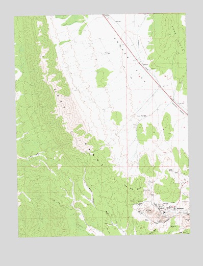
Riepetown, NV USGS Topographic Map
Click on map above to begin viewing in our Map Viewer.

This topographic map contains these locations and features:
Feature Name Type Latitude Longitude GNIS ID View Map
Alpha ShaftMineN39.2580°W115.0314°854347View Map
Boston-Ely ShaftMineN39.2677°W115.0375°854374View Map
Copper FlatFlatN39.3458°W115.0411°839677View Map
Copper Flat WellWellN39.3169°W115.0311°839686View Map
Deep WellWellN39.3533°W115.0581°853519View Map
Emma Nevada ShaftMineN39.2619°W115.0025°840360View Map
Emma ShaftMineN39.2672°W115.0389°840361View Map
Giroux Concentrator (historical)LocaleN39.2658°W115.0228°856662View Map
Giroux SpringsSpringN39.2747°W115.0296°845176View Map
Jog Along RidgeRidgeN39.2572°W115.0245°852106View Map
KimberlyPopulated PlaceN39.2633°W115.0225°845525View Map
Kimberly Post OfficePost OfficeN39.2633°W115.0225°864909View Map
Lyons SpringSpringN39.2856°W115.0138°845203View Map
Matilda TunnelMineN39.2688°W115.0414°841969View Map
Morris ShaftMineN39.2599°W115.0209°856320View Map
Old Glory ShaftMineN39.2633°W115.0245°854804View Map
Pilot KnobSummitN39.2660°W115.0234°845598View Map
Richard ShaftMineN39.2569°W115.0214°854593View Map
RiepetownPopulated PlaceN39.2644°W115.0117°856354View Map
Riepetown Post Office (historical)Post OfficeN39.2644°W115.0117°864511View Map
Rusty RidgeRidgeN39.2663°W115.0342°852105View Map
Taylor MineMineN39.2672°W115.0247°853916View Map
The Big BendBendN39.2758°W115.0409°844235View Map
Tripp PitMineN39.2597°W115.0222°845986View Map
Tripp Veteran PitMineN39.2622°W115.0272°853917View Map
Veteran (historical)Populated PlaceN39.2674°W115.0295°850913View Map
Veteran PitMineN39.2633°W115.0309°844583View Map
Veteran ShaftMineN39.2655°W115.0325°854805View Map
Weary FlatFlatN39.2674°W115.0156°844679View Map
West Camp WellWellN39.2797°W115.0300°845283View Map
White HillSummitN39.2538°W115.0147°844772View Map

Note: Coordinates in the location and feature list above are referenced to NAD83 datum.


Copyright (C) 2008-2024 Ryan Niemi / Sunset Dynamics ... All Rights Reserved