TopoQuest Logo
Do you find TopoQuest useful?
Help keep TopoQuest running and adding new maps/features by donating!
Bitcoin:  19c7KJd3qBynnjoSw5npx9KScwjBe4ifkT
Litecoin:  LXs6TkuXGGXo1vDsWCkWVdjQX94eUKd6ui
Home View Maps Find Maps Find Places Resources & Links


Richton, Mississippi Topographic Map

USGS Map Title: Richton, MS
USGS Map MRC: 31088C8
DRG (GeoTIFF) Download: o31088c8.tif


Neighboring USGS Topographic Map Quads:


  Ovett, MS  
31089D1
 

  Rhodes, MS  
31088D8
 

  Mulberry, MS  
31088D7
 

  Ovett SE, MS  
31089C1
 

  Richton, MS  
31088C8
 

  Brewer, MS  
31088C7
 

  New Augusta, MS  
31089B1
 

  Beaumont, MS  
31088B8
 

  Neely, MS  
31088B7


Map MRC Location:

N32°
W89°
N32°
W88°
H8 H7 H6 H5 H4 H3 H2 H1
G8 G7 G6 G5 G4 G3 G2 G1
F8 F7 F6 F5 F4 F3 F2 F1
E8 E7 E6 E5 E4 E3 E2 E1
D8 D7 D6 D5 D4 D3 D2 D1
C8 C7 C6 C5 C4 C3 C2 C1
B8 B7 B6 B5 B4 B3 B2 B1
A8 A7 A6 A5 A4 A3 A2 A1
N31°
W89°
N31°
W88°

Richton, MS USGS 1:24K Topographic Map Preview:
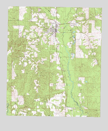
Richton, MS USGS Topographic Map
Click on map above to begin viewing in our Map Viewer.

This topographic map contains these locations and features:
Feature Name Type Latitude Longitude GNIS ID View Map
Beaver Dam CreekStreamN31.3566°W88.9245°692511View Map
Bethlehem Missionary ChurchChurchN31.2577°W88.9143°666987View Map
Browns CemeteryCemeteryN31.3679°W88.9573°667641View Map
Clay Hill ChurchChurchN31.3402°W88.9812°668534View Map
Clay Hill School (historical)SchoolN31.3402°W88.9817°683354View Map
Crane LakeLakeN31.2513°W88.9414°668928View Map
East SidePopulated PlaceN31.3549°W88.9112°691834View Map
First Assembly of God ChurchChurchN31.3591°W88.9070°2596645View Map
First United Pentecostal ChurchChurchN31.3349°W88.9324°2596467View Map
George Guthrie Pond DamDamN31.3418°W88.9367°680672View Map
Hinton CemeteryCemeteryN31.2566°W88.9881°671240View Map
HintonvillePopulated PlaceN31.2610°W88.9220°691935View Map
Hintonville Volunteer Fire DepartmentBuildingN31.2622°W88.8999°2667933View Map
Holy Hill ChurchChurchN31.3207°W88.9767°671371View Map
Isaiah Hinton CemeteryCemeteryN31.3066°W88.9273°671726View Map
James Grantham Pond DamDamN31.3385°W88.8867°680669View Map
Joe Blackmon Pond DamDamN31.3602°W88.9617°680683View Map
McSwainPopulated PlaceN31.3146°W88.9770°692060View Map
McSwain CemeteryCemeteryN31.3154°W88.9892°673440View Map
Meadows Mill (historical)LocaleN31.3593°W88.9314°683356View Map
Mississippi Forestry Commission Perry County WorkstationBuildingN31.2964°W88.9568°2667890View Map
New Zion ChurchChurchN31.3166°W88.8823°674870View Map
Perry County General HospitalHospitalN31.3458°W88.9374°705947View Map
Perry County Hospital Nursing CenterBuildingN31.3457°W88.9375°2596226View Map
Pine BranchStreamN31.3132°W88.9181°675799View Map
Pine Forest Regional Library - Richton Public LibraryBuildingN31.3501°W88.9356°2596228View Map
Richs Mill (historical)LocaleN31.3646°W88.9353°705948View Map
RichtonPopulated PlaceN31.3493°W88.9400°676647View Map
Richton Elementary SchoolSchoolN31.3510°W88.9420°705949View Map
Richton First Baptist ChurchChurchN31.3498°W88.9394°2596336View Map
Richton High SchoolSchoolN31.3507°W88.9428°705950View Map
Richton Lookout TowerTowerN31.2963°W88.9567°711303View Map
Richton Police DepartmentBuildingN31.3492°W88.9347°2332881View Map
Richton Post OfficePost OfficeN31.3501°W88.9354°2596634View Map
Richton Publically Owned Treatment WorksLocaleN31.3516°W88.9275°2596875View Map
Richton United Methodist ChurchChurchN31.3488°W88.9406°2596883View Map
Richton Volunteer Fire DepartmentBuildingN31.3496°W88.9347°2332730View Map
Richton-Perry County AirportAirportN31.3185°W88.9339°680314View Map
Saint Paul Baptist ChurchChurchN31.3160°W88.9770°2596749View Map
Scott Nicholson Catfish Ponds DamDamN31.3435°W88.9801°680673View Map
Seminary ChurchChurchN31.2663°W88.9473°677511View Map
Sunset CemeteryCemeteryN31.3443°W88.9420°678436View Map
Supervisor District 3CivilN31.3744°W88.9139°712028View Map
Supervisor District 4CivilN31.2522°W88.9248°712029View Map
Town of RichtonCivilN31.3495°W88.9407°2407209View Map

Note: Coordinates in the location and feature list above are referenced to NAD83 datum.


Copyright (C) 2008-2024 Ryan Niemi / Sunset Dynamics ... All Rights Reserved