TopoQuest Logo
Do you find TopoQuest useful?
Help keep TopoQuest running and adding new maps/features by donating!
Bitcoin:  19c7KJd3qBynnjoSw5npx9KScwjBe4ifkT
Litecoin:  LXs6TkuXGGXo1vDsWCkWVdjQX94eUKd6ui
Home View Maps Find Maps Find Places Resources & Links


Resort Lake, Michigan Topographic Map

USGS Map Title: Resort Lake, MI
USGS Map MRC: 45087D7
DRG (GeoTIFF) Download: o45087d7.tif


Neighboring USGS Topographic Map Quads:


  Amberg, WI  
45087E8
 

  Miscauno Island, WI  
45087E7
 

  Banat, MI  
45087E6
 

  Wausaukee North, WI  
45087D8
 

  Resort Lake, MI  
45087D7
 

  Swanson, MI  
45087D6
 

  Wausaukee South, WI  
45087C8
 

  Bear Point, MI  
45087C7
 

  McAllister, WI  
45087C6


Map MRC Location:

N46°
W88°
N46°
W87°
H8 H7 H6 H5 H4 H3 H2 H1
G8 G7 G6 G5 G4 G3 G2 G1
F8 F7 F6 F5 F4 F3 F2 F1
E8 E7 E6 E5 E4 E3 E2 E1
D8 D7 D6 D5 D4 D3 D2 D1
C8 C7 C6 C5 C4 C3 C2 C1
B8 B7 B6 B5 B4 B3 B2 B1
A8 A7 A6 A5 A4 A3 A2 A1
N45°
W88°
N45°
W87°

Resort Lake, MI USGS 1:24K Topographic Map Preview:
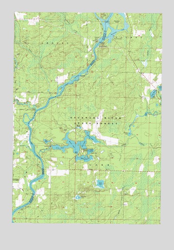
Resort Lake, MI USGS Topographic Map
Click on map above to begin viewing in our Map Viewer.

This topographic map contains these locations and features:
Feature Name Type Latitude Longitude GNIS ID View Map
10 ReservoirReservoirN45.4516°W87.8451°1792191View Map
Baker LakeLakeN45.4180°W87.8096°620484View Map
Bass LakeLakeN45.4147°W87.8137°620708View Map
Becher LakeLakeN45.4252°W87.8065°620964View Map
Buck HillSummitN45.4302°W87.8340°622171View Map
Chalk Hill CampLocaleN45.4972°W87.7984°1562932View Map
Coldwater CreekStreamN45.4783°W87.8090°1563246View Map
Duck LakeLakeN45.4402°W87.7629°624938View Map
East LakeLakeN45.4227°W87.8154°625210View Map
Holmes CreekStreamN45.4177°W87.8590°1566562View Map
Johnson LakeLakeN45.4290°W87.7765°629340View Map
Lake AnnLakeN45.4560°W87.7500°620138View Map
Lake MaryLakeN45.4523°W87.7571°631685View Map
Lazy River AirportAirportN45.4010°W87.8621°2717085View Map
Little Shakey CreekStreamN45.4405°W87.7615°630762View Map
Long LakeLakeN45.4197°W87.8351°630948View Map
Longrie CreekStreamN45.4283°W87.7746°631014View Map
Lost LakeLakeN45.3987°W87.8006°631098View Map
Lost Lake CemeteryCemeteryN45.4061°W87.7961°2353257View Map
Lost Lake ChurchChurchN45.4064°W87.7962°631112View Map
Merryman IslandIslandN45.4955°W87.7884°632143View Map
Muskrat LakeLakeN45.3904°W87.8198°633178View Map
Osborn LakeLakeN45.4236°W87.8466°634126View Map
Pike RiverStreamN45.4414°W87.8559°1571390View Map
Pike River School (historical)SchoolN45.4319°W87.8743°1876864View Map
Resort LakeLakeN45.4208°W87.8234°635808View Map
Rosebush CreekStreamN45.5000°W87.7843°636220View Map
Rosebush LakeReservoirN45.4887°W87.7911°636222View Map
Round IslandIslandN45.4950°W87.8001°1572637View Map
Shakey LakesReservoirN45.4208°W87.8426°637644View Map
Shakey Lakes County ParkParkN45.4181°W87.8167°2099841View Map
Shakey RiverStreamN45.4144°W87.8518°637645View Map
Sixty IslandsIslandN45.4605°W87.8251°1574226View Map
Spring LakeLakeN45.4316°W87.8187°638590View Map
Squaw CreekStreamN45.4497°W87.8434°1574761View Map
Squaw Creek 2WP1486 DamDamN45.4516°W87.8451°1792190View Map
Township of LakeCivilN45.4114°W87.7590°1626576View Map
Wausaukee State ForestForestN45.4008°W87.8726°1845654View Map
White Rapids DamDamN45.4825°W87.8032°1576653View Map
White Rapids DamDamN45.4819°W87.8023°1616328View Map

Note: Coordinates in the location and feature list above are referenced to NAD83 datum.


Copyright (C) 2008-2024 Ryan Niemi / Sunset Dynamics ... All Rights Reserved