TopoQuest Logo
Do you find TopoQuest useful?
Help keep TopoQuest running and adding new maps/features by donating!
Bitcoin:  19c7KJd3qBynnjoSw5npx9KScwjBe4ifkT
Litecoin:  LXs6TkuXGGXo1vDsWCkWVdjQX94eUKd6ui
Home View Maps Find Maps Find Places Resources & Links


Reeds Peak, New Mexico Topographic Map

USGS Map Title: Reeds Peak, NM
USGS Map MRC: 33107B7
DRG (GeoTIFF) Download: o33107b7.tif


Neighboring USGS Topographic Map Quads:


  Baily Points, NM  
33107C8
 

  Lookout Mountain, NM  
33107C7
 

  Winston, NM  
33107C6
 

  Bonner Canyon, NM  
33107B8
 

  Reeds Peak, NM  
33107B7
 

  Sugarloaf Peak, NM  
33107B6
 

  Hay Mesa, NM  
33107A8
 

  Victorio Park, NM  
33107A7
 

  Apache Peak, NM  
33107A6


Map MRC Location:

N34°
W108°
N34°
W107°
H8 H7 H6 H5 H4 H3 H2 H1
G8 G7 G6 G5 G4 G3 G2 G1
F8 F7 F6 F5 F4 F3 F2 F1
E8 E7 E6 E5 E4 E3 E2 E1
D8 D7 D6 D5 D4 D3 D2 D1
C8 C7 C6 C5 C4 C3 C2 C1
B8 B7 B6 B5 B4 B3 B2 B1
A8 A7 A6 A5 A4 A3 A2 A1
N33°
W108°
N33°
W107°

Reeds Peak, NM USGS 1:24K Topographic Map Preview:
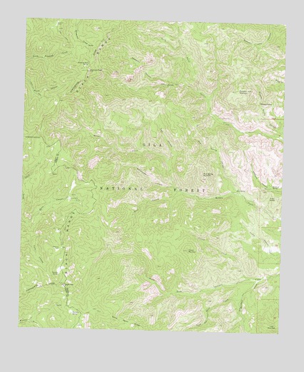
Reeds Peak, NM USGS Topographic Map
Click on map above to begin viewing in our Map Viewer.

This topographic map contains these locations and features:
Feature Name Type Latitude Longitude GNIS ID View Map
Black RangeRangeN33.1845°W107.8411°920566View Map
Cherry CreekStreamN33.1462°W107.7648°905074View Map
Cherry MountainSummitN33.1578°W107.7956°905081View Map
Curtis WellWellN33.1578°W107.7567°905566View Map
Deadman CanyonValleyN33.2248°W107.8056°905642View Map
Diamond PeakSummitN33.2292°W107.8445°905756View Map
Diamond Peak SpringSpringN33.2320°W107.8450°905757View Map
Hickland SpringSpringN33.1840°W107.7556°906945View Map
Hidden SpringSpringN33.1792°W107.7567°906955View Map
Lake MountainSummitN33.1256°W107.7503°907828View Map
Marshall CreekStreamN33.1465°W107.7603°908422View Map
Moccasin John MountainSummitN33.2223°W107.7739°908812View Map
Mud SpringSpringN33.1823°W107.7728°908943View Map
Mud Spring CanyonValleyN33.1812°W107.7717°908950View Map
Mud Spring MountainSummitN33.1867°W107.7892°908954View Map
Newman SpringSpringN33.1312°W107.8500°909080View Map
North Prong Circle Seven CreekStreamN33.2220°W107.7909°909178View Map
Rattlesnake CanyonValleyN33.1840°W107.8020°910020View Map
Rattlesnake CorralLocaleN33.1831°W107.8020°912869View Map
Reeds MeadowFlatN33.1803°W107.8520°912877View Map
Reeds PeakSummitN33.1426°W107.8542°910107View Map
Reeds Peak Lookout TowerTowerN33.1428°W107.8542°923546View Map
Reeds RanchLocaleN33.1776°W107.8520°910108View Map
Skid CanyonValleyN33.1815°W107.7989°911116View Map
Spud Patch CreekStreamN33.1381°W107.7695°911356View Map
Spud Patch RidgeRidgeN33.1267°W107.8203°911357View Map
Squeaky SpringSpringN33.1470°W107.8570°911374View Map
Trail CanyonValleyN33.1934°W107.8061°911775View Map
Turkey ParkFlatN33.2481°W107.8606°911877View Map
Upper Circle Seven WellWellN33.2109°W107.7825°911973View Map
Upper Morgen SpringSpringN33.2051°W107.8459°912873View Map
Upper Palomas CorralLocaleN33.1453°W107.7736°912876View Map
Whiskey SpringSpringN33.2176°W107.7623°912287View Map
Whiskey Spring CanyonValleyN33.2028°W107.7503°912288View Map
Whitmore CabinLocaleN33.1573°W107.8570°912359View Map

Note: Coordinates in the location and feature list above are referenced to NAD83 datum.


Copyright (C) 2008-2024 Ryan Niemi / Sunset Dynamics ... All Rights Reserved