TopoQuest Logo
Do you find TopoQuest useful?
Help keep TopoQuest running and adding new maps/features by donating!
Bitcoin:  19c7KJd3qBynnjoSw5npx9KScwjBe4ifkT
Litecoin:  LXs6TkuXGGXo1vDsWCkWVdjQX94eUKd6ui
Home View Maps Find Maps Find Places Resources & Links


Redwood Point, California Topographic Map

USGS Map Title: Redwood Point, CA
USGS Map MRC: 37122E2
DRG (GeoTIFF) Download: o37122e2.tif


Neighboring USGS Topographic Map Quads:


  Hunters Point, CA  
37122F3
 

  San Leandro, CA  
37122F2
 

  Hayward, CA  
37122F1
 

  San Mateo, CA  
37122E3
 

  Redwood Point, CA  
37122E2
 

  Newark, CA  
37122E1
 

  Woodside, CA  
37122D3
 

  Palo Alto, CA  
37122D2
 

  Mountain View, CA  
37122D1


Map MRC Location:

N38°
W123°
N38°
W122°
H8 H7 H6 H5 H4 H3 H2 H1
G8 G7 G6 G5 G4 G3 G2 G1
F8 F7 F6 F5 F4 F3 F2 F1
E8 E7 E6 E5 E4 E3 E2 E1
D8 D7 D6 D5 D4 D3 D2 D1
C8 C7 C6 C5 C4 C3 C2 C1
B8 B7 B6 B5 B4 B3 B2 B1
A8 A7 A6 A5 A4 A3 A2 A1
N37°
W123°
N37°
W122°

Redwood Point, CA USGS 1:24K Topographic Map Preview:
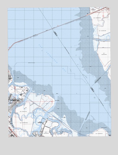
Redwood Point, CA USGS Topographic Map
Click on map above to begin viewing in our Map Viewer.

This topographic map contains these locations and features:
Feature Name Type Latitude Longitude GNIS ID View Map
Alameda CreekStreamN37.5944°W122.1469°1654946View Map
Bair IslandIslandN37.5299°W122.2222°254583View Map
Bay SloughGutN37.5491°W122.2372°254590View Map
Bayside Community ChurchChurchN37.5638°W122.2500°1786125View Map
Belmont SloughStreamN37.5541°W122.2444°255065View Map
Bird IslandIslandN37.5510°W122.2369°1786127View Map
Bowditch Middle SchoolSchoolN37.5597°W122.2484°1786128View Map
Christ the Victor Lutheran ChurchChurchN37.5641°W122.2500°1786134View Map
City of Foster CityCivilN37.5791°W122.2388°2410534View Map
City of Redwood CityCivilN37.5175°W122.2112°2410919View Map
Fire Station Number 2BuildingN37.5035°W122.2477°1786137View Map
First SloughGutN37.5063°W122.1986°223522View Map
Greco IslandIslandN37.5177°W122.1830°224532View Map
KNBR-AM (San Francisco)TowerN37.5472°W122.2344°1664953View Map
Mariner ParkParkN37.5249°W122.2489°1786148View Map
Marlin ParkParkN37.5305°W122.2483°1786149View Map
Mount Eden CreekStreamN37.6024°W122.1455°229145View Map
Petes HarborHarborN37.5044°W122.2150°1786152View Map
Port of Redwood CityHarborN37.5133°W122.2086°230945View Map
Press Wireless Radio StationLocaleN37.5372°W122.2361°1654392View Map
Pulgas CreekStreamN37.5072°W122.2452°234518View Map
Ravenswood PointCapeN37.5074°W122.1369°231281View Map
Redwood City Fire Department StationBuildingN37.5341°W122.2396°2623927View Map
Redwood CreekStreamN37.5264°W122.1962°255118View Map
Redwood PointCapeN37.5349°W122.1947°255028View Map
Redwood ShoresPopulated PlaceN37.5319°W122.2480°1786154View Map
Saint Lukes Catholic ChurchChurchN37.5535°W122.2497°1786155View Map
San Mateo BridgeBridgeN37.6019°W122.2047°252051View Map
Sandpiper Elementary SchoolSchoolN37.5377°W122.2359°2504447View Map
Seaport Village North Shopping CenterLocaleN37.5038°W122.2119°1786156View Map
Shannon ParkParkN37.5367°W122.2417°2124415View Map
Smith SloughGutN37.5069°W122.2339°253900View Map
South Bay Sewer Authority Treatment PlantLocaleN37.5456°W122.2294°2124416View Map
Steinberger SloughGutN37.5305°W122.2386°253931View Map
Westpoint SloughGutN37.5060°W122.1927°237562View Map

Note: Coordinates in the location and feature list above are referenced to NAD83 datum.


Copyright (C) 2008-2024 Ryan Niemi / Sunset Dynamics ... All Rights Reserved