TopoQuest Logo
Do you find TopoQuest useful?
Help keep TopoQuest running and adding new maps/features by donating!
Bitcoin:  19c7KJd3qBynnjoSw5npx9KScwjBe4ifkT
Litecoin:  LXs6TkuXGGXo1vDsWCkWVdjQX94eUKd6ui
Home View Maps Find Maps Find Places Resources & Links


Red Rock, Texas Topographic Map

USGS Map Title: Red Rock, TX
USGS Map MRC: 29097H4
DRG (GeoTIFF) Download: o29097h4.tif


Neighboring USGS Topographic Map Quads:


  Lytton Springs, TX  
30097A5
 

  Bastrop SW, TX  
30097A4
 

  Bastrop, TX  
30097A3
 

  Dale, TX  
29097H5
 

  Red Rock, TX  
29097H4
 

  Rosanky, TX  
29097H3
 

  McMahan, TX  
29097G5
 

  Delhi, TX  
29097G4
 

  Jeddo, TX  
29097G3


Map MRC Location:

N30°
W98°
N30°
W97°
H8 H7 H6 H5 H4 H3 H2 H1
G8 G7 G6 G5 G4 G3 G2 G1
F8 F7 F6 F5 F4 F3 F2 F1
E8 E7 E6 E5 E4 E3 E2 E1
D8 D7 D6 D5 D4 D3 D2 D1
C8 C7 C6 C5 C4 C3 C2 C1
B8 B7 B6 B5 B4 B3 B2 B1
A8 A7 A6 A5 A4 A3 A2 A1
N29°
W98°
N29°
W97°

Red Rock, TX USGS 1:24K Topographic Map Preview:
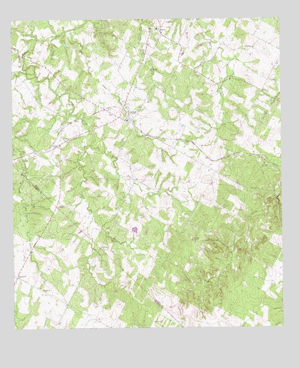
Red Rock, TX USGS Topographic Map
Click on map above to begin viewing in our Map Viewer.

This topographic map contains these locations and features:
Feature Name Type Latitude Longitude GNIS ID View Map
BatemanPopulated PlaceN29.9513°W97.4753°1379396View Map
Bateman Oil FieldOilfieldN29.9386°W97.4917°1351587View Map
Bee Creek Oil FieldOilfieldN29.9594°W97.4900°1351768View Map
Carrol Lentz Oil FieldOilfieldN29.9952°W97.4575°1353874View Map
Clarks CemeteryCemeteryN29.8891°W97.4844°1354574View Map
Elm CreekStreamN29.9783°W97.4931°1356947View Map
Elm GrovePopulated PlaceN29.8908°W97.4875°1379715View Map
Five Points Volunteer Fire DepartmentBuildingN29.9890°W97.4355°2552201View Map
Flag HillSummitN29.9105°W97.4164°1357400View Map
Hendrix CemeteryCemeteryN29.9766°W97.4150°1359034View Map
Huber LakeReservoirN29.9150°W97.4438°1865386View Map
Huber Lake DamDamN29.9136°W97.4453°1865385View Map
Lentz CemeteryCemeteryN29.9722°W97.4414°1361086View Map
Lower Elm CreekStreamN29.9494°W97.4642°1361910View Map
Meredith CemeteryCemeteryN29.9986°W97.4276°1362633View Map
Old Red Rock CemeteryCemeteryN29.9658°W97.4708°1364470View Map
PettytownPopulated PlaceN29.9074°W97.4594°1380351View Map
Red RockPopulated PlaceN29.9597°W97.4461°1366208View Map
Red Rock CemeteryCemeteryN29.9636°W97.4561°1366210View Map
Red Rock Post OfficePost OfficeN29.9591°W97.4462°2731988View Map
RocknePopulated PlaceN29.9958°W97.4311°1366735View Map
Smith CemeteryCemeteryN29.9527°W97.3958°1368463View Map
TaylorsvillePopulated PlaceN29.8961°W97.4981°1380933View Map
Upper Cedar HollowValleyN29.9949°W97.4715°1370495View Map
Upper Elm CreekStreamN29.9491°W97.4636°1370504View Map
WattersonPopulated PlaceN29.9891°W97.3878°1380748View Map

Note: Coordinates in the location and feature list above are referenced to NAD83 datum.


Copyright (C) 2008-2024 Ryan Niemi / Sunset Dynamics ... All Rights Reserved