TopoQuest Logo
Do you find TopoQuest useful?
Help keep TopoQuest running and adding new maps/features by donating!
Bitcoin:  19c7KJd3qBynnjoSw5npx9KScwjBe4ifkT
Litecoin:  LXs6TkuXGGXo1vDsWCkWVdjQX94eUKd6ui
Home View Maps Find Maps Find Places Resources & Links


Raymond, Nebraska Topographic Map

USGS Map Title: Raymond, NE
USGS Map MRC: 40096H7
DRG (GeoTIFF) Download: o40096h7.tif


Neighboring USGS Topographic Map Quads:


  Valparaiso SW, NE  
41096A8
 

  Valparaiso, NE  
41096A7
 

  Ceresco, NE  
41096A6
 

  Garland, NE  
40096H8
 

  Raymond, NE  
40096H7
 

  Davey, NE  
40096H6
 

  Pleasant Dale, NE  
40096G8
 

  Emerald, NE  
40096G7
 

  Lincoln, NE  
40096G6


Map MRC Location:

N41°
W97°
N41°
W96°
H8 H7 H6 H5 H4 H3 H2 H1
G8 G7 G6 G5 G4 G3 G2 G1
F8 F7 F6 F5 F4 F3 F2 F1
E8 E7 E6 E5 E4 E3 E2 E1
D8 D7 D6 D5 D4 D3 D2 D1
C8 C7 C6 C5 C4 C3 C2 C1
B8 B7 B6 B5 B4 B3 B2 B1
A8 A7 A6 A5 A4 A3 A2 A1
N40°
W97°
N40°
W96°

Raymond, NE USGS 1:24K Topographic Map Preview:
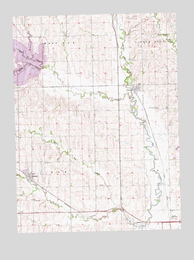
Raymond, NE USGS Topographic Map
Click on map above to begin viewing in our Map Viewer.

This topographic map contains these locations and features:
Feature Name Type Latitude Longitude GNIS ID View Map
Area Eleven CampgroundLocaleN40.9875°W96.8517°1898591View Map
Area One CampgroundLocaleN40.9564°W96.8709°1898593View Map
Area Ten CampgroundLocaleN40.9889°W96.8697°1898592View Map
Bradley North DamDamN40.9117°W96.8553°1768364View Map
Bradley North ReservoirReservoirN40.9122°W96.8553°1768365View Map
Bradley North ReservoirReservoirN40.9096°W96.8552°1768367View Map
Bradley South DamDamN40.9083°W96.8553°1768366View Map
Branched Oak Dam-Site 18 DamDamN40.9700°W96.8536°1768790View Map
Branched Oak LakeReservoirN40.9706°W96.8536°827621View Map
Branched Oak LakeReservoirN40.9738°W96.8718°1768791View Map
Branched Oak Lake State Recreation AreaParkN40.9778°W96.8670°1898598View Map
Branched Oak Lake State Wildlife Management AreaParkN40.9778°W96.8670°1898599View Map
Countryside Co-op ElevatorLocaleN40.9569°W96.7828°1898451View Map
Elk CreekStreamN40.8758°W96.7803°829054View Map
Elk Election PrecinctCivilN40.9154°W96.8531°1928850View Map
GarrattLocaleN40.9250°W96.7684°1898919View Map
Kawasaki Motors Emergency Medical Response TeamBuildingN40.8770°W96.7581°2553779View Map
MalcolmPopulated PlaceN40.9067°W96.8628°831011View Map
Malcolm (historical)LocaleN40.9061°W96.8642°1898463View Map
Malcolm CemeteryCemeteryN40.9153°W96.8539°831012View Map
Malcolm Post OfficePost OfficeN40.9075°W96.8651°1898465View Map
Malcolm Public SchoolsSchoolN40.9139°W96.8714°1898468View Map
Malcolm United Methodist ChurchChurchN40.9067°W96.8628°1898464View Map
Malcolm Volunteer Fire and RescueBuildingN40.9080°W96.8662°2553319View Map
Middle Oak CreekStreamN40.9703°W96.8517°831270View Map
Moessner DamDamN40.9783°W96.7603°1769010View Map
Moessner ReservoirReservoirN40.9774°W96.7601°1769011View Map
Northwest Community ChurchChurchN40.9067°W96.8628°1898467View Map
Oak Creek CemeteryCemeteryN40.9455°W96.7667°831807View Map
Oak Valley Public SchoolSchoolN40.9014°W96.7631°836214View Map
RaymondLocaleN40.9553°W96.7836°1898453View Map
RaymondPopulated PlaceN40.9569°W96.7828°832478View Map
Raymond Central High SchoolSchoolN40.9572°W96.7809°1898452View Map
Raymond Post OfficePost OfficeN40.9564°W96.7835°1899081View Map
Raymond United Methodist ChurchChurchN40.9569°W96.7828°1899082View Map
Raymond Volunteer Fire Department - Station 1BuildingN40.9603°W96.7786°2553496View Map
Saint Pauls CemeteryCemeteryN40.8933°W96.8622°833065View Map
Saint Pauls Lutheran ChurchChurchN40.9067°W96.8628°1898466View Map
Township of ElkCivilN40.9083°W96.8420°1899261View Map
Township of West OakCivilN40.9972°W96.8420°1899262View Map
Village of MalcolmCivilN40.9088°W96.8656°2399229View Map
Village of RaymondCivilN40.9568°W96.7815°2399050View Map
West Oak (historical)LocaleN40.8778°W96.7586°1898502View Map
West Oak CreekStreamN40.8861°W96.7947°834609View Map
Westview County HomeLocaleN40.8814°W96.7570°834656View Map
WoodlawnPopulated PlaceN40.8800°W96.7792°835480View Map
Woodlawn (historical)LocaleN40.8783°W96.7814°1898501View Map
Woodlawn Post Office (historical)Post OfficeN40.8800°W96.7792°1898500View Map

Note: Coordinates in the location and feature list above are referenced to NAD83 datum.


Copyright (C) 2008-2024 Ryan Niemi / Sunset Dynamics ... All Rights Reserved