TopoQuest Logo
Do you find TopoQuest useful?
Help keep TopoQuest running and adding new maps/features by donating!
Bitcoin:  19c7KJd3qBynnjoSw5npx9KScwjBe4ifkT
Litecoin:  LXs6TkuXGGXo1vDsWCkWVdjQX94eUKd6ui
Home View Maps Find Maps Find Places Resources & Links


Ray Mesa, Utah Topographic Map

USGS Map Title: Ray Mesa, UT
USGS Map MRC: 38109C1
DRG (GeoTIFF) Download: o38109c1.tif


Neighboring USGS Topographic Map Quads:


  Mount Peale, UT  
38109D2
 

  Buckeye Reservoir, CO  
38109D1
 

  Roc Creek, CO  
38108D8
 

  La Sal East, UT  
38109C2
 

  Ray Mesa, UT  
38109C1
 

  Paradox, CO  
38108C8
 

  Lisbon Valley, UT  
38109B2
 

  Lisbon Gap, UT  
38109B1
 

  Anderson Mesa, CO  
38108B8


Map MRC Location:

N39°
W110°
N39°
W109°
H8 H7 H6 H5 H4 H3 H2 H1
G8 G7 G6 G5 G4 G3 G2 G1
F8 F7 F6 F5 F4 F3 F2 F1
E8 E7 E6 E5 E4 E3 E2 E1
D8 D7 D6 D5 D4 D3 D2 D1
C8 C7 C6 C5 C4 C3 C2 C1
B8 B7 B6 B5 B4 B3 B2 B1
A8 A7 A6 A5 A4 A3 A2 A1
N38°
W110°
N38°
W109°

Ray Mesa, UT USGS 1:24K Topographic Map Preview:
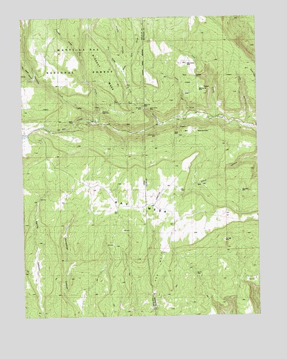
Ray Mesa, UT USGS Topographic Map
Click on map above to begin viewing in our Map Viewer.

This topographic map contains these locations and features:
Feature Name Type Latitude Longitude GNIS ID View Map
Angle MineMineN38.3505°W109.0332°1735503View Map
Birthday MineMineN38.3383°W109.0212°1735787View Map
Black Hat MineMineN38.3414°W109.0637°1437853View Map
Blue Cap MineMineN38.3369°W109.0590°1735772View Map
Blue Cap MineMineN38.3372°W109.0609°1437860View Map
Brushy Basin MineMineN38.2553°W109.0559°1735774View Map
Brushy Basin Number 3 MineMineN38.2539°W109.0437°198114View Map
Brushy Basin Number 3 MineMineN38.2542°W109.0487°185670View Map
Carla May Group MineMineN38.3297°W109.0387°1735797View Map
Confusion MineMineN38.3500°W109.0329°185681View Map
Dry DrawValleyN38.3542°W109.0734°1437854View Map
Elray MineMineN38.3033°W109.0087°1735776View Map
Eva MineMineN38.3250°W109.0257°1735788View Map
Evening Star MineMineN38.3442°W109.0390°185676View Map
Firefly MineMineN38.3314°W109.0982°1437861View Map
Gray Daun MineMineN38.3375°W109.0965°1455712View Map
Greasy Spoon MineMineN38.3169°W109.0287°1735790View Map
Hang Dog CreekStreamN38.3667°W109.1232°1441576View Map
Hespeotus MineMineN38.3311°W109.0696°1437855View Map
Hideout MesaSummitN38.3475°W109.0751°1437856View Map
Hop CreekStreamN38.3314°W109.0862°1441843View Map
Ice Lake CreekStreamN38.3330°W109.0396°185685View Map
Independence MineMineN38.3528°W109.0396°1735778View Map
Lion CanyonValleyN38.3304°W109.0524°201772View Map
Lion CreekStreamN38.3328°W109.0237°185669View Map
Lion Creek MineMineN38.3519°W109.0323°1735791View Map
Lion GulchValleyN38.3299°W109.0060°185684View Map
Lode MineMineN38.3475°W109.0354°1735988View Map
Lucky Number One MineMineN38.3036°W109.0146°1735780View Map
Marjorie Ann MineMineN38.3472°W109.0365°185678View Map
Maud MineMineN38.3253°W109.0459°185675View Map
Midnight MineMineN38.3203°W109.0218°1735548View Map
Morning Star MineMineN38.3453°W109.0284°185679View Map
New Yellow Spot MineMineN38.3503°W109.0146°185680View Map
Pine Lodge RanchLocaleN38.3292°W109.1243°1437858View Map
Pole Spring CanyonValleyN38.3503°W109.1182°1444563View Map
Prayer Number Nine MineMineN38.3278°W109.0457°1735781View Map
Rattlesnake MineMineN38.3567°W109.0448°1735782View Map
Ray MesaSummitN38.3128°W109.1189°203143View Map
Saint Patrick ClaimsMineN38.3472°W109.0209°1735793View Map
Saint Patrick Number Seven MineMineN38.3414°W109.0451°1735500View Map
Soldier Boy MineMineN38.3422°W109.0451°1735499View Map
Soldier Boy MineMineN38.3475°W109.0323°1735794View Map
Spring CanyonValleyN38.3111°W109.1146°1437863View Map
State Line DrawValleyN38.3503°W109.0698°1446106View Map
Summer MineMineN38.3522°W109.0434°1735784View Map
Sumner MineMineN38.3519°W109.0437°185683View Map
The HornSummitN38.2750°W109.0534°185672View Map
Too High MineMineN38.2930°W109.0109°1735570View Map
Trinity CanyonValleyN38.3503°W109.0701°1446720View Map
Trough DrawValleyN38.3608°W109.0957°1446729View Map
Twomile CreekStreamN38.3342°W109.0882°1446820View Map
Uranium Girl MineMineN38.3256°W109.0545°1735795View Map
Vanadium Queen MineMineN38.3353°W109.0818°1437859View Map
Vista Grande MineMineN38.3553°W109.0368°185682View Map
Wedge MineMineN38.3511°W109.0382°185677View Map
Wray Mesa MineMineN38.3033°W109.0090°185673View Map
Yellow Bird MinesMineN38.3283°W109.0307°185674View Map
Yip Yip MineMineN38.2683°W109.0340°185671View Map
Yucca MineMineN38.2828°W109.0140°1735796View Map

Note: Coordinates in the location and feature list above are referenced to NAD83 datum.


Copyright (C) 2008-2024 Ryan Niemi / Sunset Dynamics ... All Rights Reserved