TopoQuest Logo
Do you find TopoQuest useful?
Help keep TopoQuest running and adding new maps/features by donating!
Bitcoin:  19c7KJd3qBynnjoSw5npx9KScwjBe4ifkT
Litecoin:  LXs6TkuXGGXo1vDsWCkWVdjQX94eUKd6ui
Home View Maps Find Maps Find Places Resources & Links


Ravens Nest, Nevada Topographic Map

USGS Map Title: Ravens Nest, NV
USGS Map MRC: 40116E1
DRG (GeoTIFF) Download: o40116e1.tif


Neighboring USGS Topographic Map Quads:


  Carlin West, NV  
40116F2
 

  Carlin East, NV  
40116F1
 

  Grindstone Mountain, NV  
40115F8
 

  Palisade, NV  
40116E2
 

  Ravens Nest, NV  
40116E1
 

  Bullion, NV  
40115E8
 

  McCormack Spring, NV  
40116D2
 

  Papoose Canyon, NV  
40116D1
 

  Robinson Mountain, NV  
40115D8


Map MRC Location:

N41°
W117°
N41°
W116°
H8 H7 H6 H5 H4 H3 H2 H1
G8 G7 G6 G5 G4 G3 G2 G1
F8 F7 F6 F5 F4 F3 F2 F1
E8 E7 E6 E5 E4 E3 E2 E1
D8 D7 D6 D5 D4 D3 D2 D1
C8 C7 C6 C5 C4 C3 C2 C1
B8 B7 B6 B5 B4 B3 B2 B1
A8 A7 A6 A5 A4 A3 A2 A1
N40°
W117°
N40°
W116°

Ravens Nest, NV USGS 1:24K Topographic Map Preview:
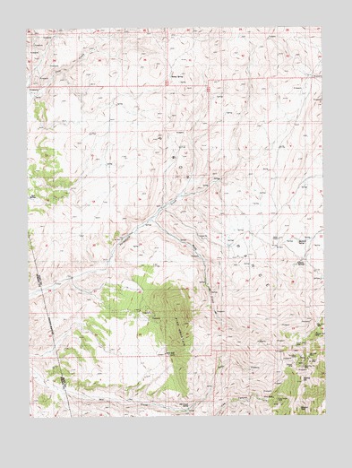
Ravens Nest, NV USGS Topographic Map
Click on map above to begin viewing in our Map Viewer.

This topographic map contains these locations and features:
Feature Name Type Latitude Longitude GNIS ID View Map
Brodine MineMineN40.5180°W116.0103°855382View Map
Bullion MineMineN40.5180°W116.0103°855377View Map
Bunker HillSummitN40.5108°W116.0112°854385View Map
Burke MineMineN40.5180°W116.0103°855379View Map
Cherry SpringsSpringN40.5491°W116.0134°839462View Map
Copper Bell MineMineN40.5263°W116.0045°849574View Map
Delmas MineMineN40.5169°W116.0148°849568View Map
Ennor MineMineN40.5044°W116.0220°854310View Map
Grey Eagle MineMineN40.5046°W116.0209°847350View Map
Helen M MineMineN40.5058°W116.0231°854311View Map
Independence MineMineN40.5046°W116.0231°854312View Map
Key MineMineN40.5180°W116.0103°855375View Map
Mahogany MineMineN40.5180°W116.0103°855380View Map
Mendota MineMineN40.5188°W116.0078°849571View Map
Mill Creek SpringSpringN40.5027°W116.0590°849567View Map
Murdock SpringSpringN40.5563°W116.0115°849576View Map
Palisade MineMineN40.5180°W116.0103°855381View Map
Pine MountainSummitN40.5294°W116.0606°842829View Map
Piņon RangeRangeN40.5571°W116.0187°858139View Map
Ravens NestSummitN40.5021°W116.0123°843108View Map
Red Bird MineMineN40.5283°W116.0045°849575View Map
Red SpringsSpringN40.5707°W116.1219°843174View Map
Silver King MineMineN40.5221°W116.0128°849573View Map
Sky Blue MineMineN40.5180°W116.0103°855383View Map
Standing Elk MineMineN40.5158°W116.0103°849569View Map
Storm King MineMineN40.5180°W116.0103°855376View Map
Stump SpringSpringN40.6093°W116.0648°844057View Map
Sweepstake MineMineN40.5180°W116.0148°854309View Map
Sylvania MineMineN40.5188°W116.0128°849572View Map
Tripoli MineMineN40.5171°W116.0076°849570View Map
Webb CreekStreamN40.5635°W116.0754°844685View Map
Webb RanchLocaleN40.5635°W116.0731°844686View Map
Webfoot MineMineN40.5180°W116.0103°855378View Map

Note: Coordinates in the location and feature list above are referenced to NAD83 datum.


Copyright (C) 2008-2024 Ryan Niemi / Sunset Dynamics ... All Rights Reserved