TopoQuest Logo
Do you find TopoQuest useful?
Help keep TopoQuest running and adding new maps/features by donating!
Bitcoin:  19c7KJd3qBynnjoSw5npx9KScwjBe4ifkT
Litecoin:  LXs6TkuXGGXo1vDsWCkWVdjQX94eUKd6ui
Home View Maps Find Maps Find Places Resources & Links


Rattlesnake Butte, Colorado Topographic Map

USGS Map Title: Rattlesnake Butte, CO
USGS Map MRC: 40107C1
DRG (GeoTIFF) Download: o40107c1.tif


Neighboring USGS Topographic Map Quads:


  Mount Harris, CO  
40107D2
 

  Milner, CO  
40107D1
 

  Cow Creek, CO  
40106D8
 

  Dunckley, CO  
40107C2
 

  Rattlesnake Butte, CO  
40107C1
 

  Oak Creek, CO  
40106C8
 

  Dunckley Pass, CO  
40107B2
 

  Sand Point, CO  
40107B1
 

  Yampa, CO  
40106B8


Map MRC Location:

N41°
W108°
N41°
W107°
H8 H7 H6 H5 H4 H3 H2 H1
G8 G7 G6 G5 G4 G3 G2 G1
F8 F7 F6 F5 F4 F3 F2 F1
E8 E7 E6 E5 E4 E3 E2 E1
D8 D7 D6 D5 D4 D3 D2 D1
C8 C7 C6 C5 C4 C3 C2 C1
B8 B7 B6 B5 B4 B3 B2 B1
A8 A7 A6 A5 A4 A3 A2 A1
N40°
W108°
N40°
W107°

Rattlesnake Butte, CO USGS 1:24K Topographic Map Preview:
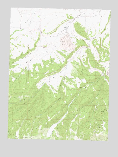
Rattlesnake Butte, CO USGS Topographic Map
Click on map above to begin viewing in our Map Viewer.

This topographic map contains these locations and features:
Feature Name Type Latitude Longitude GNIS ID View Map
Apex MineMineN40.3005°W107.0351°1683244View Map
Apex Number Two MineMineN40.2930°W107.0312°1735378View Map
Bear GulchValleyN40.2883°W107.0987°171458View Map
Big Mack MineMineN40.3147°W107.0037°1735643View Map
Blue Spruce MineMineN40.3066°W107.0073°1683245View Map
Colo-Yamp MineMineN40.3280°W107.0606°1683248View Map
Eckman ParkFlatN40.3278°W107.0923°171508View Map
Eckman Park Number 1 DamDamN40.3216°W107.1123°201086View Map
Eckman Park Reservoir Number 1ReservoirN40.3216°W107.1123°201087View Map
Energy MineMineN40.3436°W107.0548°171507View Map
Foidel Creek MineMineN40.3461°W107.0612°1683249View Map
Foidel School (historical)SchoolN40.3569°W107.0556°171506View Map
Johnnies Coal MineMineN40.2780°W107.0378°1683246View Map
Little Middle CreekStreamN40.3205°W107.0531°171500View Map
Little Trout CreekStreamN40.3122°W107.0101°171502View Map
Middle Creek MineMineN40.3386°W107.0278°1683247View Map
Mule GulchValleyN40.2906°W107.0170°171501View Map
North Fork Middle CreekStreamN40.3083°W107.0756°171459View Map
Number One ReservoirReservoirN40.3201°W107.1119°196700View Map
Pinnacle PeakSummitN40.3380°W107.0809°171505View Map
Rattlesnake ButteSummitN40.3122°W107.0334°171504View Map
Reservoir Number ThreeReservoirN40.3248°W107.0734°196721View Map
Reservoir Number TwoReservoirN40.3166°W107.1044°196722View Map
Trout Creek SchoolSchoolN40.3008°W107.0312°171503View Map

Note: Coordinates in the location and feature list above are referenced to NAD83 datum.


Copyright (C) 2008-2024 Ryan Niemi / Sunset Dynamics ... All Rights Reserved