TopoQuest Logo
Do you find TopoQuest useful?
Help keep TopoQuest running and adding new maps/features by donating!
Bitcoin:  19c7KJd3qBynnjoSw5npx9KScwjBe4ifkT
Litecoin:  LXs6TkuXGGXo1vDsWCkWVdjQX94eUKd6ui
Home View Maps Find Maps Find Places Resources & Links


Raritan, Illinois Topographic Map

USGS Map Title: Raritan, IL
USGS Map MRC: 40090F7
DRG (GeoTIFF) Download: o40090f7.tif


Neighboring USGS Topographic Map Quads:


  Gladstone, IL  
40090G8
 

  Kirkwood West, IL  
40090G7
 

  Kirkwood East, IL  
40090G6
 

  Stronghurst, IL  
40090F8
 

  Raritan, IL  
40090F7
 

  Roseville, IL  
40090F6
 

  La Harpe, IL  
40090E8
 

  Blandinsville, IL  
40090E7
 

  Good Hope, IL  
40090E6


Map MRC Location:

N41°
W91°
N41°
W90°
H8 H7 H6 H5 H4 H3 H2 H1
G8 G7 G6 G5 G4 G3 G2 G1
F8 F7 F6 F5 F4 F3 F2 F1
E8 E7 E6 E5 E4 E3 E2 E1
D8 D7 D6 D5 D4 D3 D2 D1
C8 C7 C6 C5 C4 C3 C2 C1
B8 B7 B6 B5 B4 B3 B2 B1
A8 A7 A6 A5 A4 A3 A2 A1
N40°
W91°
N40°
W90°

Raritan, IL USGS 1:24K Topographic Map Preview:
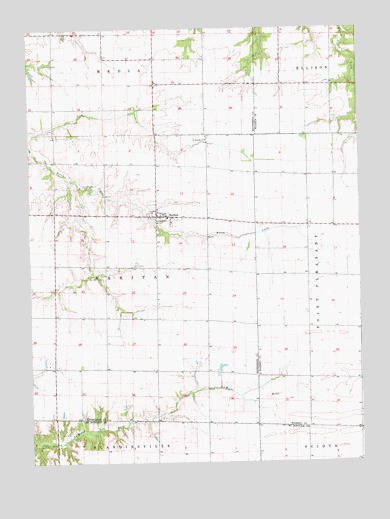
Raritan, IL USGS Topographic Map
Click on map above to begin viewing in our Map Viewer.

This topographic map contains these locations and features:
Feature Name Type Latitude Longitude GNIS ID View Map
Barry School (historical)SchoolN40.7198°W90.8085°1719519View Map
Boston CornersLocaleN40.7189°W90.7596°1823685View Map
Centerville School (historical)SchoolN40.6820°W90.8468°1719523View Map
Cox School (historical)SchoolN40.6975°W90.8746°1719529View Map
Duck Pond School (historical)SchoolN40.6525°W90.8462°1719533View Map
Ellison School (historical)SchoolN40.7492°W90.8660°1719534View Map
Gearhart School (historical)SchoolN40.6875°W90.8074°1719537View Map
Horse BranchStreamN40.7453°W90.8299°424155View Map
Jackson Corner School (historical)SchoolN40.7342°W90.7701°1719300View Map
Jacksons CornersLocaleN40.7337°W90.7701°1823712View Map
Piper School (historical)SchoolN40.6789°W90.7704°1719311View Map
Pleasant View School (historical)SchoolN40.7073°W90.7693°1719312View Map
RaritanPopulated PlaceN40.6959°W90.8274°416397View Map
Raritan CemeteryCemeteryN40.6916°W90.8269°1968257View Map
Raritan Fire Protection DistrictBuildingN40.6967°W90.8266°2640329View Map
Raritan Post OfficePost OfficeN40.6958°W90.8267°2788396View Map
Saint Patrick's CemeteryCemeteryN40.7184°W90.8074°1968262View Map
Saint Patricks ChurchChurchN40.7181°W90.8085°417683View Map
South Prairie School (historical)SchoolN40.7417°W90.8143°1719561View Map
Stanley School (historical)SchoolN40.7184°W90.8649°1719565View Map
Sunny Ridge School (historical)SchoolN40.6514°W90.8085°1719570View Map
Township of RaritanCivilN40.6785°W90.8463°429619View Map
Village of RaritanCivilN40.6958°W90.8250°2399045View Map
Waggy School (historical)SchoolN40.6495°W90.7696°1719328View Map

Note: Coordinates in the location and feature list above are referenced to NAD83 datum.


Copyright (C) 2008-2024 Ryan Niemi / Sunset Dynamics ... All Rights Reserved