TopoQuest Logo
Do you find TopoQuest useful?
Help keep TopoQuest running and adding new maps/features by donating!
Bitcoin:  19c7KJd3qBynnjoSw5npx9KScwjBe4ifkT
Litecoin:  LXs6TkuXGGXo1vDsWCkWVdjQX94eUKd6ui
Home View Maps Find Maps Find Places Resources & Links


Rantoul, Kansas Topographic Map

USGS Map Title: Rantoul, KS
USGS Map MRC: 38095E1
DRG (GeoTIFF) Download: o38095e1.tif


Neighboring USGS Topographic Map Quads:


  Le Loup, KS  
38095F2
 

  Wellsville, KS  
38095F1
 

  Antioch, KS  
38094F8
 

  Peoria, KS  
38095E2
 

  Rantoul, KS  
38095E1
 

  Paola West, KS  
38094E8
 

  Garnett NW, KS  
38095D2
 

  Lane, KS  
38095D1
 

  Osawatomie, KS  
38094D8


Map MRC Location:

N39°
W96°
N39°
W95°
H8 H7 H6 H5 H4 H3 H2 H1
G8 G7 G6 G5 G4 G3 G2 G1
F8 F7 F6 F5 F4 F3 F2 F1
E8 E7 E6 E5 E4 E3 E2 E1
D8 D7 D6 D5 D4 D3 D2 D1
C8 C7 C6 C5 C4 C3 C2 C1
B8 B7 B6 B5 B4 B3 B2 B1
A8 A7 A6 A5 A4 A3 A2 A1
N38°
W96°
N38°
W95°

Rantoul, KS USGS 1:24K Topographic Map Preview:
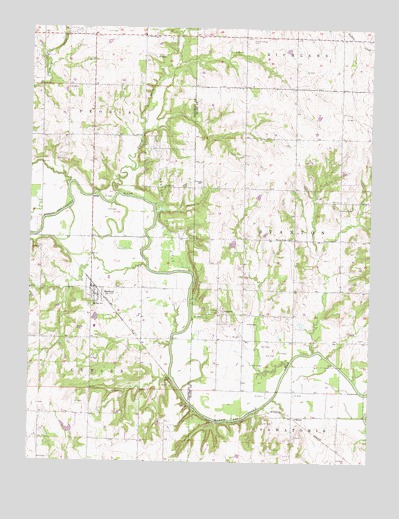
Rantoul, KS USGS Topographic Map
Click on map above to begin viewing in our Map Viewer.

This topographic map contains these locations and features:
Feature Name Type Latitude Longitude GNIS ID View Map
City of RantoulCivilN38.5480°W95.1010°2396322View Map
Cutler Township Fire DepartmentBuildingN38.5497°W95.1018°2111248View Map
Dempsay Farm Airport (historical)AirportN38.5389°W95.1072°481311View Map
Hickory CreekStreamN38.5792°W95.1116°479375View Map
Howard CemeteryCemeteryN38.5872°W95.1164°479692View Map
Mannen CemeteryCemeteryN38.5733°W95.0117°479697View Map
New Hope Baptist ChurchChurchN38.6223°W95.0834°479695View Map
New Hope CemeteryCemeteryN38.6073°W95.0649°2673314View Map
O'BrienPopulated PlaceN38.5133°W95.0280°484900View Map
Pleasant Valley CemeteryCemeteryN38.6222°W95.0430°479696View Map
RantoulPopulated PlaceN38.5486°W95.1002°479688View Map
Rantoul Oil FieldOilfieldN38.5700°W95.0752°479691View Map
Rantoul Post OfficePost OfficeN38.5501°W95.1020°2693938View Map
Rantoul Sewer Treatment PlantLocaleN38.5529°W95.0960°2691927View Map
Spring Ridge ChurchChurchN38.5645°W95.0297°479690View Map
StantonPopulated PlaceN38.5433°W95.0544°479689View Map
Stanton CemeteryCemeteryN38.5425°W95.0594°2575131View Map
Township of PeoriaCivilN38.6083°W95.1199°479373View Map
Township of StantonCivilN38.5648°W95.0045°479699View Map
Turkey CreekStreamN38.5772°W95.0925°479698View Map
Victory School (historical)SchoolN38.5806°W95.0627°479693View Map
Wellsville Oil FieldOilfieldN38.6181°W95.1183°479694View Map

Note: Coordinates in the location and feature list above are referenced to NAD83 datum.


Copyright (C) 2008-2024 Ryan Niemi / Sunset Dynamics ... All Rights Reserved