TopoQuest Logo
Do you find TopoQuest useful?
Help keep TopoQuest running and adding new maps/features by donating!
Bitcoin:  19c7KJd3qBynnjoSw5npx9KScwjBe4ifkT
Litecoin:  LXs6TkuXGGXo1vDsWCkWVdjQX94eUKd6ui
Home View Maps Find Maps Find Places Resources & Links


Randolph, Mississippi Topographic Map

USGS Map Title: Randolph, MS
USGS Map MRC: 34089B2
DRG (GeoTIFF) Download: o34089b2.tif


Neighboring USGS Topographic Map Quads:


  Denmark, MS  
34089C3
 

  Thaxton, MS  
34089C2
 

  Northwest Pontotoc, MS  
34089C1
 

  Tula, MS  
34089B3
 

  Randolph, MS  
34089B2
 

  Southwest Pontotoc, MS  
34089B1
 

  Sarepta, MS  
34089A3
 

  Robbs, MS  
34089A2
 

  Houlka, MS  
34089A1


Map MRC Location:

N35°
W90°
N35°
W89°
H8 H7 H6 H5 H4 H3 H2 H1
G8 G7 G6 G5 G4 G3 G2 G1
F8 F7 F6 F5 F4 F3 F2 F1
E8 E7 E6 E5 E4 E3 E2 E1
D8 D7 D6 D5 D4 D3 D2 D1
C8 C7 C6 C5 C4 C3 C2 C1
B8 B7 B6 B5 B4 B3 B2 B1
A8 A7 A6 A5 A4 A3 A2 A1
N34°
W90°
N34°
W89°

Randolph, MS USGS 1:24K Topographic Map Preview:
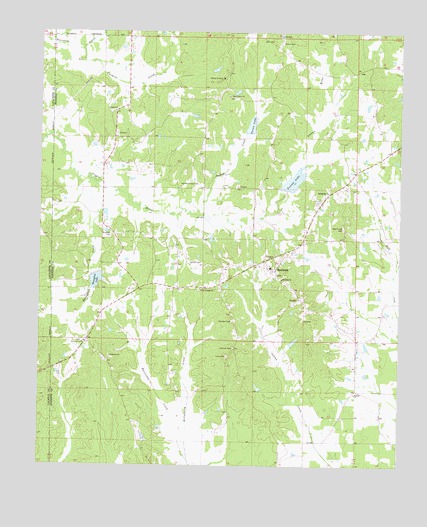
Randolph, MS USGS Topographic Map
Click on map above to begin viewing in our Map Viewer.

This topographic map contains these locations and features:
Feature Name Type Latitude Longitude GNIS ID View Map
Andersons Lake DamDamN34.2068°W89.2267°682503View Map
Antioch ChurchChurchN34.2273°W89.2242°666330View Map
Antioch School (historical)SchoolN34.2276°W89.2240°706847View Map
Bramlett CemeteryCemeteryN34.1920°W89.2253°667516View Map
Camp YoconaLocaleN34.2368°W89.1867°667995View Map
Carey Springs CemeteryCemeteryN34.1765°W89.1937°706855View Map
Carey Springs ChurchChurchN34.1762°W89.1942°668059View Map
Carey Springs School (historical)SchoolN34.1762°W89.1942°706856View Map
Cofer (historical)LocaleN34.1829°W89.2226°684700View Map
County Line ChurchChurchN34.1607°W89.2342°668875View Map
County Line School (historical)SchoolN34.1601°W89.2345°706868View Map
Griffin School (historical)SchoolN34.1457°W89.1403°706880View Map
Guinn CemeteryCemeteryN34.2470°W89.1667°670764View Map
Guinn CreekStreamN34.1996°W89.2012°670765View Map
Guinn LakeReservoirN34.2232°W89.1769°670766View Map
Harrison-Tutor CemeteryCemeteryN34.2065°W89.1948°670982View Map
HebronPopulated PlaceN34.1468°W89.1398°706883View Map
Hebron ChurchChurchN34.1459°W89.1401°671078View Map
Herndon CemeteryCemeteryN34.1668°W89.1831°671129View Map
Honeyfork CreekStreamN34.2043°W89.2284°671383View Map
Honeyfork LakeReservoirN34.1784°W89.2303°671384View Map
Hopewell ChurchChurchN34.1565°W89.2253°671438View Map
Hopewell School (historical)SchoolN34.1565°W89.2256°706885View Map
Hurricane CreekStreamN34.1268°W89.1978°671615View Map
Jenkins Lake DamDamN34.2318°W89.1401°682524View Map
Johnson CemeteryCemeteryN34.1590°W89.1826°671927View Map
Little CreekStreamN34.1996°W89.2134°684711View Map
Oak Forest CemeteryCemeteryN34.1937°W89.1445°675006View Map
Oak Forest School (historical)SchoolN34.1948°W89.1451°706896View Map
Piney Grove ChurchChurchN34.2318°W89.1848°675902View Map
Piney Grove School (historical)SchoolN34.2321°W89.1851°706902View Map
RandolphPopulated PlaceN34.1815°W89.1684°676469View Map
Randolph ChurchChurchN34.1790°W89.1659°676470View Map
Randolph High School (historical)SchoolN34.1823°W89.1698°706917View Map
Randolph Post OfficePost OfficeN34.1856°W89.1633°2768683View Map
Randolph Volunteer Fire DepartmentBuildingN34.1783°W89.1668°2665902View Map
Salmon CemeteryCemeteryN34.1837°W89.1937°677302View Map
Springville ChurchChurchN34.2040°W89.1498°678190View Map
Supervisor District 3CivilN34.1562°W89.1534°712038View Map
Tutor CemeteryCemeteryN34.1568°W89.1848°678993View Map
Tutor School (historical)SchoolN34.1559°W89.1848°706943View Map
Twomile CreekStreamN34.2459°W89.2348°695035View Map
Yocana Lake DamDamN34.2384°W89.1934°682532View Map
Yocona LakeReservoirN34.2074°W89.1620°679950View Map
Yocona River Watershed Y-14-11 DamDamN34.2184°W89.1801°682509View Map
Yocona River Watershed Y-14-12 DamDamN34.2084°W89.1617°682505View Map
Yocona River Watershed Y-14-13 DamDamN34.1851°W89.2317°682495View Map

Note: Coordinates in the location and feature list above are referenced to NAD83 datum.


Copyright (C) 2008-2024 Ryan Niemi / Sunset Dynamics ... All Rights Reserved