TopoQuest Logo
Do you find TopoQuest useful?
Help keep TopoQuest running and adding new maps/features by donating!
Bitcoin:  19c7KJd3qBynnjoSw5npx9KScwjBe4ifkT
Litecoin:  LXs6TkuXGGXo1vDsWCkWVdjQX94eUKd6ui
Home View Maps Find Maps Find Places Resources & Links


Rainier Mesa, Nevada Topographic Map

USGS Map Title: Rainier Mesa, NV
USGS Map MRC: 37116B2
DRG (GeoTIFF) Download: o37116b2.tif


Neighboring USGS Topographic Map Quads:


  Dead Horse Flat, NV  
37116C3
 

  Quartet Dome, NV  
37116C2
 

  Oak Spring Butte, NV  
37116C1
 

  Ammonia Tanks, NV  
37116B3
 

  Rainier Mesa, NV  
37116B2
 

  Oak Spring, NV  
37116B1
 

  Buckboard Mesa, NV  
37116A3
 

  Tippipah Spring, NV  
37116A2
 

  Yucca Flat, NV  
37116A1


Map MRC Location:

N38°
W117°
N38°
W116°
H8 H7 H6 H5 H4 H3 H2 H1
G8 G7 G6 G5 G4 G3 G2 G1
F8 F7 F6 F5 F4 F3 F2 F1
E8 E7 E6 E5 E4 E3 E2 E1
D8 D7 D6 D5 D4 D3 D2 D1
C8 C7 C6 C5 C4 C3 C2 C1
B8 B7 B6 B5 B4 B3 B2 B1
A8 A7 A6 A5 A4 A3 A2 A1
N37°
W117°
N37°
W116°

Rainier Mesa, NV USGS 1:24K Topographic Map Preview:
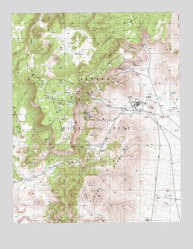
Rainier Mesa, NV USGS Topographic Map
Click on map above to begin viewing in our Map Viewer.

This topographic map contains these locations and features:
Feature Name Type Latitude Longitude GNIS ID View Map
Aqueduct MesaSummitN37.2316°W116.1875°849595View Map
Area 12 Branch Post OfficePost OfficeN37.1955°W116.1581°864809View Map
Area 12 CampLocaleN37.1955°W116.1581°863749View Map
Burnt MountainRidgeN37.2438°W116.1253°839212View Map
Captain Jack SpringSpringN37.1685°W116.1697°839314View Map
Dolomite Hill Drill HoleWellN37.1850°W116.1917°840087View Map
Effinger 1 Drill HoleWellN37.1900°W116.1512°840305View Map
Effinger 2 Drill HoleWellN37.1841°W116.1762°840306View Map
Effinger 3 Drill HoleWellN37.1969°W116.1431°840307View Map
Effinger 4 Drill HoleWellN37.1830°W116.1753°840308View Map
Egg PointCliffN37.1847°W116.2050°840310View Map
Gold MeadowsFlatN37.2280°W116.2084°840689View Map
Hagestad 1 Drill HoleWellN37.1922°W116.2173°840854View Map
Nevada Test Site Area 14LocaleN37.2391°W116.1520°842424View Map
Pinyon ButteSummitN37.1280°W116.2170°842857View Map
Rainier MesaSummitN37.2105°W116.2373°845611View Map
Survey ButteSummitN37.2083°W116.1712°844120View Map
The AqueductValleyN37.2280°W116.1520°844230View Map
Tonque WashStreamN37.1908°W116.1300°844362View Map
Twin PeaksSummitN37.2250°W116.1287°844484View Map
Whiterock 1 Drill HoleWellN37.2022°W116.1320°844826View Map
Whiterock 2 Drill HoleWellN37.2027°W116.1314°844827View Map
Whiterock 4 Drill HoleWellN37.1994°W116.1317°844828View Map
Whiterock SpringSpringN37.2016°W116.1323°845741View Map
Whiterock Spring (historical)LocaleN37.2008°W116.1331°854795View Map

Note: Coordinates in the location and feature list above are referenced to NAD83 datum.


Copyright (C) 2008-2024 Ryan Niemi / Sunset Dynamics ... All Rights Reserved