TopoQuest Logo
Do you find TopoQuest useful?
Help keep TopoQuest running and adding new maps/features by donating!
Bitcoin:  19c7KJd3qBynnjoSw5npx9KScwjBe4ifkT
Litecoin:  LXs6TkuXGGXo1vDsWCkWVdjQX94eUKd6ui
Home View Maps Find Maps Find Places Resources & Links


Raeford, North Carolina Topographic Map

USGS Map Title: Raeford, NC
USGS Map MRC: 34079H2
DRG (GeoTIFF) Download: o34079h2.tif


Neighboring USGS Topographic Map Quads:


  McCain, NC  
35079A3
 

  Nicholson Creek, NC  
35079A2
 

  Clifdale, NC  
35079A1
 

  Wagram, NC  
34079H3
 

  Raeford, NC  
34079H2
 

  Parkton, NC  
34079H1
 

  Wakulla, NC  
34079G3
 

  Red Springs, NC  
34079G2
 

  Rennert, NC  
34079G1


Map MRC Location:

N35°
W80°
N35°
W79°
H8 H7 H6 H5 H4 H3 H2 H1
G8 G7 G6 G5 G4 G3 G2 G1
F8 F7 F6 F5 F4 F3 F2 F1
E8 E7 E6 E5 E4 E3 E2 E1
D8 D7 D6 D5 D4 D3 D2 D1
C8 C7 C6 C5 C4 C3 C2 C1
B8 B7 B6 B5 B4 B3 B2 B1
A8 A7 A6 A5 A4 A3 A2 A1
N34°
W80°
N34°
W79°

Raeford, NC USGS 1:24K Topographic Map Preview:
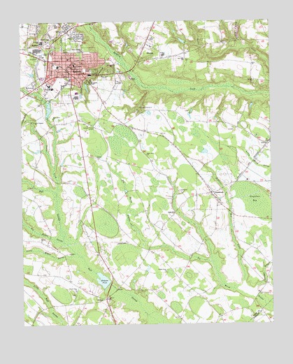
Raeford, NC USGS Topographic Map
Click on map above to begin viewing in our Map Viewer.

This topographic map contains these locations and features:
Feature Name Type Latitude Longitude GNIS ID View Map
AntiochPopulated PlaceN34.8857°W79.2084°1018832View Map
Antioch ChurchChurchN34.8857°W79.2075°980216View Map
Antioch Volunteer Fire DepartmentBuildingN34.8800°W79.2054°2639307View Map
ArabiaPopulated PlaceN34.9502°W79.1256°980266View Map
Big Middle SwampStreamN34.9091°W79.2284°981426View Map
Black BranchStreamN34.9893°W79.1378°981514View Map
Bridges Grove ChurchChurchN34.8968°W79.1784°981878View Map
Center Grove ChurchChurchN34.8893°W79.2231°982933View Map
City of RaefordCivilN34.9808°W79.2287°2404587View Map
DundarrachPopulated PlaceN34.9293°W79.1550°984428View Map
Dundarrach Census Designated PlaceCensusN34.9247°W79.1575°2402416View Map
Edenborough CenterLocaleN34.9766°W79.2250°1007370View Map
Gibson FarmsLocaleN34.8886°W79.2150°2647171View Map
Gold HillPopulated PlaceN34.9213°W79.1731°1020464View Map
Highland Biblical GardensCemeteryN34.9574°W79.2124°986770View Map
HillcrestPopulated PlaceN34.9871°W79.1892°1020776View Map
Hillcrest Fire DepartmentBuildingN34.9931°W79.1861°2638126View Map
Hodgins PondReservoirN34.8935°W79.2097°986872View Map
Hodgins Pond DamDamN34.8924°W79.2064°998186View Map
Hoke County High SchoolSchoolN34.9730°W79.2343°1006657View Map
Hoke County Rescue SquadBuildingN34.9797°W79.2185°2720586View Map
Hoke County Sheriff's OfficeBuildingN34.9791°W79.2171°2769779View Map
J W McLauchlin Elementary SchoolSchoolN34.9821°W79.2228°989607View Map
J W Turlington Middle - High SchoolSchoolN34.9849°W79.2260°1006656View Map
Juniper BranchStreamN34.8904°W79.1323°987838View Map
Lake McNeillReservoirN34.8888°W79.1367°989640View Map
Leach Spring ChurchChurchN34.9646°W79.1889°988246View Map
McLaughlin ChapelChurchN34.9752°W79.2148°989606View Map
McNeill Lake DamDamN34.8868°W79.1314°998180View Map
McNeills Mill CreekStreamN34.8924°W79.1392°989641View Map
Millside ChurchChurchN34.9099°W79.2403°990030View Map
Mount Calvary ChurchChurchN34.9957°W79.2411°990329View Map
North Carolina State Highway Patrol Troop H District 6 Substation Hoke CountyBuildingN34.9837°W79.2331°2769676View Map
North Raeford Fire DepartmentBuildingN34.9902°W79.2457°2638105View Map
Peddlers BranchStreamN34.9827°W79.1975°992000View Map
Philippi ChurchChurchN34.9754°W79.1328°992137View Map
Piney Grove ChurchChurchN34.9604°W79.2336°992339View Map
RaefordPopulated PlaceN34.9810°W79.2242°1022137View Map
Raeford Fire DepartmentBuildingN34.9847°W79.2184°2638242View Map
Raeford Police DepartmentBuildingN34.9813°W79.2244°2769752View Map
Raeford Post OfficePost OfficeN34.9802°W79.2256°2768298View Map
Raeford Road Shopping CenterLocaleN34.9782°W79.2150°1007369View Map
Robbin Heights ChurchChurchN34.9882°W79.2189°993440View Map
Rock Hill ChurchChurchN34.9843°W79.1678°993508View Map
Rockfish Grove ChurchChurchN34.9929°W79.2348°993537View Map
Saint Elizabeths ChurchChurchN34.9735°W79.2423°993885View Map
SaundersPopulated PlaceN34.9904°W79.2398°1022512View Map
Scurlock SchoolSchoolN34.9863°W79.1784°994450View Map
Shady Grove ChurchChurchN34.9452°W79.1873°994542View Map
Silver CityPopulated PlaceN34.9960°W79.2261°1022633View Map
Silver City Census Designated PlaceCensusN34.9972°W79.2291°2402853View Map
Singletons BaySwampN34.9263°W79.1331°994867View Map
South Freedom ChurchChurchN34.9591°W79.2428°995163View Map
Stonewall Volunteer Fire DepartmentBuildingN34.9258°W79.1511°2639390View Map
Toneys CreekStreamN34.9299°W79.2325°996153View Map
Township of AntiochCivilN34.8879°W79.2082°1026801View Map
Township of RaefordCivilN35.0000°W79.2294°1026805View Map
Township of StonewallCivilN34.9345°W79.1338°1026806View Map
Upchurch Elementary SchoolSchoolN34.9917°W79.2392°996542View Map
Williamson PondReservoirN34.9641°W79.2359°998235View Map
Williamson Pond DamDamN34.9618°W79.2364°998236View Map
WSHB-AM (Raeford)TowerN34.9788°W79.2086°1018385View Map

Note: Coordinates in the location and feature list above are referenced to NAD83 datum.


Copyright (C) 2008-2024 Ryan Niemi / Sunset Dynamics ... All Rights Reserved