TopoQuest Logo
Do you find TopoQuest useful?
Help keep TopoQuest running and adding new maps/features by donating!
Bitcoin:  19c7KJd3qBynnjoSw5npx9KScwjBe4ifkT
Litecoin:  LXs6TkuXGGXo1vDsWCkWVdjQX94eUKd6ui
Home View Maps Find Maps Find Places Resources & Links


Big Creek, West Virginia Topographic Map

USGS Map Title: Big Creek, WV
USGS Map MRC: 38082A1
DRG (GeoTIFF) Download: o38082a1.tif


Neighboring USGS Topographic Map Quads:


  Branchland, WV  
38082B2
 

  Hager, WV  
38082B1
 

  Griffithsville, WV  
38081B8
 

  Ranger, WV  
38082A2
 

  Big Creek, WV  
38082A1
 

  Mud, WV  
38081A8
 

  Trace, WV  
37082H2
 

  Chapmanville, WV  
37082H1
 

  Henlawson, WV  
37081H8


Map MRC Location:

N39°
W83°
N39°
W82°
H8 H7 H6 H5 H4 H3 H2 H1
G8 G7 G6 G5 G4 G3 G2 G1
F8 F7 F6 F5 F4 F3 F2 F1
E8 E7 E6 E5 E4 E3 E2 E1
D8 D7 D6 D5 D4 D3 D2 D1
C8 C7 C6 C5 C4 C3 C2 C1
B8 B7 B6 B5 B4 B3 B2 B1
A8 A7 A6 A5 A4 A3 A2 A1
N38°
W83°
N38°
W82°

Big Creek, WV USGS 1:24K Topographic Map Preview:
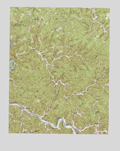
Big Creek, WV USGS Topographic Map
Click on map above to begin viewing in our Map Viewer.

This topographic map contains these locations and features:
Feature Name Type Latitude Longitude GNIS ID View Map
Abbott BranchStreamN38.0107°W82.0751°1534787View Map
Abbott ForkStreamN38.0498°W82.0665°1550071View Map
Adkins CemeteryCemeteryN38.0276°W82.1176°1534819View Map
Adkins CemeteryCemeteryN38.0768°W82.0743°1534822View Map
Allen (historical)Populated PlaceN38.1226°W82.0754°1741586View Map
Arnold CemeteryCemeteryN38.1198°W82.1154°1535019View Map
BaberPopulated PlaceN38.0084°W82.0457°1535094View Map
Back ForkStreamN38.0776°W82.0540°1535100View Map
BancoPopulated PlaceN38.0026°W82.0085°1553794View Map
Barker CemeteryCemeteryN38.1073°W82.0076°1535223View Map
Barker HollowValleyN38.1218°W82.0465°1535232View Map
Bear Branch CemeteryCemeteryN38.1243°W82.0218°1535350View Map
Bee BranchStreamN38.1145°W82.0204°1535478View Map
Bell CemeteryCemeteryN38.0187°W82.0396°1535599View Map
Bias CemeteryCemeteryN38.0318°W82.0168°1535755View Map
Big BranchStreamN38.0795°W82.0865°1535793View Map
Big CreekStreamN38.0032°W82.0412°1535822View Map
Big CreekPopulated PlaceN38.0043°W82.0401°1553892View Map
Big Creek Census Designated PlaceCensusN38.0054°W82.0361°2586764View Map
Big Creek Post OfficePost OfficeN38.0038°W82.0405°1742484View Map
Big Fork Sand CreekStreamN38.0512°W82.1196°1535840View Map
Big Ugly Wildlife Management AreaParkN38.0834°W82.0326°1741593View Map
Bill Frye BranchStreamN38.0998°W82.0549°1535995View Map
Bishop CemeteryCemeteryN38.0809°W82.0865°1536042View Map
Bobby CreekStreamN38.0834°W82.0932°1536181View Map
Broad BranchStreamN38.0432°W82.0279°1536359View Map
Broad Branch School (historical)SchoolN38.0343°W82.0146°1536360View Map
Brumfield BranchStreamN38.0598°W82.0743°1536455View Map
Buck ForkStreamN38.0470°W82.1176°1536552View Map
Burrel HollowValleyN38.1132°W82.0501°1536772View Map
Canoe ForkStreamN38.0040°W82.0746°1537006View Map
Canoe Tree ForkStreamN38.0254°W82.0740°1537013View Map
Charley Trace ForkStreamN38.0807°W82.0415°1537219View Map
Chestnut Oak CreekStreamN38.0737°W82.0199°1537289View Map
Coal HollowValleyN38.0601°W82.0015°1537454View Map
DaisyPopulated PlaceN38.0087°W82.0537°1554251View Map
DeHaven CemeteryCemeteryN38.0695°W82.0835°1538083View Map
Dial BranchStreamN38.0065°W82.0646°1538165View Map
Doss ForkStreamN38.0776°W82.0346°1538279View Map
Dotson BranchStreamN38.1068°W82.0090°1538281View Map
Drum GapGapN38.0365°W82.0926°1538327View Map
Durg Frye HollowValleyN38.0740°W82.0685°1538453View Map
Duty CemeteryCemeteryN38.0270°W82.0174°1538475View Map
Duty CemeteryCemeteryN38.0301°W82.0035°1538476View Map
Ed Stone BranchStreamN38.0079°W82.0154°1538543View Map
Elias ForkStreamN38.0420°W82.1157°1538596View Map
Elkins CemeteryCemeteryN38.1140°W82.0576°1538653View Map
Ferrell CemeteryCemeteryN38.0354°W82.0521°1538931View Map
FerrellsburgPopulated PlaceN38.0251°W82.1054°1538940View Map
Ferrellsburg CemeteryCemeteryN38.0259°W82.1057°2586332View Map
Ferrellsburg Elementary School (historical)SchoolN38.0231°W82.1032°1741617View Map
FryPopulated PlaceN38.0151°W82.0832°1554517View Map
Frye CemeteryCemeteryN38.0401°W82.0440°1539289View Map
Frye CemeteryCemeteryN38.0751°W82.0607°1539291View Map
GillPopulated PlaceN38.0879°W82.1212°1549701View Map
Gordons BranchStreamN38.0690°W82.0724°1539534View Map
Green Shoals BranchStreamN38.0145°W82.0840°1539683View Map
Green Shoals ChurchChurchN38.0176°W82.0804°1539684View Map
Green Shoals MountainSummitN38.0457°W82.0610°1539685View Map
Hager CemeteryCemeteryN38.1190°W82.0982°1539832View Map
Hamilton Creek School (historical)SchoolN38.1076°W82.1143°1539877View Map
Harts Creek District (historical)CivilN38.0375°W82.1126°1928289View Map
Hunter CemeteryCemeteryN38.0373°W82.0160°1540598View Map
Hurricane HollowValleyN38.0576°W82.0074°1540630View Map
Justice CemeteryCemeteryN38.0018°W82.0093°1541050View Map
King Rough HollowStreamN38.0854°W82.0493°1541212View Map
Lambert CemeteryCemeteryN38.0107°W82.0768°1541328View Map
Lambert HollowValleyN38.1126°W82.0526°1541331View Map
Laurel CreekStreamN38.0695°W82.0765°1541418View Map
Laurelly BranchStreamN38.0862°W82.0518°1541550View Map
LeetPopulated PlaceN38.0687°W82.0760°1549780View Map
Leet School (historical)SchoolN38.0770°W82.0835°1541613View Map
Left Fork Broad BranchStreamN38.0329°W82.0146°1541637View Map
Lefthand CreekStreamN38.0490°W82.0168°1541759View Map
Lefthand School (historical)SchoolN38.0504°W82.0174°1541772View Map
Lick BranchStreamN38.0759°W82.0507°1541850View Map
Lick HollowValleyN38.0540°W82.0121°1541902View Map
Limestone BranchStreamN38.0068°W82.0449°1541972View Map
Limestone School (historical)SchoolN38.0201°W82.0401°1541982View Map
Little Sulphur CreekStreamN38.0526°W82.0610°1542233View Map
Little Sulphur CreekStreamN38.0484°W82.0010°1542234View Map
Little Ugly CreekStreamN38.0879°W82.1229°1542249View Map
Long ForkStreamN38.0270°W82.0176°1542370View Map
Lucas CemeteryCemeteryN38.0209°W82.0785°1542603View Map
Lucas CemeteryCemeteryN38.0598°W82.1162°1542604View Map
Lucas School (historical)SchoolN38.0504°W82.0660°1542608View Map
Marsh ForkStreamN38.0007°W82.0985°1542787View Map
May CemeteryCemeteryN38.0201°W82.0415°1542892View Map
Middle HollowValleyN38.0534°W82.0168°1543200View Map
Mile BranchStreamN38.0679°W82.1187°1543267View Map
Mobley CemeteryCemeteryN38.0043°W82.0382°1543475View Map
Mudlick ForkStreamN38.0607°W82.0060°1543949View Map
Mudlick HollowValleyN38.0909°W82.0587°1543952View Map
North Branch Ed Stone BranchStreamN38.0109°W82.0115°1544199View Map
North Fork Big CreekStreamN38.0012°W82.0082°1544202View Map
Offard HollowValleyN38.0023°W82.1068°1544330View Map
Orchard HollowValleyN38.0065°W82.0246°1544438View Map
Pea RidgeRidgeN38.1134°W82.0640°1544663View Map
Pea Ridge CemeteryCemeteryN38.1129°W82.0660°1544666View Map
Pea Ridge School (historical)SchoolN38.1184°W82.0640°1544667View Map
Pigeonroost CreekStreamN38.0776°W82.1157°1544825View Map
Pigeonroost ForkStreamN38.0629°W82.0057°1544831View Map
Piney ForkStreamN38.0037°W82.1057°1544922View Map
Pot ForkStreamN38.1007°W82.0229°1545179View Map
Pratt BranchStreamN38.0748°W82.0329°1545230View Map
Rakes CemeteryCemeteryN38.0623°W82.0957°1545387View Map
Right Fork Laurel CreekStreamN38.0737°W82.0193°1741670View Map
Road BranchStreamN38.0362°W82.0529°1545793View Map
Rockhouse BranchStreamN38.0532°W82.0696°1545970View Map
Rockpen BranchStreamN38.0393°W82.0454°1545996View Map
Rocky GapGapN38.0420°W82.0907°1546023View Map
Rocky GapGapN38.0623°W82.0465°1546024View Map
Sally ForkStreamN38.0987°W82.0221°1546298View Map
Sand CreekLocaleN38.0634°W82.1240°1546342View Map
Sand CreekStreamN38.0609°W82.1249°1546343View Map
Sand Creek School (historical)SchoolN38.0526°W82.1204°1546344View Map
Sandlick HollowValleyN38.1015°W82.0029°1546396View Map
Sandy GapGapN38.0640°W82.0315°1546407View Map
Schoolhouse HollowValleyN38.1009°W82.0062°1546497View Map
Short Bend BranchStreamN38.0465°W82.0068°1546715View Map
Shuff HollowValleyN38.0290°W82.0190°1546755View Map
Slab CreekStreamN38.1132°W82.0193°1546883View Map
Spears (historical)Populated PlaceN38.1223°W82.1157°1741679View Map
Spears CemeteryCemeteryN38.1126°W82.0829°1547115View Map
Spears ForkStreamN38.0198°W82.0782°1547117View Map
Sperry HollowValleyN38.0873°W82.0774°1547132View Map
Spring BranchStreamN38.0095°W82.1087°1547167View Map
Squirrel BranchStreamN38.0073°W82.0282°1547297View Map
Steve BranchStreamN38.1184°W82.0196°1547394View Map
Stone Branch ChurchChurchN38.0101°W82.0126°1547446View Map
Stowers CemeteryCemeteryN38.0120°W82.0432°1547541View Map
Sulphur CreekStreamN38.0490°W82.0540°1547711View Map
Sulphur Springs ForkStreamN38.0629°W82.0057°1547722View Map
Tantrough BranchStreamN38.0140°W82.0574°1547899View Map
Thomas CemeteryCemeteryN38.0040°W82.0046°1548021View Map
Thomas HollowValleyN38.0090°W82.0221°1548030View Map
Thompson CemeteryCemeteryN38.1168°W82.0060°1548042View Map
ToneyPopulated PlaceN38.0109°W82.0729°1549955View Map
Toney CemeteryCemeteryN38.0429°W82.0310°1548153View Map
Toney School (historical)SchoolN38.0420°W82.0432°1548164View Map
Tramrod HollowValleyN38.1065°W82.0246°1548252View Map
Tucker ForkStreamN38.0490°W82.0526°1548300View Map
Turtlelick HollowValleyN38.1093°W82.0099°1548388View Map
Union GapGapN38.1134°W82.0915°1548481View Map
Union Gap School (historical)SchoolN38.1132°W82.0912°1548482View Map
Varnie CemeteryCemeteryN38.0045°W82.0032°1548635View Map
Walker BranchStreamN38.0237°W82.1068°1548713View Map
Walker CemeteryCemeteryN38.0143°W82.1093°1548716View Map
Walker School (historical)SchoolN38.0157°W82.1079°1548730View Map
Whetstone GapGapN38.0648°W82.0168°1549005View Map
Workman ForkStreamN38.0007°W82.0985°1549417View Map
Workman Fork ChurchChurchN38.0004°W82.0974°1549418View Map

Note: Coordinates in the location and feature list above are referenced to NAD83 datum.


Copyright (C) 2008-2024 Ryan Niemi / Sunset Dynamics ... All Rights Reserved