TopoQuest Logo
Do you find TopoQuest useful?
Help keep TopoQuest running and adding new maps/features by donating!
Bitcoin:  19c7KJd3qBynnjoSw5npx9KScwjBe4ifkT
Litecoin:  LXs6TkuXGGXo1vDsWCkWVdjQX94eUKd6ui
Home View Maps Find Maps Find Places Resources & Links


Quality, Kentucky Topographic Map

USGS Map Title: Quality, KY
USGS Map MRC: 37086A7
DRG (GeoTIFF) Download: o37086a7.tif


Neighboring USGS Topographic Map Quads:


  Rochester, KY  
37086B8
 

  South Hill, KY  
37086B7
 

  Morgantown, KY  
37086B6
 

  Dunmor, KY  
37086A8
 

  Quality, KY  
37086A7
 

  Sugar Grove, KY  
37086A6
 

  Lewisburg, KY  
36086H8
 

  Homer, KY  
36086H7
 

  South Union, KY  
36086H6


Map MRC Location:

N38°
W87°
N38°
W86°
H8 H7 H6 H5 H4 H3 H2 H1
G8 G7 G6 G5 G4 G3 G2 G1
F8 F7 F6 F5 F4 F3 F2 F1
E8 E7 E6 E5 E4 E3 E2 E1
D8 D7 D6 D5 D4 D3 D2 D1
C8 C7 C6 C5 C4 C3 C2 C1
B8 B7 B6 B5 B4 B3 B2 B1
A8 A7 A6 A5 A4 A3 A2 A1
N37°
W87°
N37°
W86°

Quality, KY USGS 1:24K Topographic Map Preview:
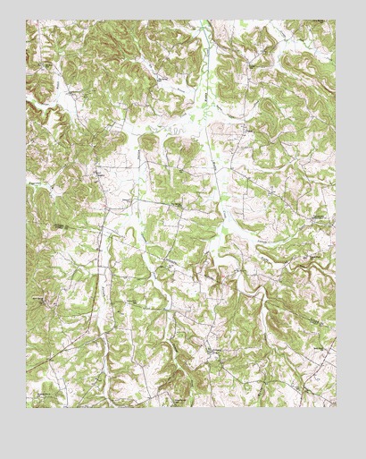
Quality, KY USGS Topographic Map
Click on map above to begin viewing in our Map Viewer.

This topographic map contains these locations and features:
Feature Name Type Latitude Longitude GNIS ID View Map
Alum Spring SchoolSchoolN37.1248°W86.7544°485914View Map
AndersonPopulated PlaceN37.0181°W86.7997°507397View Map
Bald Knob ChurchChurchN37.0187°W86.7542°486276View Map
Big BranchStreamN37.1084°W86.8039°487131View Map
Big Spring SchoolSchoolN37.1053°W86.8217°487271View Map
BostonPopulated PlaceN37.0887°W86.7869°507558View Map
Boston Lick CreekStreamN37.1025°W86.8014°487715View Map
Brushy ForkStreamN37.0537°W86.7836°488134View Map
Caney Fork SchoolSchoolN37.0484°W86.7608°488871View Map
Concord ChurchChurchN37.0664°W86.8331°489928View Map
Dallam CreekStreamN37.0978°W86.8019°490540View Map
Davis LakeReservoirN37.0357°W86.8438°2743071View Map
Duncan CemeteryCemeteryN37.0453°W86.8180°491293View Map
Duncan CreekStreamN37.0667°W86.8297°491302View Map
Flat Rock BranchStreamN37.0587°W86.7958°485683View Map
Gupton Grove (historical)Populated PlaceN37.0376°W86.8051°2743077View Map
Hickory Grove ChurchChurchN37.0037°W86.8703°494128View Map
Lees BridgeBridgeN37.0442°W86.7883°496180View Map
Mount Zion (historical)Populated PlaceN37.1106°W86.8681°2742343View Map
Mount Zion SchoolSchoolN37.1100°W86.8678°498956View Map
Pauline (historical)Populated PlaceN37.0110°W86.7580°2743090View Map
QualityPopulated PlaceN37.0756°W86.8467°508888View Map
Sand Spring ChurchChurchN37.0342°W86.8681°502941View Map
Smith CemeteryCemeteryN37.0056°W86.7650°503751View Map
Townsville (historical)Populated PlaceN37.1173°W86.7982°2742354View Map
Toy Spring (historical)Populated PlaceN37.0647°W86.8120°2742355View Map
Toy Spring SchoolSchoolN37.0650°W86.8125°505404View Map
TurnertownPopulated PlaceN37.0603°W86.7600°509250View Map
Union Grove SchoolSchoolN37.0017°W86.8153°505800View Map
Union SchoolSchoolN37.1103°W86.7847°505816View Map
Union Zion SchoolSchoolN37.0339°W86.8303°505826View Map

Note: Coordinates in the location and feature list above are referenced to NAD83 datum.


Copyright (C) 2008-2024 Ryan Niemi / Sunset Dynamics ... All Rights Reserved