TopoQuest Logo
Do you find TopoQuest useful?
Help keep TopoQuest running and adding new maps/features by donating!
Bitcoin:  19c7KJd3qBynnjoSw5npx9KScwjBe4ifkT
Litecoin:  LXs6TkuXGGXo1vDsWCkWVdjQX94eUKd6ui
Home View Maps Find Maps Find Places Resources & Links


Pyramid Hills, California Topographic Map

USGS Map Title: Pyramid Hills, CA
USGS Map MRC: 35120G1
DRG (GeoTIFF) Download: o35120g1.tif


Neighboring USGS Topographic Map Quads:


  Garza Peak, CA  
35120H2
 

  Kettleman Plain, CA  
35120H1
 

  Los Viejos, CA  
35119H8
 

  Tent Hills, CA  
35120G2
 

  Pyramid Hills, CA  
35120G1
 

  Avenal Gap, CA  
35119G8
 

  Orchard Peak, CA  
35120F2
 

  Sawtooth Ridge, CA  
35120F1
 

  Emigrant Hill, CA  
35119F8


Map MRC Location:

N36°
W121°
N36°
W120°
H8 H7 H6 H5 H4 H3 H2 H1
G8 G7 G6 G5 G4 G3 G2 G1
F8 F7 F6 F5 F4 F3 F2 F1
E8 E7 E6 E5 E4 E3 E2 E1
D8 D7 D6 D5 D4 D3 D2 D1
C8 C7 C6 C5 C4 C3 C2 C1
B8 B7 B6 B5 B4 B3 B2 B1
A8 A7 A6 A5 A4 A3 A2 A1
N35°
W121°
N35°
W120°

Pyramid Hills, CA USGS 1:24K Topographic Map Preview:
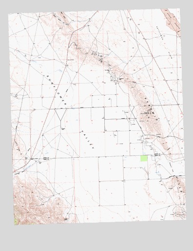
Pyramid Hills, CA USGS Topographic Map
Click on map above to begin viewing in our Map Viewer.

This topographic map contains these locations and features:
Feature Name Type Latitude Longitude GNIS ID View Map
Arroyo MenudoStreamN35.8733°W120.0001°255292View Map
Avenal CreekStreamN35.7750°W120.0746°255340View Map
Cottonwood CanyonValleyN35.7825°W120.1151°240977View Map
Cottonwood CanyonValleyN35.7833°W120.1135°1986687View Map
Cottonwood CreekStreamN35.8075°W120.0818°240981View Map
Cottonwood Pumping StationLocaleN35.7772°W120.0915°1654604View Map
Dagany GapGapN35.7816°W120.0090°253999View Map
Deadman GapGapN35.8347°W120.0468°241323View Map
Devil DenAreaN35.7541°W120.0801°1682777View Map
Devils Den Oil FieldOilfieldN35.7539°W120.0035°277372View Map
Dudley Pump Station (historical)LocaleN35.8277°W120.0212°1682780View Map
Indian RocksSummitN35.7522°W120.0907°1660794View Map
Orchard RanchLocaleN35.8061°W120.0893°246948View Map
Pyramid HillsRangeN35.8166°W120.0260°252280View Map
Pyramid Hills Microwave Relay StationTowerN35.8133°W120.0251°1654775View Map
Sulphur Spring CanyonValleyN35.8691°W120.0654°250062View Map
Sunflower ValleyBasinN35.8058°W120.0743°254316View Map

Note: Coordinates in the location and feature list above are referenced to NAD83 datum.


Copyright (C) 2008-2024 Ryan Niemi / Sunset Dynamics ... All Rights Reserved