TopoQuest Logo
Do you find TopoQuest useful?
Help keep TopoQuest running and adding new maps/features by donating!
Bitcoin:  19c7KJd3qBynnjoSw5npx9KScwjBe4ifkT
Litecoin:  LXs6TkuXGGXo1vDsWCkWVdjQX94eUKd6ui
Home View Maps Find Maps Find Places Resources & Links


Pueblo Nuevo, Texas Topographic Map

USGS Map Title: Pueblo Nuevo, TX
USGS Map MRC: 30104A6
DRG (GeoTIFF) Download: o30104a6.tif


Neighboring USGS Topographic Map Quads:


  Candelaria, TX  
30104B6
 

  Capote Falls, TX  
30104B5


  Pueblo Nuevo, TX  
30104A6
 

  Ruidosa Hot Springs, TX  
30104A5


  Las Conchas, TX  
29104H6
 

  Sierra Parda, TX  
29104H5


Map MRC Location:

N31°
W105°
N31°
W104°
H8 H7 H6 H5 H4 H3 H2 H1
G8 G7 G6 G5 G4 G3 G2 G1
F8 F7 F6 F5 F4 F3 F2 F1
E8 E7 E6 E5 E4 E3 E2 E1
D8 D7 D6 D5 D4 D3 D2 D1
C8 C7 C6 C5 C4 C3 C2 C1
B8 B7 B6 B5 B4 B3 B2 B1
A8 A7 A6 A5 A4 A3 A2 A1
N30°
W105°
N30°
W104°

Pueblo Nuevo, TX USGS 1:24K Topographic Map Preview:
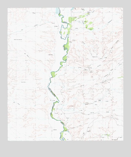
Pueblo Nuevo, TX USGS Topographic Map
Click on map above to begin viewing in our Map Viewer.

This topographic map contains these locations and features:
Feature Name Type Latitude Longitude GNIS ID View Map
Arroyo ChupaderosValleyN30.0994°W104.6847°1372334View Map
Arroyo Palo BlancoValleyN30.1101°W104.6853°1329746View Map
Arroyo PanalesValleyN30.0675°W104.6873°1329748View Map
Arroyo Tinaja BlancaValleyN30.0559°W104.6497°1329763View Map
Chupadera PilaSpringN30.0787°W104.6535°1332817View Map
El Muerto ArroyoValleyN30.0935°W104.6849°1329759View Map
Hot Springs AirportAirportN30.0073°W104.6657°1387435View Map
Hot Springs CreekStreamN30.0302°W104.7019°1338148View Map
La CienegaSwampN30.0057°W104.6444°1339296View Map
La CienegaStreamN30.1124°W104.6760°1339297View Map
Las LulasPopulated PlaceN30.0260°W104.6958°1378563View Map
Las Palomas Wildlife Management Area - Ocotillo UnitParkN30.0121°W104.6810°2028972View Map
Naegele CreekStreamN30.0363°W104.6980°1342355View Map
Naegele SpringsSpringN30.0382°W104.6490°1342356View Map
Prietos BarLocaleN30.0774°W104.6871°1376922View Map
Pueblo NuevoPopulated PlaceN30.1218°W104.6608°1378914View Map
Ranchita SpringSpringN30.1228°W104.6675°1344753View Map
Sanguijuela ArroyoValleyN30.0513°W104.7058°1346613View Map
Tijeras SpringSpringN30.0010°W104.6335°1348563View Map

Note: Coordinates in the location and feature list above are referenced to NAD83 datum.


Copyright (C) 2008-2024 Ryan Niemi / Sunset Dynamics ... All Rights Reserved