TopoQuest Logo
Do you find TopoQuest useful?
Help keep TopoQuest running and adding new maps/features by donating!
Bitcoin:  19c7KJd3qBynnjoSw5npx9KScwjBe4ifkT
Litecoin:  LXs6TkuXGGXo1vDsWCkWVdjQX94eUKd6ui
Home View Maps Find Maps Find Places Resources & Links


Prosperity, Pennsylvania Topographic Map

USGS Map Title: Prosperity, PA
USGS Map MRC: 40080A3
DRG (GeoTIFF) Download: o40080a3.tif


Neighboring USGS Topographic Map Quads:


  West Middletown, PA  
40080B4
 

  Washington West, PA  
40080B3
 

  Washington East, PA  
40080B2
 

  Claysville, PA  
40080A4
 

  Prosperity, PA  
40080A3
 

  Amity, PA  
40080A2
 

  Wind Ridge, PA  
39080H4
 

  Rogersville, PA  
39080H3
 

  Waynesburg, PA  
39080H2


Map MRC Location:

N41°
W81°
N41°
W80°
H8 H7 H6 H5 H4 H3 H2 H1
G8 G7 G6 G5 G4 G3 G2 G1
F8 F7 F6 F5 F4 F3 F2 F1
E8 E7 E6 E5 E4 E3 E2 E1
D8 D7 D6 D5 D4 D3 D2 D1
C8 C7 C6 C5 C4 C3 C2 C1
B8 B7 B6 B5 B4 B3 B2 B1
A8 A7 A6 A5 A4 A3 A2 A1
N40°
W81°
N40°
W80°

Prosperity, PA USGS 1:24K Topographic Map Preview:
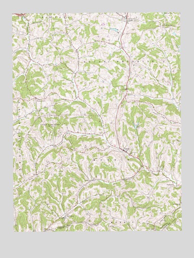
Prosperity, PA USGS Topographic Map
Click on map above to begin viewing in our Map Viewer.

This topographic map contains these locations and features:
Feature Name Type Latitude Longitude GNIS ID View Map
Bells LakesReservoirN40.0601°W80.2838°1169184View Map
Bethel ChurchChurchN40.0812°W80.2901°1169376View Map
Borough of Green HillsCivilN40.1153°W80.3049°1215668View Map
Camp AdelawanLocaleN40.1192°W80.3587°1170967View Map
Carroll CemeteryCemeteryN40.0337°W80.3565°1171262View Map
Crafts CreekStreamN40.0534°W80.3076°1172592View Map
Day Covered BridgeBridgeN40.0294°W80.2928°2740710View Map
Elliott CemeteryCemeteryN40.0523°W80.3487°1174150View Map
Enlow Fork MineMineN40.0803°W80.3561°2724919View Map
Fairview CemeteryCemeteryN40.0528°W80.3703°1174475View Map
GalePopulated PlaceN40.0326°W80.3570°1175384View Map
Green HillsPopulated PlaceN40.1137°W80.2998°1217432View Map
Hamestring RunStreamN40.0167°W80.3256°1176415View Map
Jameson Memorial Hospital HeliportAirportN40.0131°W80.3623°1213724View Map
Joint School (historical)SchoolN40.0342°W80.3553°1206035View Map
LagondaPopulated PlaceN40.1215°W80.2892°1178761View Map
Lick RunStreamN40.0154°W80.3262°1179294View Map
Lindley Schoolhouse (historical)SchoolN40.0579°W80.3326°1206036View Map
Lone Pine Golf CourseLocaleN40.1117°W80.3020°1206037View Map
Morris Township Volunteer Fire Department Station 42BuildingN40.0459°W80.2935°2644940View Map
Mount Zion CemeteryCemeteryN40.0470°W80.3298°1181898View Map
Neal DamDamN40.1134°W80.2931°1194543View Map
Neal LakeReservoirN40.1134°W80.2931°1194544View Map
Old ConcordPopulated PlaceN40.0087°W80.3367°1182907View Map
Pleasant GrovePopulated PlaceN40.0765°W80.3567°1184009View Map
PlumbsockPopulated PlaceN40.0251°W80.2540°1184125View Map
Point LookoutPopulated PlaceN40.1165°W80.2617°1184176View Map
ProsperityPopulated PlaceN40.0470°W80.2948°1184466View Map
Prosperity Post OfficePost OfficeN40.0459°W80.2923°2779747View Map
Sawhill RunStreamN40.1040°W80.3631°1193294View Map
Short CreekStreamN40.0356°W80.2778°1187594View Map
South Buffalo CemeteryCemeteryN40.1233°W80.3660°1188045View Map
South Franklin Township Municipal BuildingBuildingN40.1240°W80.2914°2430775View Map
South Franklin Volunteer Fire Department Station 32BuildingN40.1226°W80.2914°2644734View Map
SpartaPopulated PlaceN40.0287°W80.3187°1204697View Map
Sparta Post Office (historical)Post OfficeN40.0287°W80.3187°1214492View Map
Township of MorrisCivilN40.0378°W80.2930°1217197View Map
Township of South FranklinCivilN40.0997°W80.2913°1217207View Map
Upper Tenmile ChurchChurchN40.0445°W80.2878°1190257View Map
Van BurenPopulated PlaceN40.0773°W80.2906°1190331View Map
Van Buren Post Office (historical)Post OfficeN40.0773°W80.2906°1214499View Map
West UnionPopulated PlaceN40.0026°W80.2706°1193644View Map
Wilson Schoolhouse (historical)SchoolN40.0554°W80.2662°1206034View Map

Note: Coordinates in the location and feature list above are referenced to NAD83 datum.


Copyright (C) 2008-2024 Ryan Niemi / Sunset Dynamics ... All Rights Reserved