TopoQuest Logo
Do you find TopoQuest useful?
Help keep TopoQuest running and adding new maps/features by donating!
Bitcoin:  19c7KJd3qBynnjoSw5npx9KScwjBe4ifkT
Litecoin:  LXs6TkuXGGXo1vDsWCkWVdjQX94eUKd6ui
Home View Maps Find Maps Find Places Resources & Links


Prospect South, Oregon Topographic Map

USGS Map Title: Prospect South, OR
USGS Map MRC: 42122F4
DRG (GeoTIFF) Download: o42122f4.tif


Neighboring USGS Topographic Map Quads:


  Whetstone Point, OR  
42122G5
 

  Prospect North, OR  
42122G4
 

  Red Blanket Mountain, OR  
42122G3
 

  Cascade Gorge, OR  
42122F5
 

  Prospect South, OR  
42122F4
 

  Imnaha Creek, OR  
42122F3
 

  Butte Falls, OR  
42122E5
 

  Big Butte Springs, OR  
42122E4
 

  Rustler Peak, OR  
42122E3


Map MRC Location:

N43°
W123°
N43°
W122°
H8 H7 H6 H5 H4 H3 H2 H1
G8 G7 G6 G5 G4 G3 G2 G1
F8 F7 F6 F5 F4 F3 F2 F1
E8 E7 E6 E5 E4 E3 E2 E1
D8 D7 D6 D5 D4 D3 D2 D1
C8 C7 C6 C5 C4 C3 C2 C1
B8 B7 B6 B5 B4 B3 B2 B1
A8 A7 A6 A5 A4 A3 A2 A1
N42°
W123°
N42°
W122°

Prospect South, OR USGS 1:24K Topographic Map Preview:
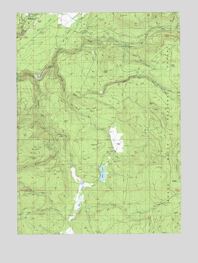
Prospect South, OR USGS Topographic Map
Click on map above to begin viewing in our Map Viewer.

This topographic map contains these locations and features:
Feature Name Type Latitude Longitude GNIS ID View Map
Aiken County ParkParkN42.7326°W122.4367°1987707View Map
Ash CreekStreamN42.7137°W122.4998°1155031View Map
Barr CreekStreamN42.7382°W122.4961°1137539View Map
Barr Creek FallsFallsN42.7462°W122.4956°1157109View Map
Beaver Dam CreekStreamN42.7121°W122.4850°1137830View Map
Bessie CreekStreamN42.7407°W122.3781°1137955View Map
Blue Goose SpringSpringN42.6681°W122.4871°1138300View Map
Boundary ButteSummitN42.6980°W122.4000°1138498View Map
Buck CreekStreamN42.7004°W122.4623°1138752View Map
Butte Falls-Prospect DivisionCivilN42.6678°W122.4789°1937972View Map
Carney FlatFlatN42.6718°W122.4448°1139384View Map
Cod CreekStreamN42.7471°W122.4886°1155074View Map
Conley SpringSpringN42.7162°W122.4345°1140040View Map
Copco PowerhouseLocaleN42.7315°W122.4123°1163696View Map
Crane CreekStreamN42.6537°W122.4500°1140368View Map
Cur CreekStreamN42.6346°W122.4150°1140559View Map
Dailey DamDamN42.6549°W122.4361°1153929View Map
Daniel CreekStreamN42.7318°W122.4175°1140615View Map
Daniel SpringSpringN42.7188°W122.3833°1140616View Map
Dead Dog GulchValleyN42.6390°W122.4000°1140684View Map
Elk GladeFlatN42.6604°W122.4536°1141774View Map
Geppert CreekStreamN42.6749°W122.4275°1159023View Map
Gyppo CreekStreamN42.7396°W122.3792°1143176View Map
Imnaha CreekStreamN42.7062°W122.3889°1144003View Map
Lodgepole Guard StationLocaleN42.6537°W122.3781°1145322View Map
Medco PondLakeN42.6589°W122.4358°1158366View Map
Middle Fork Parsnip CreekStreamN42.6351°W122.3845°1146155View Map
Middle Fork Rogue RiverStreamN42.7199°W122.4728°1146159View Map
Mill CreekStreamN42.7401°W122.4953°1146235View Map
Mill Creek FallsFallsN42.7403°W122.4952°1155397View Map
Mill-Mar RanchLocaleN42.6762°W122.4223°1146257View Map
Oakridge School (historical)SchoolN42.7471°W122.4650°1162154View Map
Parsnip CreekStreamN42.6421°W122.4531°1147469View Map
Prospect PowerhouseLocaleN42.7310°W122.4184°1167426View Map
Prospect State AirportAirportN42.7448°W122.4864°1154036View Map
Prospect State ParkParkN42.7479°W122.4928°1157108View Map
Red Blanket CreekStreamN42.7276°W122.4678°1148272View Map
Reinecke BurnAreaN42.6715°W122.4920°1148372View Map
Round Mountain CreekStreamN42.6810°W122.4709°1148790View Map
South Fork DamDamN42.7062°W122.3878°1149961View Map
South Fork Parsnip CreekStreamN42.6351°W122.3842°1149999View Map
South Fork Vine Maple CreekStreamN42.6385°W122.4725°1150037View Map
Svinth CreekStreamN42.7399°W122.3934°1150718View Map
Twentynine CreekStreamN42.7401°W122.3825°1151550View Map
Vine Maple CreekStreamN42.6390°W122.4545°1151774View Map
Zimmerman BurnAreaN42.6821°W122.3914°1152782View Map

Note: Coordinates in the location and feature list above are referenced to NAD83 datum.


Copyright (C) 2008-2024 Ryan Niemi / Sunset Dynamics ... All Rights Reserved