TopoQuest Logo
Do you find TopoQuest useful?
Help keep TopoQuest running and adding new maps/features by donating!
Bitcoin:  19c7KJd3qBynnjoSw5npx9KScwjBe4ifkT
Litecoin:  LXs6TkuXGGXo1vDsWCkWVdjQX94eUKd6ui
Home View Maps Find Maps Find Places Resources & Links


Prospect, Ohio Topographic Map

USGS Map Title: Prospect, OH
USGS Map MRC: 40083D2
DRG (GeoTIFF) Download: o40083d2.tif


Neighboring USGS Topographic Map Quads:


  New Bloomington, OH  
40083E3
 

  Marion West, OH  
40083E2
 

  Marion East, OH  
40083E1
 

  Richwood, OH  
40083D3
 

  Prospect, OH  
40083D2
 

  Waldo, OH  
40083D1
 

  Magnetic Springs, OH  
40083C3
 

  Ostrander, OH  
40083C2
 

  Delaware, OH  
40083C1


Map MRC Location:

N41°
W84°
N41°
W83°
H8 H7 H6 H5 H4 H3 H2 H1
G8 G7 G6 G5 G4 G3 G2 G1
F8 F7 F6 F5 F4 F3 F2 F1
E8 E7 E6 E5 E4 E3 E2 E1
D8 D7 D6 D5 D4 D3 D2 D1
C8 C7 C6 C5 C4 C3 C2 C1
B8 B7 B6 B5 B4 B3 B2 B1
A8 A7 A6 A5 A4 A3 A2 A1
N40°
W84°
N40°
W83°

Prospect, OH USGS 1:24K Topographic Map Preview:
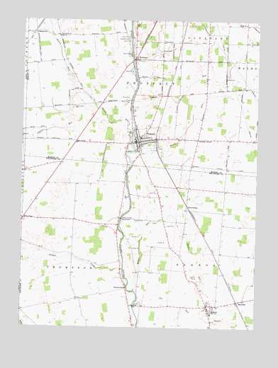
Prospect, OH USGS Topographic Map
Click on map above to begin viewing in our Map Viewer.

This topographic map contains these locations and features:
Feature Name Type Latitude Longitude GNIS ID View Map
Battle RunStreamN40.4464°W83.1899°1037681View Map
Battle Run Fire DepartmentBuildingN40.4484°W83.1866°2550036View Map
Beaver RunStreamN40.4703°W83.2202°1037766View Map
Bethlehem (historical)Populated PlaceN40.4837°W83.1319°1070636View Map
Brown Taylor CemeteryCemeteryN40.4648°W83.2227°1038378View Map
Buckeye Valley Middle SchoolSchoolN40.3809°W83.1488°1050818View Map
CentervillePopulated PlaceN40.4948°W83.2433°1056784View Map
Davids RunStreamN40.4645°W83.1921°1039593View Map
Drumm School (historical)SchoolN40.4334°W83.2360°1050815View Map
Elgin South Elementary SchoolSchoolN40.4523°W83.1869°1049667View Map
Gast CornerPopulated PlaceN40.4501°W83.2216°1062778View Map
Gooding CornersLocaleN40.4514°W83.1569°1040951View Map
Hoskins BridgeBridgeN40.4195°W83.1971°1041812View Map
Kebler RunStreamN40.3898°W83.1894°1066056View Map
Kerr CornerPopulated PlaceN40.4192°W83.2488°1062835View Map
Lavender BridgeBridgeN40.3837°W83.1899°1042443View Map
Markel-Kirts CemeteryCemeteryN40.4997°W83.1984°1960534View Map
MeredithPopulated PlaceN40.3862°W83.1316°1043231View Map
Mooney CemeteryCemeteryN40.4395°W83.2207°1806225View Map
Mount Union Church of the United Brethren in Christ (historical)ChurchN40.4909°W83.1716°1071785View Map
Mounts CemeteryCemeteryN40.4878°W83.1766°1072235View Map
Newman BridgeBridgeN40.4839°W83.1913°1049666View Map
NewmansPopulated PlaceN40.4842°W83.1913°1043866View Map
Norton Post Office (historical)Post OfficeN40.4339°W83.1569°1984028View Map
Ottawa CreekStreamN40.3987°W83.1955°1066128View Map
Ottawa School (historical)SchoolN40.4039°W83.2227°1050816View Map
Otterbein CemeteryCemeteryN40.4922°W83.1942°1044221View Map
Otterbine Church (historical)ChurchN40.4923°W83.1952°1072269View Map
Packer AirportAirportN40.4066°W83.2206°1082977View Map
Patton RunStreamN40.4506°W83.1916°1066135View Map
ProspectPopulated PlaceN40.4503°W83.1885°1061575View Map
Prospect CemeteryCemeteryN40.4531°W83.1916°1044778View Map
Prospect Post OfficePost OfficeN40.4501°W83.1888°2035980View Map
RadnorPopulated PlaceN40.3842°W83.1507°1061581View Map
Radnor CemeteryCemeteryN40.3856°W83.1499°1806234View Map
Radnor Census Designated PlaceCensusN40.3852°W83.1459°2628956View Map
Radnor Post OfficePost OfficeN40.3848°W83.1513°1984018View Map
Radnor Township Volunteer Fire DepartmentBuildingN40.3783°W83.1497°2549714View Map
RobertsburgPopulated PlaceN40.4242°W83.1619°1062983View Map
Schweinfurth CemeteryCemeteryN40.4981°W83.1416°1960544View Map
Shiloh ChurchChurchN40.4934°W83.2316°1046215View Map
Shoup CemeteryCemeteryN40.3917°W83.1944°1806238View Map
Thompson ChapelChurchN40.3912°W83.1941°1058073View Map
Township of ProspectCivilN40.4662°W83.1874°1086583View Map
Township of RadnorCivilN40.3802°W83.1532°1086055View Map
Township of ThompsonCivilN40.3928°W83.2195°1086058View Map
Trinity Evangelical Lutheran ChurchChurchN40.4987°W83.1319°1072262View Map
Utz RunStreamN40.3848°W83.1896°1047390View Map
Village of ProspectCivilN40.4539°W83.1848°2399027View Map
Walls CemeteryCemeteryN40.4766°W83.1421°1047517View Map
Williams School (historical)SchoolN40.3873°W83.2132°1050817View Map

Note: Coordinates in the location and feature list above are referenced to NAD83 datum.


Copyright (C) 2008-2024 Ryan Niemi / Sunset Dynamics ... All Rights Reserved