TopoQuest Logo
Do you find TopoQuest useful?
Help keep TopoQuest running and adding new maps/features by donating!
Bitcoin:  19c7KJd3qBynnjoSw5npx9KScwjBe4ifkT
Litecoin:  LXs6TkuXGGXo1vDsWCkWVdjQX94eUKd6ui
Home View Maps Find Maps Find Places Resources & Links


Princeton West, Wisconsin Topographic Map

USGS Map Title: Princeton West, WI
USGS Map MRC: 43089G2
DRG (GeoTIFF) Download: o43089g2.tif


Neighboring USGS Topographic Map Quads:


  Germania, WI  
43089H3
 

  Neshkoro, WI  
43089H2
 

  Fairburn, WI  
43089H1
 

  Montello, WI  
43089G3
 

  Princeton West, WI  
43089G2
 

  Princeton East, WI  
43089G1
 

  Observatory Hill, WI  
43089F3
 

  Marquette, WI  
43089F2
 

  Manchester, WI  
43089F1


Map MRC Location:

N44°
W90°
N44°
W89°
H8 H7 H6 H5 H4 H3 H2 H1
G8 G7 G6 G5 G4 G3 G2 G1
F8 F7 F6 F5 F4 F3 F2 F1
E8 E7 E6 E5 E4 E3 E2 E1
D8 D7 D6 D5 D4 D3 D2 D1
C8 C7 C6 C5 C4 C3 C2 C1
B8 B7 B6 B5 B4 B3 B2 B1
A8 A7 A6 A5 A4 A3 A2 A1
N43°
W90°
N43°
W89°

Princeton West, WI USGS 1:24K Topographic Map Preview:
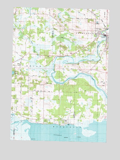
Princeton West, WI USGS Topographic Map
Click on map above to begin viewing in our Map Viewer.

This topographic map contains these locations and features:
Feature Name Type Latitude Longitude GNIS ID View Map
City of PrincetonCivilN43.8526°W89.1305°1583986View Map
Haystack PointCapeN43.7516°W89.2232°1566221View Map
Immanuel ChurchChurchN43.8211°W89.2398°1566871View Map
MecanPopulated PlaceN43.7961°W89.2151°1577720View Map
Mecan RiverStreamN43.8172°W89.1962°1569302View Map
Mill RaceStreamN43.8505°W89.1326°1569497View Map
Princeton Ambulance ServiceBuildingN43.8506°W89.1282°2698286View Map
Princeton CemeteryCemeteryN43.8541°W89.1444°2775469View Map
Princeton Fire and Rescue DepartmentBuildingN43.8506°W89.1282°2697964View Map
Princeton Lock (historical)DamN43.8261°W89.1579°1843766View Map
Princeton Wastewater Treatment PlantLocaleN43.8628°W89.1403°2709428View Map
Puckaway LakeLakeN43.7565°W89.1704°1571957View Map
Saint John the Baptist Catholic ChurchChurchN43.8519°W89.1423°1843774View Map
Saint John the Baptist Catholic SchoolSchoolN43.8512°W89.1422°1843775View Map
Saint Johns Catholic CemeteryCemeteryN43.8529°W89.1438°2775470View Map
Saint Johns Lutheran CemeteryCemeteryN43.8422°W89.1274°1573045View Map
Saint Johns Lutheran ChurchChurchN43.8489°W89.1254°1843778View Map
Saint Johns Lutheran SchoolSchoolN43.8483°W89.1253°1843779View Map
School Number 1 (historical)SchoolN43.8158°W89.1521°1843787View Map
School Number 4 (historical)SchoolN43.8305°W89.1762°1843793View Map
School Number 5 (historical)SchoolN43.7894°W89.1373°1843796View Map
School Number 6 (historical)SchoolN43.7708°W89.1751°1843469View Map
School Number 7 (historical)SchoolN43.8208°W89.2390°1843470View Map
School Number 7 (historical)SchoolN43.8658°W89.1690°1843801View Map
Town of MarquetteCivilN43.7507°W89.1476°1583661View Map
Town of MecanCivilN43.8275°W89.2133°1583681View Map
Trinity ChurchChurchN43.7969°W89.2212°1575625View Map

Note: Coordinates in the location and feature list above are referenced to NAD83 datum.


Copyright (C) 2008-2024 Ryan Niemi / Sunset Dynamics ... All Rights Reserved