TopoQuest Logo
Do you find TopoQuest useful?
Help keep TopoQuest running and adding new maps/features by donating!
Bitcoin:  19c7KJd3qBynnjoSw5npx9KScwjBe4ifkT
Litecoin:  LXs6TkuXGGXo1vDsWCkWVdjQX94eUKd6ui
Home View Maps Find Maps Find Places Resources & Links


Pricedale, Mississippi Topographic Map

USGS Map Title: Pricedale, MS
USGS Map MRC: 31090C3
DRG (GeoTIFF) Download: o31090c3.tif


Neighboring USGS Topographic Map Quads:


  Bogue Chitto, MS  
31090D4
 

  Ruth, MS  
31090D3
 

  Topeka, MS  
31090D2
 

  McComb North, MS  
31090C4
 

  Pricedale, MS  
31090C3
 

  Jayess, MS  
31090C2
 

  McComb South, MS  
31090B4
 

  Holmesville, MS  
31090B3
 

  Mesa, MS  
31090B2


Map MRC Location:

N32°
W91°
N32°
W90°
H8 H7 H6 H5 H4 H3 H2 H1
G8 G7 G6 G5 G4 G3 G2 G1
F8 F7 F6 F5 F4 F3 F2 F1
E8 E7 E6 E5 E4 E3 E2 E1
D8 D7 D6 D5 D4 D3 D2 D1
C8 C7 C6 C5 C4 C3 C2 C1
B8 B7 B6 B5 B4 B3 B2 B1
A8 A7 A6 A5 A4 A3 A2 A1
N31°
W91°
N31°
W90°

Pricedale, MS USGS 1:24K Topographic Map Preview:
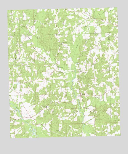
Pricedale, MS USGS Topographic Map
Click on map above to begin viewing in our Map Viewer.

This topographic map contains these locations and features:
Feature Name Type Latitude Longitude GNIS ID View Map
Bogue Chitto Baptist ChurchChurchN31.2875°W90.2741°667381View Map
Bogue Chitto CemeteryCemeteryN31.2852°W90.2748°709880View Map
Boyd CemeteryCemeteryN31.2749°W90.2801°667490View Map
Bridges CemeteryCemeteryN31.2818°W90.3243°667567View Map
Calvary Baptist ChurchChurchN31.2896°W90.2962°709885View Map
Calvary CemeteryCemeteryN31.2916°W90.2959°709886View Map
Carters CreekStreamN31.2738°W90.2934°668120View Map
Clear CreekStreamN31.2680°W90.3609°668554View Map
Dog RiverStreamN31.3021°W90.3023°669318View Map
East Topisaw CreekStreamN31.3655°W90.2756°669615View Map
Eaton CemeteryCemeteryN31.3310°W90.3173°709900View Map
Felders CampgroundLocaleN31.3180°W90.3193°669931View Map
Felders Mill (historical)LocaleN31.3224°W90.3215°687630View Map
Friendship ChurchChurchN31.2671°W90.3745°670216View Map
Friendship Volunteer Fire DepartmentBuildingN31.2684°W90.3743°2667941View Map
Garner CemeteryCemeteryN31.2979°W90.3023°709909View Map
Greer BranchStreamN31.3302°W90.3276°670729View Map
Guy Lake DamDamN31.3135°W90.3651°680653View Map
Herron CemeteryCemeteryN31.3121°W90.3159°709925View Map
John Felder Memorial ParkCemeteryN31.3135°W90.3193°671898View Map
Kaigler CemeteryCemeteryN31.2741°W90.2979°709987View Map
Labon Bacot CemeteryCemeteryN31.2543°W90.3579°709953View Map
Little CreekStreamN31.3491°W90.3426°672591View Map
Little Creek Oil FieldOilfieldN31.3382°W90.3732°672600View Map
Mars Hill ChurchChurchN31.2563°W90.3204°673146View Map
McCullough CemeteryCemeteryN31.3124°W90.2912°673323View Map
McCullough CemeteryCemeteryN31.3410°W90.3162°710020View Map
McDavid CemeteryCemeteryN31.3585°W90.3551°673329View Map
McEwen CemeteryCemeteryN31.3207°W90.2956°673346View Map
Mount Zion ChurchChurchN31.3102°W90.3284°674331View Map
New Zion ChurchChurchN31.3430°W90.3582°674871View Map
North Pike Middle SchoolSchoolN31.2802°W90.3337°674955View Map
Nunnery Lake DamDamN31.3018°W90.3651°680649View Map
Pinehaven Lake DamDamN31.3702°W90.3251°680688View Map
PricedalePopulated PlaceN31.2905°W90.2948°676336View Map
Quinns BridgeBridgeN31.2693°W90.3615°687673View Map
Ruth Post OfficePost OfficeN31.3742°W90.3072°2768779View Map
Shady Grove ChurchChurchN31.3524°W90.3498°677556View Map
Spring Beulah ChurchChurchN31.3418°W90.3131°678065View Map
Spring Lake DamDamN31.3618°W90.3268°680685View Map
Spring Leaf Church (historical)ChurchN31.3341°W90.2820°687683View Map
Spring Leaf School (historical)SchoolN31.3410°W90.3137°687684View Map
Thompson CemeteryCemeteryN31.2668°W90.3368°709915View Map
TopisawPopulated PlaceN31.2899°W90.2731°692271View Map
Turnipseed CemeteryCemeteryN31.2679°W90.2765°709917View Map
Union Primitive ChurchChurchN31.3618°W90.2906°679107View Map
Walker CemeteryCemeteryN31.2849°W90.3051°709945View Map
WCCA-FM (Mccomb)TowerN31.2793°W90.2793°680186View Map
West Topisaw CreekStreamN31.3152°W90.3001°679530View Map

Note: Coordinates in the location and feature list above are referenced to NAD83 datum.


Copyright (C) 2008-2024 Ryan Niemi / Sunset Dynamics ... All Rights Reserved