TopoQuest Logo
Do you find TopoQuest useful?
Help keep TopoQuest running and adding new maps/features by donating!
Bitcoin:  19c7KJd3qBynnjoSw5npx9KScwjBe4ifkT
Litecoin:  LXs6TkuXGGXo1vDsWCkWVdjQX94eUKd6ui
Home View Maps Find Maps Find Places Resources & Links


Prescott, Iowa Topographic Map

USGS Map Title: Prescott, IA
USGS Map MRC: 41094A5
DRG (GeoTIFF) Download: o41094a5.tif


Neighboring USGS Topographic Map Quads:


  Bridgewater, IA  
41094B6
 

  Nevinville, IA  
41094B5
 

  Orient, IA  
41094B4
 

  Corning North, IA  
41094A6
 

  Prescott, IA  
41094A5
 

  Creston West, IA  
41094A4
 

  Corning South, IA  
40094H6
 

  Lenox, IA  
40094H5
 

  Kent, IA  
40094H4


Map MRC Location:

N42°
W95°
N42°
W94°
H8 H7 H6 H5 H4 H3 H2 H1
G8 G7 G6 G5 G4 G3 G2 G1
F8 F7 F6 F5 F4 F3 F2 F1
E8 E7 E6 E5 E4 E3 E2 E1
D8 D7 D6 D5 D4 D3 D2 D1
C8 C7 C6 C5 C4 C3 C2 C1
B8 B7 B6 B5 B4 B3 B2 B1
A8 A7 A6 A5 A4 A3 A2 A1
N41°
W95°
N41°
W94°

Prescott, IA USGS 1:24K Topographic Map Preview:
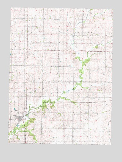
Prescott, IA USGS Topographic Map
Click on map above to begin viewing in our Map Viewer.

This topographic map contains these locations and features:
Feature Name Type Latitude Longitude GNIS ID View Map
Bohemian National CemeteryCemeteryN41.1153°W94.5716°454735View Map
Cipra BranchStreamN41.0572°W94.5372°455416View Map
City of PrescottCivilN41.0238°W94.6130°2396270View Map
East Fork East Nodaway RiverStreamN41.0750°W94.5336°456144View Map
Evergreen CemeteryCemeteryN41.0300°W94.6138°456421View Map
Kline MuseumBuildingN41.0228°W94.6097°1968950View Map
Kosar BranchStreamN41.1053°W94.5475°458141View Map
Mount Zion BranchStreamN41.0325°W94.6000°459351View Map
Mount Zion CemeteryCemeteryN41.0864°W94.6031°459353View Map
Old Evergreen CemeteryCemeteryN41.0321°W94.6051°459828View Map
PrescottLocaleN41.0222°W94.6094°1968954View Map
PrescottPopulated PlaceN41.0230°W94.6136°460439View Map
Prescott City HallBuildingN41.0230°W94.6136°1968946View Map
Prescott Community ParkParkN41.0230°W94.6136°1968948View Map
Prescott Elementary SchoolSchoolN41.0260°W94.6081°1968953View Map
Prescott Post OfficePost OfficeN41.0230°W94.6116°1968951View Map
Prescott Public LibraryBuildingN41.0233°W94.6100°1968949View Map
Prescott United Church of ChristChurchN41.0230°W94.6139°1968952View Map
Prescott Volunteer Fire DepartmentBuildingN41.0233°W94.6111°1968947View Map
Shanghai CreekStreamN41.1161°W94.5325°461526View Map
Summit CemeteryCemeteryN41.0281°W94.5290°462078View Map
Township of ColonyCivilN41.1146°W94.5279°467640View Map
Township of UnionCivilN41.0285°W94.5280°468806View Map
Union TownhallBuildingN41.0292°W94.5294°463323View Map

Note: Coordinates in the location and feature list above are referenced to NAD83 datum.


Copyright (C) 2008-2024 Ryan Niemi / Sunset Dynamics ... All Rights Reserved