TopoQuest Logo
Do you find TopoQuest useful?
Help keep TopoQuest running and adding new maps/features by donating!
Bitcoin:  19c7KJd3qBynnjoSw5npx9KScwjBe4ifkT
Litecoin:  LXs6TkuXGGXo1vDsWCkWVdjQX94eUKd6ui
Home View Maps Find Maps Find Places Resources & Links


Poynor, Texas Topographic Map

USGS Map Title: Poynor, TX
USGS Map MRC: 32095A5
DRG (GeoTIFF) Download: o32095a5.tif


Neighboring USGS Topographic Map Quads:


  Leagueville, TX  
32095B6
 

  Moore Station, TX  
32095B5
 

  Saline Bay, TX  
32095B4
 

  LaRue, TX  
32095A6
 

  Poynor, TX  
32095A5
 

  Berryville, TX  
32095A4
 

  Wilkerson Mountain, TX  
31095H6
 

  Pert, TX  
31095H5
 

  Todd City, TX  
31095H4


Map MRC Location:

N33°
W96°
N33°
W95°
H8 H7 H6 H5 H4 H3 H2 H1
G8 G7 G6 G5 G4 G3 G2 G1
F8 F7 F6 F5 F4 F3 F2 F1
E8 E7 E6 E5 E4 E3 E2 E1
D8 D7 D6 D5 D4 D3 D2 D1
C8 C7 C6 C5 C4 C3 C2 C1
B8 B7 B6 B5 B4 B3 B2 B1
A8 A7 A6 A5 A4 A3 A2 A1
N32°
W96°
N32°
W95°

Poynor, TX USGS 1:24K Topographic Map Preview:
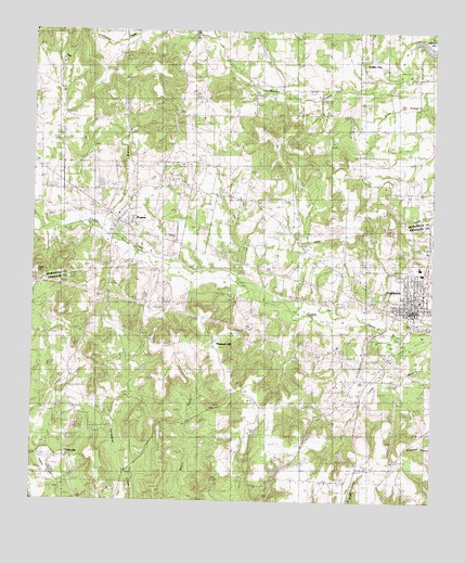
Poynor, TX USGS Topographic Map
Click on map above to begin viewing in our Map Viewer.

This topographic map contains these locations and features:
Feature Name Type Latitude Longitude GNIS ID View Map
Anderson County Constable's Office Precinct 3BuildingN32.0508°W95.5083°2751401View Map
First Baptist Church of FrankstonChurchN32.0557°W95.5022°2016528View Map
Foster CemeteryCemeteryN32.0377°W95.5975°1336079View Map
FostervillePopulated PlaceN32.0107°W95.6147°1378317View Map
FrankstonPopulated PlaceN32.0527°W95.5063°1373769View Map
Frankston City HallBuildingN32.0508°W95.5084°2753626View Map
Frankston Depot LibraryBuildingN32.0096°W95.5508°2014294View Map
Frankston Depot MuseumBuildingN32.0096°W95.5508°2014295View Map
Frankston Police DepartmentBuildingN32.0508°W95.5084°2751142View Map
Frankston Post OfficePost OfficeN32.0502°W95.5026°2731375View Map
Frankston Volunteer Fire DepartmentBuildingN32.0496°W95.5056°2655140View Map
Henderson County Constable's Office Precinct 4BuildingN32.0773°W95.5936°2751472View Map
Kathleen C Fitzgerald MuseumBuildingN32.0516°W95.5066°2032348View Map
Liberty Hill CemeteryCemeteryN32.0677°W95.5394°1339890View Map
Liberty Hill ChurchChurchN32.0732°W95.5455°1339891View Map
Mill BranchStreamN32.0710°W95.6036°1341608View Map
Mixon LakeReservoirN32.1049°W95.5966°1854611View Map
Mixon Lake DamDamN32.1035°W95.5952°1854610View Map
Myrtle Spring ChurchChurchN32.0441°W95.5686°1342345View Map
Pickle Plantation AirportAirportN32.0890°W95.5994°2676626View Map
Pine Spring ChurchChurchN32.1054°W95.5063°1344072View Map
Pine Springs Baptist ChurchChurchN32.1102°W95.5055°2021052View Map
Pleasant Hill SchoolSchoolN32.0393°W95.5697°1344224View Map
PoynorPopulated PlaceN32.0743°W95.5983°1344473View Map
Poynor CemeteryCemeteryN32.0821°W95.6002°1344474View Map
Poynor City HallBuildingN32.0740°W95.5977°2753772View Map
Poynor Post OfficePost OfficeN32.0747°W95.5988°2731639View Map
Poynor Volunteer Fire DepartmentBuildingN32.0770°W95.5955°2655291View Map
Town of FrankstonCivilN32.0561°W95.5044°2412653View Map
Town of PoynorCivilN32.0793°W95.5924°2412505View Map

Note: Coordinates in the location and feature list above are referenced to NAD83 datum.


Copyright (C) 2008-2024 Ryan Niemi / Sunset Dynamics ... All Rights Reserved