TopoQuest Logo
Do you find TopoQuest useful?
Help keep TopoQuest running and adding new maps/features by donating!
Bitcoin:  19c7KJd3qBynnjoSw5npx9KScwjBe4ifkT
Litecoin:  LXs6TkuXGGXo1vDsWCkWVdjQX94eUKd6ui
Home View Maps Find Maps Find Places Resources & Links


Pottersville, Missouri Topographic Map

USGS Map Title: Pottersville, MO
USGS Map MRC: 36092F1
DRG (GeoTIFF) Download: o36092f1.tif


Neighboring USGS Topographic Map Quads:


  Dora, MO  
36092G2
 

  Siloam Springs, MO  
36092G1
 

  Pomona, MO  
36091G8
 

  Cureall NW, MO  
36092F2
 

  Pottersville, MO  
36092F1
 

  South Fork, MO  
36091F8
 

  Bakersfield, MO  
36092E2
 

  Caulfield, MO  
36092E1
 

  Moody, MO  
36091E8


Map MRC Location:

N37°
W93°
N37°
W92°
H8 H7 H6 H5 H4 H3 H2 H1
G8 G7 G6 G5 G4 G3 G2 G1
F8 F7 F6 F5 F4 F3 F2 F1
E8 E7 E6 E5 E4 E3 E2 E1
D8 D7 D6 D5 D4 D3 D2 D1
C8 C7 C6 C5 C4 C3 C2 C1
B8 B7 B6 B5 B4 B3 B2 B1
A8 A7 A6 A5 A4 A3 A2 A1
N36°
W93°
N36°
W92°

Pottersville, MO USGS 1:24K Topographic Map Preview:
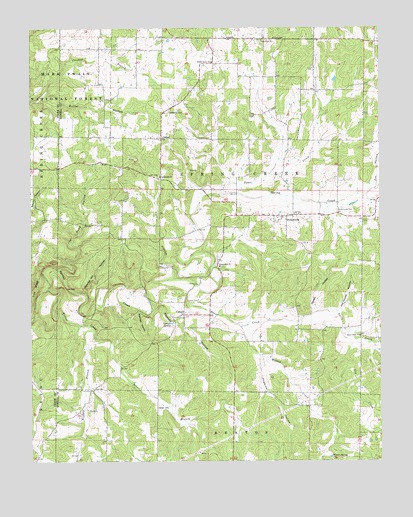
Pottersville, MO USGS Topographic Map
Click on map above to begin viewing in our Map Viewer.

This topographic map contains these locations and features:
Feature Name Type Latitude Longitude GNIS ID View Map
Bridges BranchStreamN36.6592°W92.1054°749019View Map
Butler HollowValleyN36.7298°W92.1207°749137View Map
Cold RidgeRidgeN36.6745°W92.1235°749406View Map
CriderPopulated PlaceN36.7181°W92.0782°749519View Map
Crider School (historical)SchoolN36.7181°W92.0871°753329View Map
Crossroads ChurchChurchN36.7070°W92.0790°749536View Map
CureallPopulated PlaceN36.6673°W92.0707°749552View Map
Cureall CemeteryCemeteryN36.6714°W92.0654°749553View Map
Cureall Church (historical)ChurchN36.6667°W92.0718°735112View Map
Cureall SchoolLocaleN36.6787°W92.0707°753331View Map
Cureall SpringSpringN36.6648°W92.0750°749554View Map
Davis CreekStreamN36.6759°W92.0665°749581View Map
Davis Creek ChurchChurchN36.6609°W92.0079°749583View Map
Fox HollowValleyN36.7053°W92.0013°749975View Map
Gospel Hill ChurchChurchN36.6812°W92.0579°750088View Map
Hall HollowValleyN36.6789°W92.0743°750194View Map
Herien HollowValleyN36.6684°W92.0249°750300View Map
Hide A Way LakeReservoirN36.6367°W92.0168°764768View Map
Hide A Way Lake DamDamN36.6367°W92.0168°764767View Map
Hopkins HollowValleyN36.6523°W92.0435°750390View Map
Joe Pond HollowValleyN36.6803°W92.1152°750513View Map
Key CreekStreamN36.6617°W92.0140°750598View Map
Ledbetter CemeteryCemeteryN36.7256°W92.0754°750673View Map
Little Zion ChurchChurchN36.7464°W92.0424°750808View Map
Low GapGapN36.6751°W92.1132°750872View Map
Morning Glory Zinc MineMineN36.6398°W92.1032°735113View Map
Old House HollowValleyN36.6687°W92.0140°751416View Map
Pleasant Point SchoolSchoolN36.7356°W92.0360°753327View Map
PottersvillePopulated PlaceN36.6959°W92.0313°751733View Map
Pottersville CemeteryCemeteryN36.6973°W92.0154°751734View Map
Pottersville Post OfficePost OfficeN36.6959°W92.0323°2782981View Map
Pottersville SchoolLocaleN36.7045°W92.0329°753328View Map
Pottersville Volunteer Fire DepartmentBuildingN36.6959°W92.0321°2621461View Map
Powder Mill HollowValleyN36.6734°W92.1057°751735View Map
Ramsey HollowValleyN36.6687°W92.0810°751806View Map
Rex HillSummitN36.6573°W92.0777°753332View Map
Rex MinesMineN36.6270°W92.0643°735115View Map
Seedtick Church (historical)ChurchN36.6806°W92.0602°753330View Map
Setzer BranchStreamN36.6592°W92.0968°752082View Map
Setzer CemeteryCemeteryN36.6406°W92.0804°752083View Map
Tabor CreekStreamN36.7028°W92.0571°752481View Map
Township of Spring CreekCivilN36.7109°W92.0405°766791View Map
Union Grove General Baptist CemeteryCemeteryN36.7409°W92.0599°2702334View Map
Union Grove General Baptist ChurchChurchN36.7403°W92.0602°752659View Map
Vienna SchoolSchoolN36.7478°W92.0874°753326View Map
Wadley BranchStreamN36.7014°W92.0335°735114View Map
Watered HollowValleyN36.6684°W92.0871°752778View Map
Willow CreekStreamN36.6745°W92.1188°752921View Map
Wilson CreekStreamN36.6637°W92.0507°752926View Map
Wilson SpringSpringN36.6258°W92.0177°752931View Map

Note: Coordinates in the location and feature list above are referenced to NAD83 datum.


Copyright (C) 2008-2024 Ryan Niemi / Sunset Dynamics ... All Rights Reserved